Crosbyton in Crosby County, Texas — The American South (West South Central)
Battle of the Freshwater Fork of the Brazos
Photographed by Allen Lowrey, March 11, 2021
1. Battle of the Freshwater Fork of the Brazos Marker
Inscription.
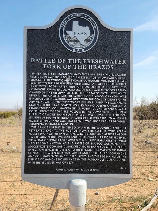
Battle of the Freshwater Fork of the Brazos. . In Sep. 1871, Col. Ranald S. Mackenzie and the 4th U.S. Cavalry received permission to lead an expedition from Fort Griffin (Shackelford County) and engage Comanche who had refused to move to their designated reservation at Fort Sill (Oklahoma territory). Soon after midnight on October 11, 1871, the Comanche surprised Col. Mackenzie’s U.S. Cavalry Troops as they camped on the Freshwater Fork of the Brazos River (now White River). The camp near the mouth of Blanco Canyon was infiltrated by numerous warriors with the goal of delaying the army’s advance into the Texas panhandle. After the Comanche stampeded the camp, scattering and taking dozens of horses, a chase ensued. Col. Mackenzie, Lt. Robert G. Carter and a small contingent of soldiers followed the Comanche. During a pursuit of more than forty miles, two Comanche and Pvt. Leander Gregg were killed, Lt. Carter’s leg was crushed when his horse slipped, and Col. Mackenzie was shot in the leg when returning to Blanco Canyon. , The army’s pursuit ended soon after the wounded and sick retreated back to the post on Nov. 5th. Carter, who kept a pocket diary of the expedition, wrote books and articles about his exploits in the Civil War and Indian wars. In 1900 he received the medal of honor for “most distinguished gallantry” in what had become known as the Battle of Blanco Canyon. Col. Mackenzie’s command marched more than 500 miles on the expedition before returning to their posts. This marked the initial contact between Quanah Parker and the Quahadi Comanche and Col. Mackenzie and the U.S. Army, and the beginning of the end of Comanche dominance in the panhandle, concluding with the Red River War of 1874. , Marker is property of the State of Texas
In Sep. 1871, Col. Ranald S. Mackenzie and the 4th U.S. Cavalry received permission to lead an expedition from Fort Griffin (Shackelford County) and engage Comanche who had refused to move to their designated reservation at Fort Sill (Oklahoma territory). Soon after midnight on October 11, 1871, the Comanche surprised Col. Mackenzie’s U.S. Cavalry Troops as they camped on the Freshwater Fork of the Brazos River (now White River). The camp near the mouth of Blanco Canyon was infiltrated by numerous warriors with the goal of delaying the army’s advance into the Texas panhandle. After the Comanche stampeded the camp, scattering and taking dozens of horses, a chase ensued. Col. Mackenzie, Lt. Robert G. Carter and a small contingent of soldiers followed the Comanche. During a pursuit of more than forty miles, two Comanche and Pvt. Leander Gregg were killed, Lt. Carter’s leg was crushed when his horse slipped, and Col. Mackenzie was shot in the leg when returning to Blanco Canyon.
The army’s pursuit ended soon after the wounded and sick retreated back to the post on Nov. 5th. Carter, who kept a pocket diary of the expedition,
Click or scan to see this page online
wrote books and articles about his exploits in the Civil War and Indian wars. In 1900 he received the medal of honor for “most distinguished gallantry” in what had become known as the Battle of Blanco Canyon. Col. Mackenzie’s command marched more than 500 miles on the expedition before returning to their posts. This marked the initial contact between Quanah Parker and the Quahadi Comanche and Col. Mackenzie and the U.S. Army, and the beginning of the end of Comanche dominance in the panhandle, concluding with the Red River War of 1874.
Marker is property of the State of Texas
Erected 2015 by Texas Historical Commission. (Marker Number 18175.)
Topics. This historical marker is listed in this topic list: Wars, US Indian. A significant historical date for this entry is October 11, 1871.
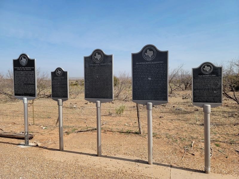
Location. 33° 39.871′ N, 101° 10.533′ W. Marker is in Crosbyton, Texas, in Crosby County. It is at the intersection of U.S. 82 and Farm to Market Road 2591, on the right when traveling west on U.S. 82. The marker is at the northeast corner of US 82 and FM 2591, along with four other markers. Touch for map. Marker is in this post office area: Crosbyton TX 79322,
Photographed by Allen Lowrey, March 11, 2021
2. Battle of the Freshwater Fork of the Brazos Marker is on the left

Regionally, this marker is on Texas’ South Plains. It is also on the American Great Plains and specifically on the Southern Plains. Globally, it is in North America, a Gulf of Mexico state, the Western Hemisphere, the Western World, and the Anglosphere. Historically, it finds itself in what was once New Spain, the Comanchería, the Republic of Texas, and one of the Confederate States of America.
Credits. This page was last revised on November 30, 2024. It was originally submitted on March 14, 2021, by Allen Lowrey of Amarillo, Texas. This page has been viewed 2,119 times since then and 135 times this year. Photos:1, 2. submitted on March 14, 2021, by Allen Lowrey of Amarillo, Texas. • J. Makali Bruton was the editor who published this page.
