Jekyll Island in Glynn County, Georgia — The American South (South Atlantic)
A Miserable Voyage
Wanderer Memory Trail
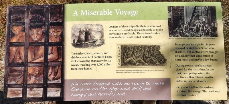
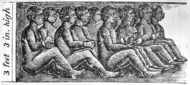
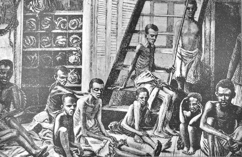
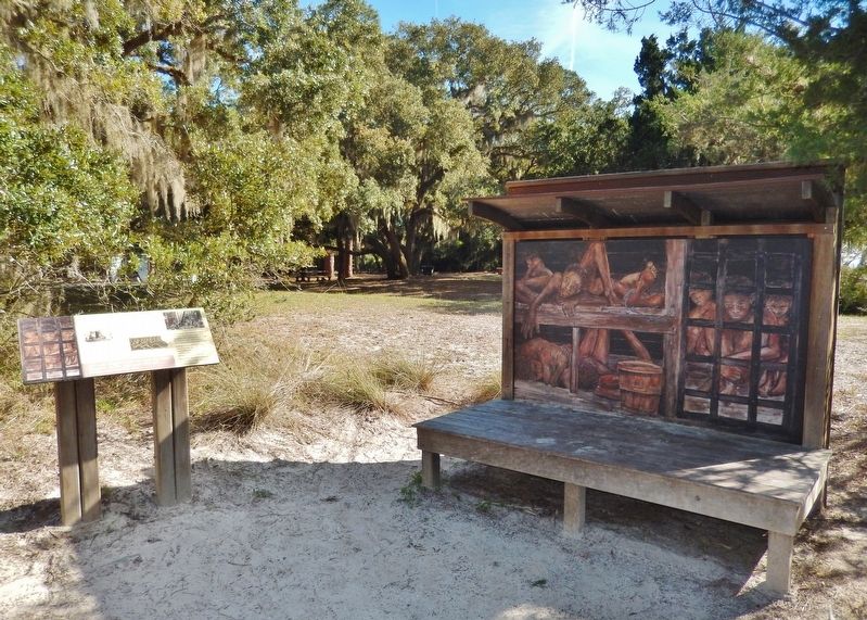
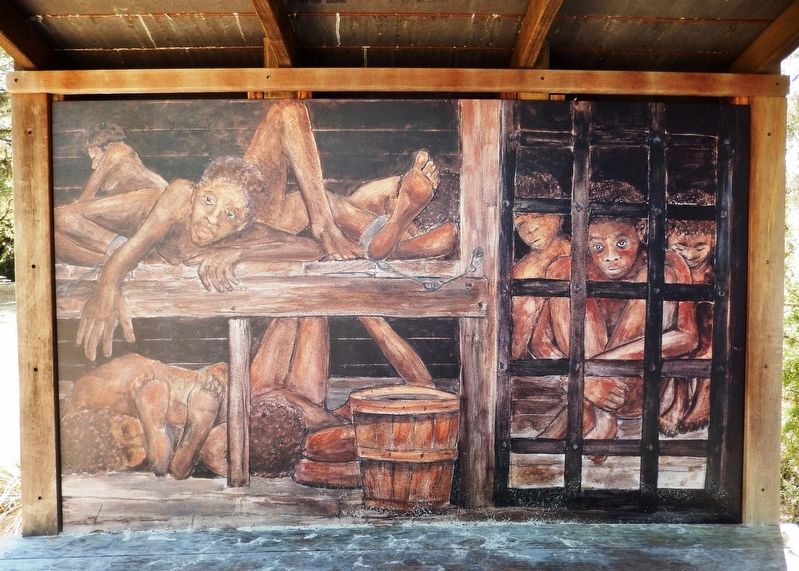
Owners of slave ships did their best to hold as many enslaved people as possible to make travel more profitable. Those forced onboard were underfed and treated brutally.
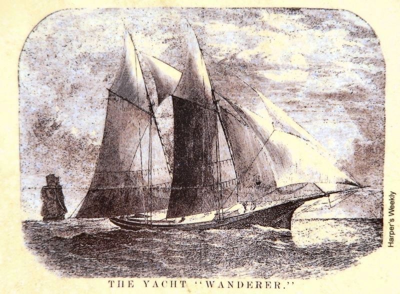
The enslaved men, women, and children were kept confined below deck aboard the Wanderer for six weeks, traveling over 6,000 miles from their homes.
Some people were packed in pens or caged behind bars. Some were shackled. The captives were brought on deck for their daily ration of corn mush and maybe a few beans.
During storms, the hatch was closed for days at a time. In the dark, cramped quarters, the captives suffered from horrible sickness, heat, and foul air.
Only about 409 of the enslaved survived the voyage. The dead were thrown overboard.
Topics. This historical marker is listed in these topic lists: African Americans • Waterways & Vessels.
Location. 31° 1.307′ N, 81° 26.057′ W. Marker is on Jekyll Island, Georgia, in Glynn County. Marker can be reached from Beach View Drive, 0.1 miles north of South Riverview Drive. Marker is located along the Wanderer Memory Trail, just north of the parking lot at St. Andrews Beach Park. Touch for map. Marker is at or near this postal address: 1 South Riverview Drive, Jekyll Island GA 31527, United States of America. Touch for directions.
Other nearby markers. At least 8 other markers are within walking distance of this marker. Marched to the Sea (within shouting distance of this marker); Strange New World (within shouting distance of this marker); Taken From Africa (within shouting distance of this marker); Wanderer Memory Trail (within shouting distance of this marker); Survivors of the Wanderer (within shouting distance of this marker); The Wanderer — Timeline (within shouting distance of this marker); The Wanderer — Cilucangy: Ward Lee (within shouting distance of this marker); The Wanderer — Timeline: Continued (within shouting distance of this marker). Touch for a list and map of all markers in Jekyll Island.
Regarding A Miserable Voyage. The UNESCO Slave Route Project: Resistance, Liberty, Heritage. This site fulfils the quality criteria set by the UNESCO Slave Route Project in conjunction with the International Network of Managers of Sites and Itineraries of Memory.
Related markers. Click here for a list of markers that are related to this marker. Wanderer Memory Trail
Also see . . .
1. Wanderer Memory Trail. The trail is located along the banks of the Jekyll River where the ship illegally came ashore
160 years ago with more than 500 enslaved Africans. (Submitted on March 17, 2021, by Cosmos Mariner of Cape Canaveral, Florida.)
2. The Wanderer. Captain Corrie sailed to the mouth of the Congo River, in present-day Democratic Republic of the Congo, which had long had an active slave market. For a period of 10 days, he had shelves and pens built into the hold in order to accept a shipment of 490-600 people, who were loaded on the ship. Many of the people died on the six-week journey across the Atlantic Ocean. (Submitted on March 17, 2021, by Cosmos Mariner of Cape Canaveral, Florida.)
3. Middle Passage (Wikipedia). The Middle Passage was the stage of the triangular trade in which millions of Africans were forcibly transported to the New World as part of the Atlantic slave trade. Ships departed Europe for African markets with manufactured goods, which were traded for purchased or kidnapped Africans, who were transported across the Atlantic as slaves; the enslaved Africans were then sold or traded for raw materials, which would be transported back to Europe to complete the voyage. (Submitted on March 19, 2021, by Cosmos Mariner of Cape Canaveral, Florida.)
Credits. This page was last revised on March 19, 2021. It was originally submitted on March 16, 2021, by Cosmos Mariner of Cape Canaveral, Florida. This page has been viewed 148 times since then and 10 times this year. Photos: 1, 2, 3, 4, 5, 6. submitted on March 17, 2021, by Cosmos Mariner of Cape Canaveral, Florida.
