Lead in Lawrence County, South Dakota — The American Midwest (Upper Plains)
From Ruts to Rails
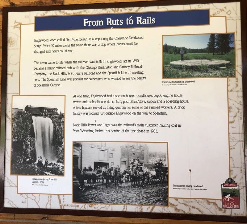
Englewood, once called Ten Mile, began as a stop along the Cheyenne-Deadwood Stage. Every 10 miles along the route there was a stoop where horses could be changed and riders could rest.
The town came to life when the railroad was built in Englewood late in 1890. It became a major railroad hub with the Chicago, Burlington and Quincy Railroad Company, the Black Hills & Ft. Pierre Railroad and the Spearfish Line all meeting here. The Spearfish Line was popular for passengers who wanted to see the beauty of Spearfish Canyon.
At one time, Englewood had a section house, roundhouse, depot, engine house, water tank, schoolhouse, dance hall, post office/store, saloon and boarding house. A few boxcars served as living quarters for some of the railroad workers. A brick factory was located just outside Englewood on the way to Spearfish.
Black Hills Power and Light was the railroad's main customer, hauling coal in from Wyoming, before this portion of the line closed in 1983.
Picture Captions
Passengers enjoying Spearfish Canyon, 1890s
Stagecoaches leaving Deadwood
Old round foundation at Englewood
Topics. This historical marker is listed in these topic lists: Parks & Recreational Areas • Railroads & Streetcars • Settlements & Settlers. A significant historical year for this entry is 1890.
Location. 44° 17.812′ N, 103° 47.071′ W. Marker is in Lead, South Dakota, in Lawrence County. Marker is at the intersection of Englewood Road and Brownsville Road on Englewood Road. Touch for map. Marker is at or near this postal address: 21431 Englewood Road, Lead SD 57754, United States of America. Touch for directions.
Other nearby markers. At least 8 other markers are within 4 miles of this marker, measured as the crow flies. George S. Mickelson Trail (a few steps from this marker); The Glover House (approx. 3.7 miles away); City Hall and Masonic Temple (approx. 3.8 miles away); Christ Episcopal Church and Grier Statue (approx. 3.8 miles away); Thomas Johnston Grier (approx. 3.8 miles away); Overshot Mucker (approx. 3.9 miles away); Dakota Rebekah Lodge (approx. 3.9 miles away); United States Post Office (approx. 3.9 miles away). Touch for a list and map of all markers in Lead.
Credits. This page was last revised on March 20, 2021. It was originally submitted on March 17, 2021, by Ruth VanSteenwyk of Aberdeen, South Dakota. This page has been viewed 118 times since then and 28 times this year. Photos: 1, 2. submitted on March 17, 2021, by Ruth VanSteenwyk of Aberdeen, South Dakota. • Bill Pfingsten was the editor who published this page.

