Near Waynesboro in Burke County, Georgia — The American South (South Atlantic)
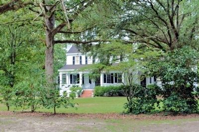
Bellevue Plantation
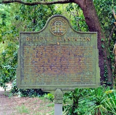
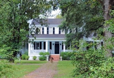
During Sherman’s March to the Sea in 1864, a rear guard action occurred here between Brig. Gen. J. L. Kilpatrick’s 3rd Cavalry Division [US], which was retreating toward Sherman’s main columns after an unsuccessful raid on Waynesboro, and Maj. Gen. Joseph Wheeler’s cavalry corps [CS] which had defeated Kilpatrick near Waynesboro. Three holes made by Minie balls fired during this action can be seen in the house. The soldiers who fell here were buried behind the residence. The Union dead remain, but the Confederates were later reinterred at Waynesboro.
The old rose bush that stands across the road from the house was damaged by horses tethered to it by Union officers while their men stripped the plantation of horses and provisions, a work in which they were engaged when struck by Confederate pursuit.
Erected 1961 by Georgia Historical Commission. (Marker Number 017-18.)
Topics and series. This historical marker is listed in this topic list: War, US Civil. In addition, it is included in the Georgia Historical Society, and the Sherman’s March to the Sea series lists. A significant historical year for this entry is 1767.
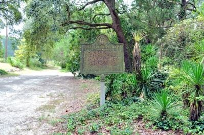
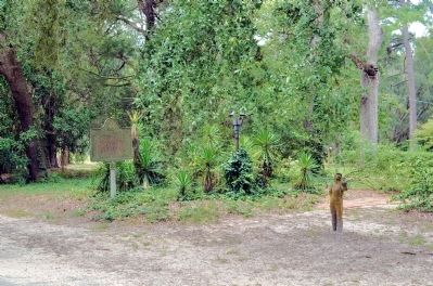
Location. 32° 55.8′ N, 82° 1.265′ W. Marker is near Waynesboro, Georgia, in Burke County. Marker can be reached from the intersection of Porter Carswell Road and Bellevue Plantation Road.
There is no public access to this marker. Marker is on private property and THE ROADS TO THE MARKER ARE PRIVATE PROPERTY. See next paragraph for more information before attempting to visit this marker. The marker is on the abandoned old alignment for Porter Carswell Road, on the right side when traveling south, just south of the intersection with the abandoned section of Bellevue Plantation Road and the abandoned old alignment of Middleground Road. Road abandonment has been verified with the Burke County Department of Roads and Bridges. —Ed.
IMPORTANT. You must seek permission from the property owner before driving on Bellevue Plantation Road west of Porter Carswell Road as this is a private road. The portion of Middleground Road approaching the marker from the northwest is also a private road and the same permission is required. The property owner has written to the Historical Marker Database to assert that he will seek prosecution for trespassing for any person found on his private roads. We cannot provide contact information for the owner; you should inquire in town. Touch for map. Marker is in this post office area: Waynesboro GA 30830, United States of America. Touch for directions.
Other nearby markers. At least 8 other markers are within 6 miles of this marker, measured as the crow flies. Site of Planters Electric Membership Corporation Organizational Meeting (within shouting distance of this marker); Carswell Grove Baptist Church (approx. 1.9 miles away); Battle of Buck Head Creek (approx. 2 miles away); Cavalry Action at Buckhead Church (approx. 2 miles away); Big Buckhead Church (approx. 2 miles away); Old Buckhead Church (approx. 3.4 miles away); The 14th Corps at Lumpkin's Station (approx. 3.8 miles away); Welcome to Magnolia Springs – The Civil War’s Camp Lawton (approx. 5.2 miles away).
More about this marker. This marker was erected on a public road, but is no longer on a public road because the road has been abandoned by the county and has become private property.
Regarding Bellevue Plantation. The home is private and not open to the public.
Credits. This page was last revised on March 20, 2021. It was originally submitted on September 29, 2012, by David Seibert of Sandy Springs, Georgia. This page has been viewed 3,752 times since then and 152 times this year. Last updated on March 20, 2021, by Carl Gordon Moore Jr. of North East, Maryland. Photos: 1, 2, 3, 4, 5. submitted on September 29, 2012, by David Seibert of Sandy Springs, Georgia. • J. Makali Bruton was the editor who published this page.
