Eddyville in Lyon County, Kentucky — The American South (East South Central)
Last Skirmish in Ky.
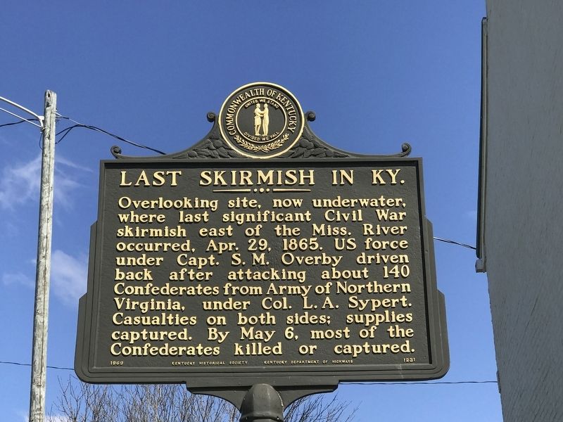
Photographed by Duane and Tracy Marsteller, March 20, 2021
1. Last Skirmish in Ky. Marker
Erected 1969 by Kentucky Historical Society and Kentucky Department of Highways. (Marker Number 1231.)
Topics and series. This historical marker is listed in this topic list: War, US Civil. In addition, it is included in the Kentucky Historical Society series list. A significant historical date for this entry is April 29, 1865.
Location. 37° 2.814′ N, 88° 4.523′ W. Marker is in Eddyville, Kentucky, in Lyon County. It is at the intersection of Kentucky Route 730 and Water Street, on the left when traveling west on Kentucky Route 730. Touch for map. Marker is at or near this postal address: 2261 KY-730, Eddyville KY 42038, United States of America. Touch for directions.

Regionally, this marker is in the American Midwest, in the South, and specifically in
this page online
Other nearby markers. At least 8 other markers are within 3 miles of this marker, measured as the crow flies: Rose Hill (a few steps from this marker); Eddyville (within shouting distance of this marker); Dr. George M. Huggans (approx. 0.2 miles away); Chittenden Lyon (approx. 0.3 miles away); Matthew Lyon (approx. 0.3 miles away); Mineral Mound Home Site (approx. 1.2 miles away); Mineral Mound (approx. 2.2 miles away); New Union Forge / Iron Made in Kentucky (approx. 2.2 miles away). Touch for a list and map of all markers in Eddyville.
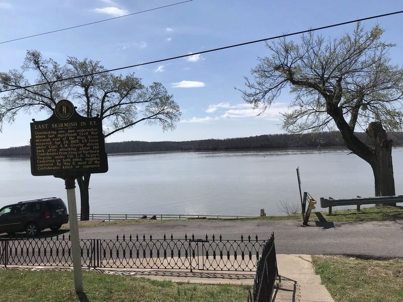
Photographed by Duane and Tracy Marsteller, March 20, 2021
2. Last Skirmish in Ky. Marker
Looking southwest toward the battlefield, now under Lake Barkley.
Credits. This page was last revised on March 22, 2021. It was originally submitted on March 22, 2021, by Duane and Tracy Marsteller of Murfreesboro, Tennessee. This page has been viewed 799 times since then and 50 times this year. Photos: 1, 2. submitted on March 22, 2021, by Duane and Tracy Marsteller of Murfreesboro, Tennessee.
