Appomattox in Appomattox County, Virginia — The American South (Mid-Atlantic)
A Strategic Delay
Appomattox Court House Nat’l Hist Park
Erected by Appomattox Court House National Historical Park, National Park Service, Dept. of the Interior.
Topics. This historical marker is listed in this topic list: War, US Civil. A significant historical date for this entry is April 9, 1865.
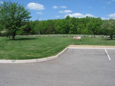
Location. 37° 22.557′ N, 78° 48.199′ W. Marker is in Appomattox, Virginia, in Appomattox County. Marker is on Old Courthouse Road (Virginia Route 24), on the right when traveling west. Marker is in the Appomattox Court House National Historical Park, at the Confederate Cemetery wayside. Touch for map. Marker is in this post office area: Appomattox VA 24522, United States of America. Touch for directions.
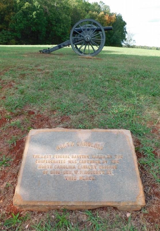
Other nearby markers. At least 8 other markers are within walking distance of this marker. Appomattox Court House Confederate Cemetery (a few steps from this marker); Appomattox (within shouting distance of this marker); Confederate Cemetery (within shouting distance of this marker); Appomattox Confederate Cemetery Memorial (within shouting distance of this marker); The First African American School in Appomattox (about 300 feet away, measured in a direct line); Wartime Landscape (about 300 feet away); North Carolina (about 400 feet away); Sears Lane (about 400 feet away). Touch for a list and map of all markers in Appomattox.
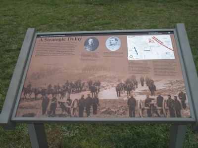
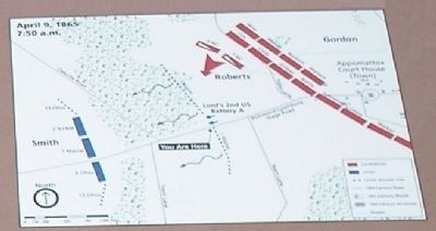
More about this marker. The bottom of the marker contains a photograph of the Union artillery and cavalry brigade that blocked the Confederate retreat. Two photographs appear at the top of the marker. They are of “James H. Lord (1832-1896), an 1857 graduate of the United States Military Academy at West Point and a Pennsylvanian, received the brevet rank of major for gallant and meritorious service in action at Appomattox Court House,” and “William P. Roberts (1841-1910) was the youngest Confederate general in service. He was promoted brigadier general in February 1865.” The top right of the marker contains a battle map. It has the caption “During the early hours of April 9, 1865, Confederate forces moved into position on the west side of Appomattox Court House and prepared to launch a dawn assault to open the road. Before daylight Lord’s two 3-inch Ordnance Rifles (blue cannons on map) began firing shells into the Confederate formations. Skirmishers of the 1st Maine Cavalry (blue dots on the map) moved forward to support Lord’s battery. When Southern troops advanced, the Federal skirmishers withdrew and Lord’s cannoneers fled. Brigadier General William P. Roberts’ North Carolina cavalry brigade captured the two Union cannons and some remaining artillerymen, but the delay helped secure the Confederate surrender.”
Also see . . .
1. Appomattox Court House National Historic Park. National Park Service website. (Submitted on January 21, 2009, by Bill Coughlin of Woodland Park, New Jersey.)
2. Appomattox Court House. CWSAC Battle Summaries website. (Submitted on January 21, 2009, by Bill Coughlin of Woodland Park, New Jersey.)
Credits. This page was last revised on March 24, 2021. It was originally submitted on January 21, 2009, by Bill Coughlin of Woodland Park, New Jersey. This page has been viewed 1,349 times since then and 16 times this year. Last updated on March 22, 2021, by Bradley Owen of Morgantown, West Virginia. Photos: 1, 2. submitted on January 21, 2009, by Bill Coughlin of Woodland Park, New Jersey. 3. submitted on April 25, 2010, by Craig Swain of Leesburg, Virginia. 4. submitted on January 21, 2009, by Bill Coughlin of Woodland Park, New Jersey. 5. submitted on April 25, 2010, by Craig Swain of Leesburg, Virginia. 6. submitted on March 24, 2021, by Bradley Owen of Morgantown, West Virginia. • Bernard Fisher was the editor who published this page.
