Neversink in Sullivan County, New York — The American Northeast (Mid-Atlantic)
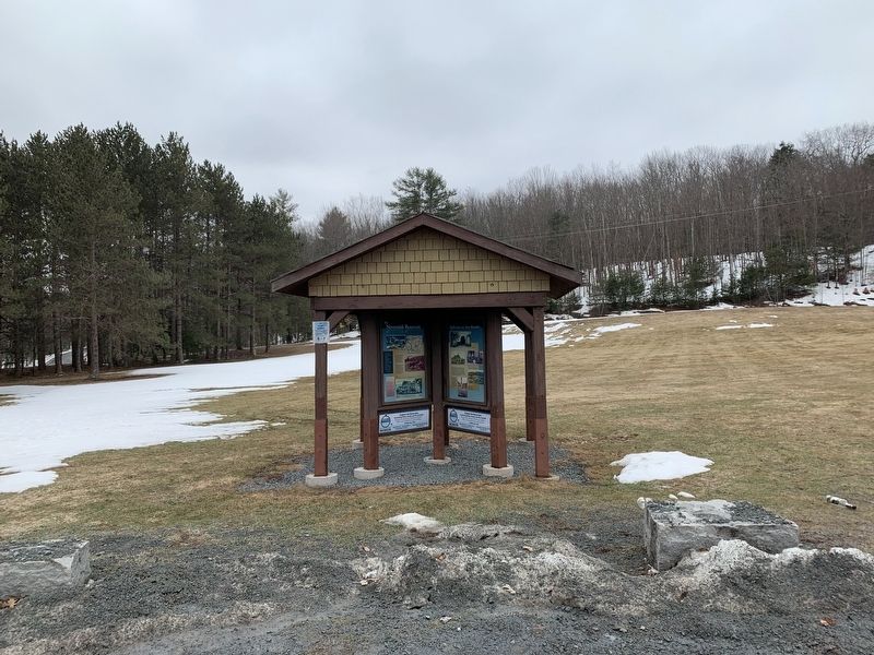
The Neversink Reservoir

Photographed by Steve Stoessel, March 17, 2021
1. The Neversink Reservoir Marker
The River Dammed to form the Neversink Reservoir is among America's most fabled fly-fishing streams. Famed fishermen like Edward R. Hewitt and Theodore Gordon, as well as local residents sought the elusive trout in the tumbling waters. Neversink and nearby Bittersweet served as home to about 300 people and as vacation spot for many more. The river, mountains and clean air attracted New York City residents to dozens of boarding houses and hotels in the Neversink Valley. Farms were plentiful and produced fresh milk and eggs for all.
Photo Captions Edward R. Hewitt fishing at Leroy's Falls in the Neversink River, 1926
Undated highway map showing the communities which were later submerged beneath the Neversink Reservoir National Survey Company
Haying on Mufson Farm, Bittersweet Frank Shannon Collection
Gathering in front of the Edgemere boarding house, Neversink
TOWN OF NEVERSINK ARCHIVES
Topics. This historical
this page online
Location. 41° 49.19′ N, 74° 38.768′ W. Marker is in Neversink, New York, in Sullivan County. It is on Neversink Road (New York State Route 55) 0.1 miles Divine Corners Road, on the right when traveling east. Touch for map. Marker is in this post office area: Neversink NY 12765, United States of America. Touch for directions.

Regionally, this marker is in Upstate New York and in the Hudson Valley. It is also in the American Northeast, in the Mid-Atlantic, in Appalachia, and specifically in Northern Appalachia. Globally, it is in North America, the Western Hemisphere, the Western World, and the Anglosphere. Historically, it finds itself in what was once New Netherland and also one of the original Thirteen Colonies.
Other nearby markers. At least 8 other markers are within 6 miles of this marker, measured as the crow flies: A different marker also named Neversink Reservoir (here, next to this marker); The New York City Water Supply System (here, next to this marker); Reflections on Two Hamlets (here, next to this marker);
Photographed by Steve Stoessel
2. The Neversink Reservoir Marker

Photographed by Steve Stoessel, March 17, 2021
3. The Neversink Reservoir
Credits. This page was last revised on March 23, 2021. It was originally submitted on March 22, 2021, by Steve Stoessel of Niskayuna, New York. This page has been viewed 353 times since then and 24 times this year. Photos: 1, 2, 3. submitted on March 22, 2021, by Steve Stoessel of Niskayuna, New York. • Bill Pfingsten was the editor who published this page.
