West Point in Davis County, Utah — The American Mountains (Southwest)
Hensley/Salt Lake Cutoff Ruts
East side:
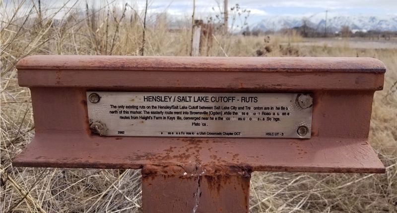
The only existing ruts on the Hensley/Salt Lake Cutoff between Salt Lake City and Tremonton are in the field north of this marker. The easterly route went into Brownsville [Ogden] while the westerly Bluff Road, and center routes from Haight's Farm in Kaysville, converged near here then continued on to Muskrat Springs.
Historical
2002 Utah Westerners Foundation & Utah Crossroads Chapter OCTA HSLCUT-3
West side:
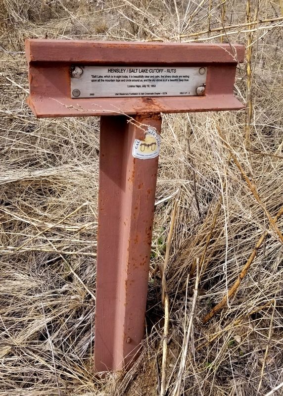
"Salt Lake which is in sight today, it is beautifully clear and calm, the silvery clouds are resting upon all the mountain tops and circle around us, and the sky above is a beautiful deep blue.
Lorena Hays, July 19, 1853
2003 Utah Westerners Foundation & Utah Crossroads Chapter - OCTA HSLCUT-3
Erected 2002 by Utah Westerners Foundation and Utah Crossroads Chapter OCTA.
Topics. This historical marker is listed in these topic lists: Roads & Vehicles • Settlements & Settlers. A significant historical date for this entry is July 19, 1853.
Location. 41° 8.4′ N, 112° 6.405′ W. Marker is in West Point, Utah, in Davis County. Marker is on 1800 North (Utah Route 37 at milepost 4), 0.2 miles east of 4325 West, on the right when traveling west. Touch for map. Marker is in this post office area: Clearfield UT 84015, United States of America. Touch for directions.
Other nearby markers. At least 8 other markers are within 5 miles of this marker, measured as the crow flies. Hensley / Salt Lake Cutoff-Bluff Road (approx. 1.8 miles away); First Settlers of Roy (approx. 3.3 miles away); First School House (approx. 3˝ miles away); Walker Brothers Store (approx. 3.6 miles away); Antelope Island (approx. 3.6 miles away); Antelope Island Causeway (approx. 3.6 miles away); Great Salt Lake (approx. 3.6 miles away); Syracuse First Social Center (approx. 4.3 miles away).
Regarding Hensley/Salt Lake Cutoff Ruts. This marker shows the point where wagon ruts could be seen in a field north of the marker for the Hensley Cutoff or Salt Lake Cutoff that was used by Samuel J. Hensley to reach the Oregon and California trails by going around the north end of the Great Salt Lake after he and his men became mired in mud trying to cross the Hastings Cutoff crossing the Salt Lake Desert south of the Great Salt Lake during a year of heavy ran. Hensley lost all his provisions and had to return to Salt Lake City in 1848. Hensley then took the route around the north end of the Great Salt Lake to make his way to California.
Additional keywords. Immigration
Credits. This page was last revised on March 23, 2021. It was originally submitted on March 23, 2021. This page has been viewed 377 times since then and 28 times this year. Photos: 1, 2. submitted on March 23, 2021, by Randy Higley of Hooper, Utah. • J. Makali Bruton was the editor who published this page.
Editor’s want-list for this marker. A wide view photo of the marker and the surrounding area together in context. • Can you help?

