The Battle of Pacific
Missouri's Civil War
— 1861 - 1865 —
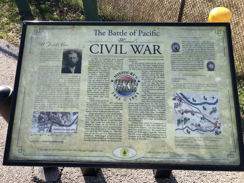
In 1864, the Confederate Army mounted a major incursion into Missouri, designed to liberate the state from federal control. Known as Price's Expedition, a force of 12,000 cavalry and mounted infantry, under the command of former Missouri governor Maj. Gen. Sterling Price, entered southeast Missouri on September 16, 1864. A brigade of Arkansas Cavalry under command of General William Cabell was detached near St. Clair and was ordered to Pacific (still called Franklin by many) to destroy the railroad facilities here. On the way here, Cabell's men destroyed the railroad bridge over the Meramec River at Moselle, which was a substantial structure that took Union soldiers some weeks to rebuild.
Cabell's troops entered the town at sunrise on October 1, 1864, and burned the railroad depot, car shops and water tanks, and looted the stores. A detachment proceeded east on the St. Louis road (now Business Route 44) and burned a railroad bridge two miles from town.
Union authorities in St. Louis reacted quickly to Cabell's threat. Three divisions of the 16th Army Corps, commanded by Gen. A.J. Smith, arrived at Jefferson Barracks in mid-September 1864. These troops had been slated to join Sherman in Atlanta, but were diverted to deal with Price's Expedition. Smith's troops included a brigade then commanded by Col. Edward Wolfe, consisting
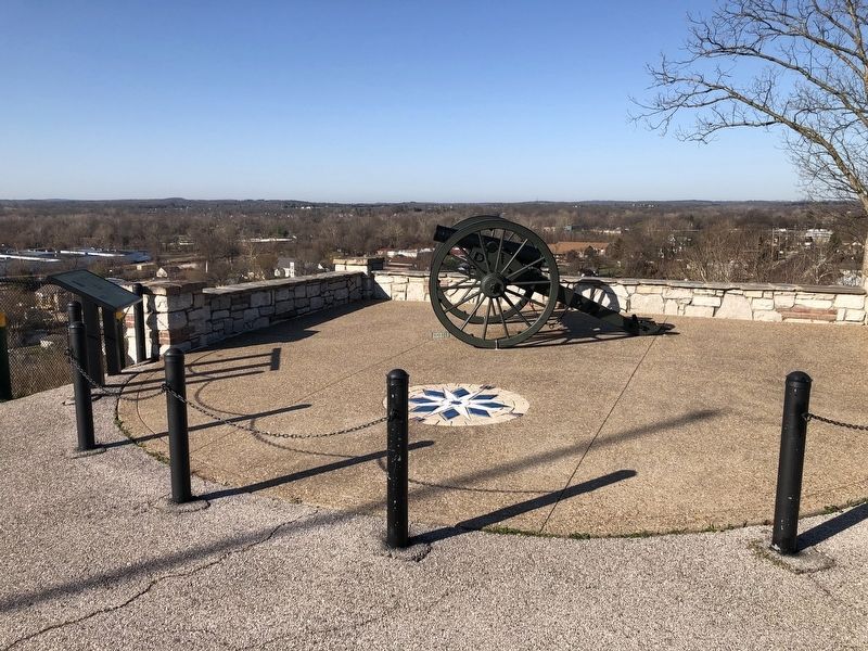
of the 52nd Indiana, the 178th New York and the 49th and 117th Illinois regiments. At 9:00 a.m., Wolfe's brigade arrived by rail from St. Louis and disembarked at the destroyed bridge two miles to the east. These troops advanced from that point, confronting Confederate pickets as they moved west.By most reports, Cabell had four pieces of artillery at Pacific. His battery, Hughey's Battery (known also as the 8th Arkansas Field Battery), was likely posted on top of this bluff, to command the town. Confederate artillery shelled the Union force as it advanced around the bluffs you observe to the east along Business Route 44.
Casualties of the Battle of Pacific were light. The Union officers reported 8 of their men wounded, and it is believed several Confederate combatants were killed.
The Confederates' work was largely done by the time of the Union attack. Cabell's rear guard held until noon and then joined the rest of the brigade as it moved west. Cabell burned the town of Gray Summit before joining the main Confederate force, which was encamped at Union. Price's army moved west towards Jefferson City, with one division, under Gen. John Marmaduke, tracking the route of present day Highway 100 to Hermann. There was a small battle at Hermann on October 3, 1864 and a larger one in Jefferson City on October 7.
General Smith moved his headquarters to Pacific on
A Tourist's View
Hawley Needham was the son of a preacher, and he grew up in Massachusetts and Rhode Island. He joined the 134th Illinois Infantry in May 1864. Hawley Needham sat near this spot on October 8, 1864, and described the scene that is in your view:
"I again resume my writing after a silence of several days. It is now Oct. 8th I think. I am now sitting on the side of one of the highest hills or rather mountains which overlook the valley in which lies the little town of Franklin. I said little, but only in size. Famous in name for probably by this time there is scarcely a Hamlet in the land but has heard of it. One week ago today Price was close by here and his men entered the place pillaging everything and burning all the property belonging either to Uncle Sam or the Railroad. The buildings were said to be the finest on this R.R. line. I suppose if we had been ready to move in season we should have smelled a little powder. But for continuing my history I will describe the scenery a little. At my feet is the valley, containing probably not more than 2 or 3 hundred acres and skirted on all sides by a succession of ridges and hills rising one above the other to an almost mountainous height nearly making a complete circle and forming a most beautiful amphitheater winding around the base of the hills. Opposite creeps a beautiful river probably the Meramac. Running nearly east and west the main track of the Pacific R.R. To the southwest runs the S.W. branch going through Rolla. The other road goes through Jefferson City where it is supposed Price is now thundering away. I think this is the most beautiful scene I have witnessed, that is of Nature's works, since my boyhood days in Old New England."
— Private Journal of Hawley V. Needham
[Sidebar:]
William Lewis Cabell, known as "Old Tige" to his troops, was born in Virginia in 1827. He graduated from West Point in 1850, and served in the regular Army until 1861, when he entered the Confederate service in Arkansas. He was a Brigadier General on October 25, 1864, when he was taken prisoner at the Battle of Mine Creek, Kansas. After the War, he moved to Dallas, Texas, and served four terms as the mayor of Dallas. He died in Dallas in 1911. Edward H. Wolfe was raised in the town of Rushville, southeast Indiana, and attended Hanover College near Madison, Indiana. He helped recruit the 52nd Indiana regiment which entered service in early 1862, and rose to the rank of Colonel commanding the regiment. He received the brevet rank of Brigadier General in 1865. Later, he was elected State Auditor of Indiana. He died in 1916 and is buried in Rushville.
Erected 2010 by Missouri's Civil War Heritage Foundation, Inc.; Funding by the City of Pacific.
Topics and series. This historical marker is listed in this topic list: War, US Civil. In addition, it is included in the Missouri’s Civil War series list. A significant historical date for this entry is September 16, 1864.
Location. 38° 29.061′ N, 90° 44.615′ W. Marker is in Pacific, Missouri, in Franklin County. Marker is on West Walnut Street, 0.1 miles west of North 2nd Street, on the left when traveling west. Touch for map. Marker is in this post office area: Pacific MO 63069, United States of America. Touch for directions.
Other nearby markers. At least 8 other markers are within walking distance of this marker. Veterans Memorial (here, next to this marker); Spc. Jeffrey L. White Jr. (within shouting distance of this marker); Pacific Honor Roll (about 600 feet away, measured in a direct line); Hero Nation! (about 800 feet away); War on the Pacific Railroad (approx. ¼ mile away); Worlds Fair, St. Louis, Missouri (approx. 0.3 miles away); Graze Catering (approx. 0.4 miles away); a different marker also named Veterans Memorial (approx. half a mile away). Touch for a list and map of all markers in Pacific.
Credits. This page was last revised on February 12, 2022. It was originally submitted on March 24, 2021, by Devry Becker Jones of Washington, District of Columbia. This page has been viewed 1,146 times since then and 199 times this year. Photos: 1, 2. submitted on March 24, 2021, by Devry Becker Jones of Washington, District of Columbia.

