
Appomattox in Appomattox County, Virginia — The American South (Mid-Atlantic)
Education in 1800's Rural Virginia
Civil Rights in Education Heritage Trail
| — | Appomattox, Virginia - Appomattox County | — |
Photographed by Craig Swain, April 18, 2010
1. Education in 1800's Rural Virginia Marker
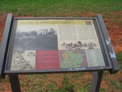
Before and during the Civil War, educational opportunities in Rural Virginia were often limited. The wealthier families employed a tutor or sent their children to boarding academies such as the nearby Union Academy. In such schools students learned a variety of subjects including history, mathematics, chemistry, and foreign languages. For less fortunate white children prior to the 1860's, there were 19 small, mostly one-room schoolhouses scattered throughout the county. African-American children had even fewer educational prospects.
Here on April 9, 1865, two brigades of United States Colored Troops advanced east along the Richmond-Lynchburg Stage Road, ensuring the surrender of Gen. Robert E. Lee's Confederate army and the end of the Civil War. This brought about the ratification of the Thirteenth Amendment on December 6, 1865. Before that time it was illegal to teach a slave to read. The first educational opportunities for blacks in Appomattox County came about through the Freedman's Bureau, created by Congress to assist former slaves. From 1866 to 1869, Plymouth Rock, a school for freedmen, operated near the Courthouse.
this page online
Erected by Civil Rights In Education Heritage Trail®. (Marker Number 3.)
Topics and series. This historical marker is listed in these topic lists: African Americans • Education • War, US Civil. In addition, it is included in the Civil Rights in Education Heritage Trail series list. A significant historical month for this entry is April 1888.
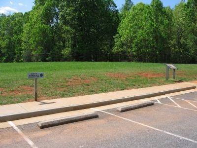
Location. This marker has been replaced by another marker nearby. It was located near 37° 22.519′ N, 78° 48.352′ W. Marker was in Appomattox, Virginia, in Appomattox County. It was on Old Courthouse Road. Marker is located at the North Carolina Memorial wayside in Appomattox Court House National
Photographed by Craig Swain, April 18, 2010
2. Education in 1800's Rural Virginia Marker

Regionally, this marker was in the Piedmont and in Central Virginia. It was also in the American South and specifically in the Upper South. Globally, it was in the North Atlantic Region, North America, the Western Hemisphere, the Western World, and the Anglosphere. Historically, it found itself in what was once the territory of the Mississippian Culture, one of the original Thirteen Colonies, one of the Confederate States of America, and the Antebellum South.
Other nearby markers. At least 8 other markers are within walking distance of this location: The North Carolina Monument (here, next to this marker); Raine Cemetery and Monument (within shouting distance of this marker); "It is a terrible thing to be killed on the last day of the war." (about 500 feet away, measured in a direct line); Lee's Last Attack (about 500 feet away); North Carolina (about 500 feet away); a different marker also named North Carolina Monument (about 700 feet away); A Strategic Delay (about 800 feet away); Appomattox Court House Confederate Cemetery (approx. 0.2 miles away). Touch for a list and map of all markers in Appomattox.
More about this marker. In the upper left is an 1892 photograph from the west showing the Richmond-Lynchburg Stage Road as it passes in front of the McLean House. On the lower left is an illustration of the village of Appomattox Court House as it appeared in 1865. In the upper right is a photo of Appomattox Court House as it looked at the time of the surrender. Sketched by R. K. Sneden. On the lower right is a map of south-central Virginia showing other schools highlighted on the Civil Rights in Education Heritage Trail.
Related marker. Click here for another marker that is related to this marker. This marker has been replaced with the linked marker.
Credits. This page was last revised on September 6, 2021. It was originally submitted on April 25, 2010, by Craig Swain of Leesburg, Virginia. This page has been viewed 2,464 times since then and 31 times this year. Last updated on March 24, 2021, by Bradley Owen of Morgantown, West Virginia. Photos: 1, 2. submitted on April 25, 2010, by Craig Swain of Leesburg, Virginia. • Bernard Fisher was the editor who published this page.
