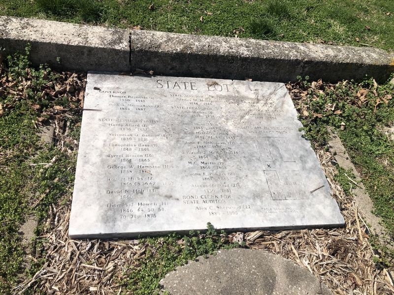
State Lot
Governor
Thomas Reynolds (1), 1840 - 1844
John S. Marmaduke (2), 1884 - 1887
State Representative
Hardy Allard (7), 1836 - 1837
Yelverton O. Bannon (8), 1830 - 1831
Theophilus Bass (9), 1848 - 1849
Tyrrel Bruton (10), 1864 - 1865
George W. Hampton (11), 1858 - 1860
Robert Hicks (12), 1846, 48, 56, 62 - 1863
David R. Holt (13), 1840
Thomas J. Howell (14), 1846, 48, 50 54, 70, 74 - 1875
State Auditor
James W. McDearmon (3), 1846 - 1848
State Treasurer
John Walker (4), 1833 - 1838
John Henry (16), 1842, 44, 48 - 1849
John F. McKernam (17), 1868 - 1873
Waller J. McMurtry (18), 1854 - 1855
M.C. Martin (19), 1866 - 1868
John F. Powers (20), 1864 - 1865
Alexander Reid (21), 1850 - 1851
Bond Clerk for State Auditor
Alex C. Sherwood (22), 1889 - 1895
Attorney General
Aikman Welco (5), 1861 - 1864
Supreme Court Clerk
Henry W. Ewing (6), 1878 - 1896
Dates are years elected and year of death.
Erected 1994 by Andrew Blunt, Eagle Scout Project.
Topics. This historical marker is listed in these topic lists: Cemeteries & Burial Sites • Government & Politics. A significant historical year for this entry is 1840.
Location.
Other nearby markers. At least 8 other markers are within walking distance of this marker. A different marker also named State Lot (here, next to this marker); Woodland-Old City Cemetery (a few steps from this marker); Jefferson City National Cemetery (within shouting distance of this marker); A National Cemetery System (within shouting distance of this marker); Navy Seabees (about 300 feet away, measured in a direct line); 39th Regiment Monument (about 400 feet away); Veterans Memorial (about 500 feet away); Missouri State Penitentiary Warden's House (approx. 0.3 miles away). Touch for a list and map of all markers in Jefferson City.
Credits. This page was last revised on March 25, 2021. It was originally submitted on March 25, 2021, by Devry Becker Jones of Washington, District of Columbia. This page has been viewed 86 times since then and 7 times this year. Photo 1. submitted on March 25, 2021, by Devry Becker Jones of Washington, District of Columbia.
Editor’s want-list for this marker. A wide shot of the marker in context. • Can you help?
