Columbia in Boone County, Missouri — The American Midwest (Upper Plains)
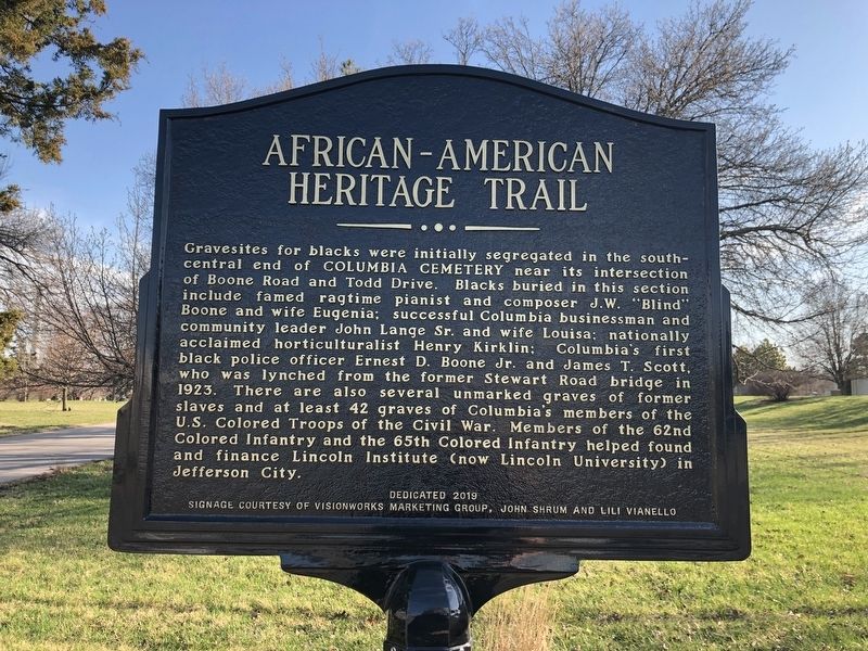
African-American Heritage Trail
Gravesites for blacks were initially segregated in the south-central end of Columbia Cemetery near its intersection of Boone Road and Todd Drive. Blacks buried in this section include famed ragtime pianist and composer J.W. "Blind" Boone and wife Eugenia; successful Columbia businessman and community leader John Lange Sr. and wife Louisa; national acclaimed horticulturalist Henry Kirklin; Columbia's first black police officer Ernest D. Boone Jr. and James T. Scott, who was lynched from the former Stewart Road bridge in 1923. There are also several unmarked graves of former slaves and at least 42 graves of Columbia's members of the U.S. Colored Troops of the Civil War. Members of the 62nd Colored Infantry and the 65th Colored Infantry helped found and finance Lincoln Institute (now Lincoln University) in Jefferson City.
Erected 2019 by Sharp End Heritage Committee, Economic Development Inc., City of Columbia; signage courtesy of Visionworks Marketing Group, John Shrum and Lili Vianello.
Topics and series. This historical marker is listed in these topic lists: African Americans • Cemeteries & Burial Sites • Education • War, US Civil. In addition, it is included in the Historically Black Colleges and Universities, and the Missouri, Columbia, African-American Heritage Trail series lists. A significant historical year for this entry is 1923.
Location. 38° 57.093′ N, 92° 20.245′ W. Marker is in Columbia, Missouri, in Boone County. Marker is on East Broadway, 0.1 miles west of North 1st Street, on the left when traveling west. Touch for map. Marker is at or near this postal address: 47 E Broadway, Columbia MO 65203, United States of America. Touch for directions.
Other nearby markers. At least 8 other markers are within walking distance of this marker. Columbia Cemetery (within shouting distance of this marker); Operation Desert Storm (within shouting distance of this marker); James Shannon L.L.D. (about 800 feet away, measured in a direct line); George Clinton Swallow (approx. 0.2 miles away); a different marker also named African-American Heritage Trail (approx. 0.2 miles away); a different marker also named African-American Heritage Trail (approx. ¼ mile away); Missouri-Kansas-Texas Railroad Yard (approx. ¼ mile away); African-American Heritage (approx. ¼ mile away). Touch for a list and map of all markers in Columbia.
Also see . . . African-American Heritage Trail complete, ready to teach
Additional keywords. Jim Crow era, acts of terrorism, segregation, lynching
Credits. This page was last revised on April 5, 2023. It was originally submitted on March 26, 2021, by Devry Becker Jones of Washington, District of Columbia. This page has been viewed 296 times since then and 32 times this year. Photos: 1, 2. submitted on March 26, 2021, by Devry Becker Jones of Washington, District of Columbia.

