Near Hedley in Donley County, Texas — The American South (West South Central)
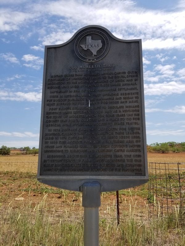
Old Mobeetie Trail
(To early town, about 40 mi. NE)
Photographed by Allen Lowrey, June 20, 2020
1. Old Mobeetie Trail Marker
A road older than recorded history; carved out in centuries of wintertime travel to the south, spring migration to the north, by millions of bison and by Indians who lived by hunting these large animals.
Important in era of Texas Panhandle settlement.
Used in 1873-1874, when first lifelong residents put dugout dwellings in the Panhandle and began to hunt buffalo to fill demand for hides and meat.
Fort Elliott, established 1875 to regulate Indians resisting white settlement, soon had as a neighbor the town of Mobeetie, which for some years was the county seat for 28 counties and a place to go for medical aid, supplies, and access to stage travel.
In 1876 Kansans came this way south for better hunting, calling this "Rath Trail," for their leader. Also, in 1876 cattlemen began to bring herds here. By 1880 this ancient path was a southern arm of Jones and Plummer Trail, over which cowboys moved longhorns to railroads and northern cattle markets.
Beginning about 1887 the Mobeetie Trail was used by "nesters" taking up farm lands alongside the old great ranches. Those it served founded and expanded agricultural-commercial economy
this page online
Erected 1966 by State Historical Survey Committee. (Marker Number 3769.)
Topics. This historical marker is listed in these topic lists: Industry & Commerce • Roads & Vehicles • Settlements & Settlers. A significant historical year for this entry is 1875.
Location. 35° 3.124′ N, 100° 35.45′ W. Marker is near Hedley, Texas, in Donley County. It is on TX-273, on the left when traveling south. The marker can be found from McLean, Texas taking TX-273 approximately 12.5 miles south. Touch for map. Marker is in this post office area: Hedley TX 79237, United States of America. Touch for directions.

Regionally, this marker is on the Texas Panhandle. It is also on the American Great Plains and specifically on the Southern Plains. Globally, it is in North America, a Gulf of Mexico state, the Western Hemisphere, the Western World, and the Anglosphere. Historically, it finds itself in what was once New Spain, the Comanchería, the Dust Bowl, the Republic of Texas, and one of the Confederate States of America.
Other nearby markers. At least 8 other markers are within 14 miles of this marker, measured

Photographed by Allen Lowrey, June 20, 2020
2. Old Mobeetie Trail Marker
Another marker is no longer nearby. Phillips 66 Service Station, McLean, Texas (was approx. 12½ miles away but has been confirmed missing).

Photographed by Allen Lowrey, June 20, 2020
3. Old Mobeetie Trail Marker
Credits. This page was last revised on March 31, 2021. It was originally submitted on June 21, 2020, by Allen Lowrey of Amarillo, Texas. This page has been viewed 920 times since then and 97 times this year. Last updated on March 31, 2021, by Allen Lowrey of Amarillo, Texas. Photos: 1, 2, 3. submitted on June 21, 2020, by Allen Lowrey of Amarillo, Texas. • J. Makali Bruton was the editor who published this page.
