Folkston in Charlton County, Georgia — The American South (South Atlantic)
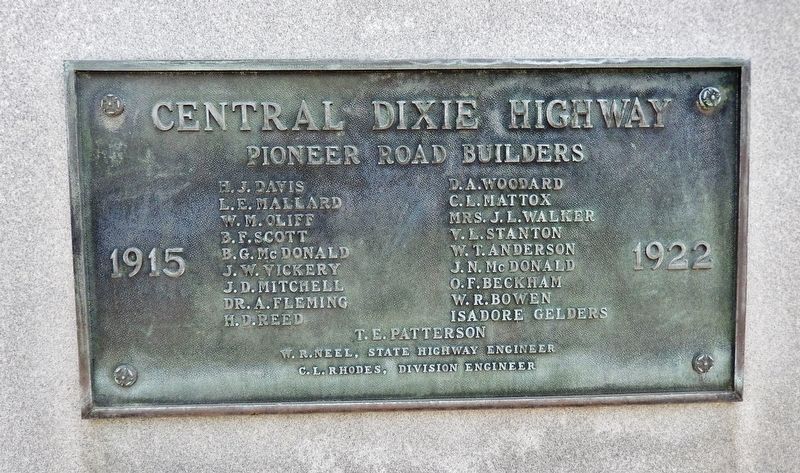
Central Dixie Highway
Pioneer Road Builders
| — | 1915-1922 | — |
Photographed by Cosmos Mariner, March 11, 2016
1. Central Dixie Highway Marker
T.E. Patterson
W.R. Neel, State Highway Engineer
C.L. Rhodes, Division Engineer
Topics. This historical marker is listed in this topic list: Roads & Vehicles. A significant historical year for this entry is 1915.
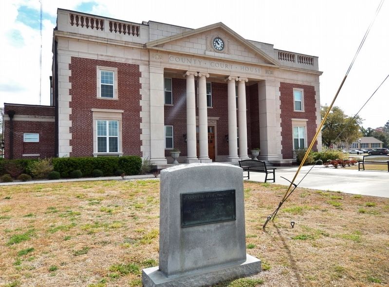
Location. 30° 49.916′ N, 82° 0.313′ W. Marker is in Folkston, Georgia, in Charlton County. It is on 3rd Street just north of Main Street (Georgia Route 40), on the right when traveling north. Marker is located directly in front of the Charlton County Courthouse. Touch for map. Marker is at or near this postal address: 1520 3rd Street, Folkston GA 31537, United States of America. Touch for directions.

Regionally, this marker is on the Coastal Plain. It is also in the American South, specifically in the Deep South, and on the Eastern Seaboard. Globally, it is in the North Atlantic Region, North America, the Western Hemisphere, the Western World, and
this page online
Other nearby markers. At least 8 other markers are within 3 miles of this marker, measured as the crow flies: Charlton County (a few steps from this marker); Henry Roddenberry (within shouting distance of this marker); Center Village or Centerville (about 400 feet away, measured in a direct line); Okefenokee Swamp (approx. 0.3 miles away); Sardis Church (approx. 2.6 miles away); Trader's Hill (Fort Alert) (approx. 3 miles away); Oldest Industry in Charlton (approx. 3 miles away); First Masonic Lodge in Charlton County (approx. 3 miles away). Touch for a list and map of all markers in Folkston.
Also see . . . Dixie Highway. The Dixie Highway, a network of roads connecting Canada to Florida in the early decades of the twentieth century, was an ambitious undertaking to build the nation's first north–south paved interstate highway. As late as 1915 Georgia boasted very few paved streets and
Photographed by Cosmos Mariner, March 11, 2016
2. Central Dixie Highway Marker
Credits. This page was last revised on March 31, 2021. It was originally submitted on March 31, 2021, by Cosmos Mariner of Cape Canaveral, Florida. This page has been viewed 497 times since then and 63 times this year. Photos: 1, 2. submitted on March 31, 2021, by Cosmos Mariner of Cape Canaveral, Florida.
