Eden in Effingham County, Georgia — The American South (South Atlantic)
Sherman's Right Wing
Photographed by Mike Stroud, September 21, 2008
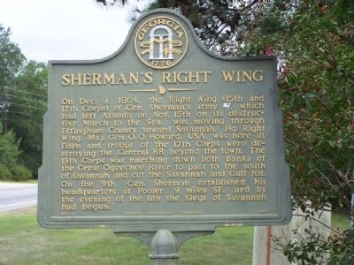
1. Sherman's Right Wing Marker
On Dec. 8, 1864, the Right Wing (15th and 17th Corps) of Gen. Sherman's army (US), which had left Atlanta on Nov. 15th on its destructive March to the Sea, was moving through Effington County toward Savannah. Hq. Right Wing, Maj. Gen. O.O. Howard, USA, was here at Eden and troops of the 17th Corps were destroying the Central RR beyond the town. The 15th Corps was marching down both banks of the Great Ogeechee River to pass to the south of Savannah and cut the Savannah and Gulf RR. On the 9th, Gen. Sherman established his headquarters at Pooler, 9 miles SE, and by the evening of the 11th the Siege of Savannah had begun.
Erected 1958 by Georgia Historical Commission. (Marker Number 051-17.)
Topics and series. This historical marker is listed in this topic list: War, US Civil. In addition, it is included in the Georgia Historical Society, and the Sherman’s March to the Sea series lists. A significant historical month for this entry is October 1855.
Location. 32° 10.367′ N, 81° 23.393′ W. Marker is in Eden, Georgia, in Effingham County. It is at the intersection of Louisville Road (U.S. 80) and Fox Bow Drive, on the
this page online

Regionally, this marker is on the Coastal Plain and in Greater Savannah. It is also in the American South and specifically in the Deep South. Globally, it is in North America, the Western Hemisphere, the Western World, and the Anglosphere. Historically, it finds itself in what was once New Spain, the territory of the Mississippian Culture, one of the original Thirteen Colonies, one of the Confederate States of America, and the Antebellum South.
Other nearby markers. At least 8 other markers are within 10 miles of this marker, measured as the crow flies: Jencks Bridge (approx. 2.1 miles away); Sherman at Zion Church (approx. 2.9 miles away); Old River Road (approx. 3.3 miles away); a different marker also named Sherman's Right Wing (approx. 5.8 miles away); a different marker also named Old River Road (approx. 9.1 miles away); Sherman at Pooler (approx. 9.1 miles away); Boeing B-47 Stratojet (approx. 9.7 miles away); Ol' Buddy (approx. 9.7 miles away).
Also see . . . Sherman's March to the Sea.
Photographed by Mike Stroud, 2008
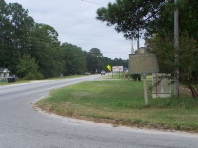
2. Sherman's Right Wing Marker, looking east along US 80 at Fox Bow Drive
The wing was under Oliver O. Howard. Peter J. Osterhaus commanded the Fifteenth Corps, and Francis P. Blair Jr. commanded the Seventeenth Corps. (Submitted on October 3, 2008, by Mike Stroud of Bluffton, South Carolina.)
Photographed by Mike Stroud, 2008
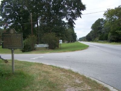
3. Sherman's Right Wing Marker, looking west along US 80
Credits. This page was last revised on October 16, 2021. It was originally submitted on October 3, 2008, by Mike Stroud of Bluffton, South Carolina. This page has been viewed 2,131 times since then and 51 times this year. Last updated on March 31, 2021, by Carl Gordon Moore Jr. of North East, Maryland. Photos: 1, 2, 3. submitted on October 3, 2008, by Mike Stroud of Bluffton, South Carolina. • Bernard Fisher was the editor who published this page.
