Old Sacramento in Sacramento County, California — The American West (Pacific Coastal)
Prisoner of the River
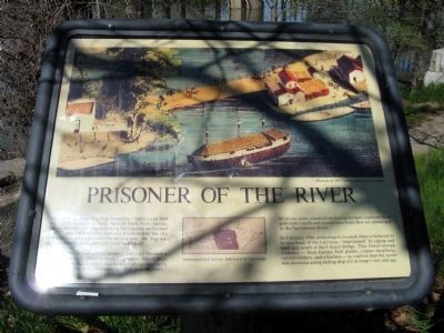
LaGrange
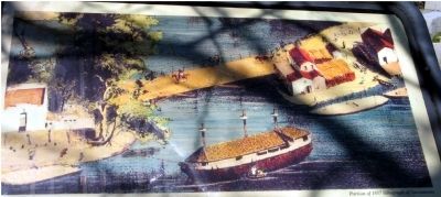
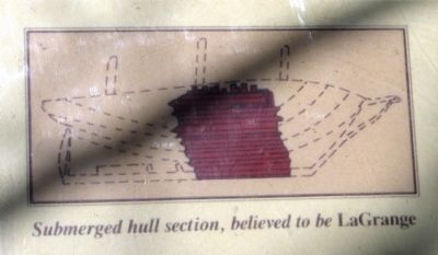
The LaGrange served as Sacramento’s jail until November 1859 when it sank during a week-long storm. Other ships were used as hotels and warehouses along the early waterfront before they too bowed to “time and the river.” In recent years, nautical archeologists have explored three gold rush vessels and several later boats that are submerged in the Sacramento River.
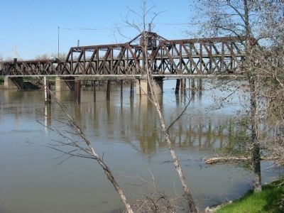
In February 1986 archeologists located what is believed to be wreckage of the LaGrange, “imprisoned” by riprap and mud just south of the I Street Bridge. They found enough evidence – floor frames, hull planks, copper sheathing, curved timbers, and a keelson – to confirm that the vessel was an ocean-going sailing ship of LaGrange's size and age.
Topics. This historical marker is listed in these topic lists: Government & Politics • Notable Places • Settlements & Settlers • Waterways & Vessels. A significant historical month for this entry is February 1986.
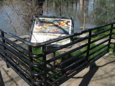
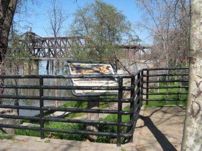
Location. 38° 35.093′ N, 121° 30.336′ W. Marker is in Sacramento, California, in Sacramento County. It is in Old Sacramento. Marker can be reached from I Street. Marker is located in Old Sacramento State Historic Park, just west of the History Museum above the Sacramento River. Touch for map. Marker is at or near this postal address: 101 I Street, Sacramento CA 95814, United States of America. Touch for directions.
Other nearby markers. At least 8 other markers are within walking distance of this marker. 1854 Flagpole (within shouting distance of this marker); 1854 City Hall and Waterworks (within shouting distance of this marker); Sacramento Water Works (within shouting distance of this marker); Sacramento's Early Waterfront (about 400 feet away, measured in a direct line); Eagle Theatre (about 400 feet away); New England Seed Store (about 600 feet away); Professor L.A. Lauriet's Assay Office (about 600 feet away); Booth Building (about 600 feet away). Touch for a list and map of all markers in Sacramento.
Additional commentary.
1. Steamboat Runs Aground on Cabbage
Article in the Golden Notes Fall 1990, a publication of the Sacramento County Historical Society:
During the Gold Rush, many argonauts formed companies and hired their own ship to bring them to California. One such group of 63, the California Mining and Trading Company, came aboard the bark La Grange. Stowed on board were the frame, engine and boiler of a small steamboat.
The La Grange arrived in San Francisco on September 17, 1849. The sidewheel steamboat was assembled at Benicia and launched October 18 with the name Commodore Jones. She was named for Commodore Thomas Jones, commander of the United States Pacific squadron. The Jones had two engines to work her sidewheels and was only 87 feet long. Early in 1850 she was sold and her named changed to Jack Hayes, after a famous Texas Ranger who became Sheriff of San Francisco. Active in the Sacramento-Marysville trade, the Jack Hays pioneered river travel as far north on the Sacramento River as Red Bluff.
In 1851 the Jack Hayes hit a snag in the Feather River and soon had two feet of water in her hold. Repaired, she began service on the Napa River, but soon returned to the Sacramento River under another new name: Sioc.
During the winter of 1852, torrential rains fell on the entire area, swelling rivers over their banks and flooding much of Sacramento City. Many businessmen moved their stores five miles east of the Embarcadero along the American River to Brighton, where a tent city was built. These branch stores were supplied from Sacramento by small steamboats. On December 20, 1852, Captain H.N. Buckland loaded 40 tons of freight on the Sioc at Sacramento and
started for Brighton up the American River. Unable to get past Lisle’s Bridge at about the modern 16th Street, Captain Budkland steered off through the flood waters around the south end of the bridge. All went well for a few yards until the Sioc came upon someone’s vegetable patch. The boat came to a shuddering stop against one of Sacramento’s giant cabbages.
The Democratic State Journal reported on December 21 that “she got aground…She reportedly is a total loss.” The next edition carried the full story:
We are gratified to state that this excellent steamer is still afloat, and not as reported yesterday “a total loss.” This gallant craft would have made the trip to Brighton, with 40 tons of freight, could she have passed Lisle’s Bridge, In endeavoring to go round the bridge she ran upon a head of cabbage, four and a half feet in diameter, and strange as it may appear, was thus brought to a stand, not being able to force down the head of cabbage or herself over it. The freight she had on board was landed safely, and the boat returned to her landing at our Levee last evening.
The Sioc survived her ordeal, was later renamed the Reindeer and ended her days on the Napa River. The La Grange ended her career tied up along the Embarcadero as
a prison ship for Sacramento County. The fate of the cabbage is not known!
— Submitted June 10, 2009, by Syd Whittle of Mesa, Arizona.
2. Sacramento's Prison Barges
Instant cities were created with the massive migration of gold seekers coming to California. Along with the law abiding folks came the usual number of people who chose to live outside of the law. As adequate jail space was not available, the "City" of Sacramento came up with the solution of creating a prison barge. The first of these barges was the bark ”Stafford” which served as a jail from March through May of 1850. The second one, “Stirling”, foundered and sank. The “La Grange” was the third and final one. The hold was partitioned into cells, and a superstructure added to the topside to properly fit the vessel out as a jail. The forward cabin was built of oak and was used as the dungeon for the prisoners convicted of the worst crimes. Iron shafts embedded in oaken planks were added. The prisoners were shackled each night. In addition, a ball and chain was riveted to the leg of each prisoner to discourage escapes.
The end of the “floating jail” era came to an end in November 1859 following heavy rains. The Sacramento Daily Union
reported on November 19, 1859 that:
About six o’clock yesterday morning the officers were aroused by cry of prisoners that the vessel was sinking, the water flowing in freely, and partially flooding cells between decks.
The vessel sank sufficiently to admit water into the lumber hole forward, rendering it inadvisable to continue prisoners below, so they were admitted upon deck and closely watched till about a quarter to four P.M., when they were by concerted action of the sheriff, chief of police, and supervisors, transferred to the Station house, 33 prisoners in all, including two females…
As the barge was securely attached to its mooring at both bow and stern, it was prevented from rising with the rise of the water level. Soon only the peak of the superstructure and two small flagpoles could be seen above the water.
— Submitted May 7, 2009, by Syd Whittle of Mesa, Arizona.
3. For More Info...
Hi, I'm very happy that someone posted the portion of my report that I posted on my website. For more info., or to contact me, please look at www.a-duda.com or www.apluscoach.org I'm happy to discuss my Ph.D. research on the LaGrange with anyone who is interested.
— Submitted December 24, 2009, by Abaigeal Duda of Salem, Massachusetts.
Additional keywords. Prisons
Credits. This page was last revised on February 7, 2023. It was originally submitted on March 13, 2009, by Syd Whittle of Mesa, Arizona. This page has been viewed 4,027 times since then and 102 times this year. Photos: 1, 2, 3, 4, 5, 6. submitted on March 13, 2009, by Syd Whittle of Mesa, Arizona.
