Thelka in San Antonio in Bexar County, Texas — The American South (West South Central)
San Antonio River Flood Control Tunnel
Photographed by James Hulse, December 24, 2020
1. San Antonio River Flood Control Tunnel Marker
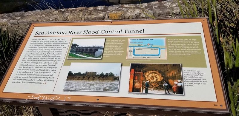
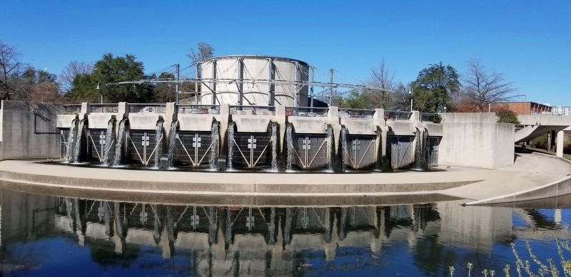
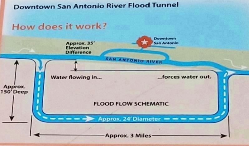
Flooding along the San Antonio River was managed by dams and changes to the river channel until 1997 when construction of an underground flood bypass tunnel was completed. The massive excavation project was accomplished using a boring machine that was lowered in pieces through a shaft at this site and reassembled deep below the surface. The "mole", as it was called, dug northward three miles and was removed through another shaft on Josephine Street in Brackenridge Park. In times of flooding, river water flows to the inlet at the upper end, drops one hundred fifty feet through a shaft into the twenty-four foot diameter tunnel, and travels three miles to the outlet here at Lone Star Boulevard. The $110 million tunnel project was completed only ten months before the devastating flood of October 1998, and it is credited with saving downtown from extensive damage.
Captions
Plazas, landscaping and water features highlight both the tunnel inlet in Brackenridge Park and outlet here on the Mission Reach of the San Antonio River Walk. The inlet (left) is seen as it appears when the river is at its normal level. The outlet (below) is pictured during the flood of May 2013.
Courtesy: San Antonio River Authority
Photo: Fred N. Pfeiffer, San Antonio
During floods, water enters the under ground tunnel at the inlet three miles north of here and is forced to the surface by gravity at the outlet. During drought periods, the tunnel becomes a recycling feature. Water is pumped from the tunnel at the inlet into the river to maintain surface flow downstream through the center of the city. The water then reenters the tunnel here at the outlet.
Based on a drawing by the San Antonio River Authority
The river tunnel was excavated using a boring machine or "mole" that also installed concrete liners as it advanced. This photograph shows the mole as it broke through at the inlet shaft.
Courtesy: San Antonio River Authority
Topics.
this page online
Location. 29° 24.111′ N, 98° 29.235′ W. Marker is in San Antonio, Texas, in Bexar County. It is in Thelka. It is at the intersection of Mission Road and Lone Star Boulevard, on the right when traveling west on Mission Road. Touch for map. Marker is in this post office area: San Antonio TX 78210, United States of America. Touch for directions.

Regionally, this marker is in South Texas. It is also in the American South. Globally, it is in North America, a Gulf of Mexico state, the Western Hemisphere, the Western World, and the Anglosphere. Historically, it finds itself in what was once New Spain, the Republic of Texas, and one of the Confederate States of America.
Other nearby markers. At least 8 other markers are within walking distance of this marker: Edgewood Independent School District (approx. ¼ mile away); Yturri-Edmunds House and Mill (approx. ¼ mile away); Mill on the Pajalache Acequia (approx. ¼ mile away); Silvestre Revueltas (approx. half a mile away); Old S.J. Brooks Home (approx. half a mile
Photographed by James Hulse, December 24, 2020
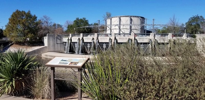
2. The view of the San Antonio River Flood Control Tunnel Marker from the road
Photographed by James Hulse, December 24, 2020
3. The Outlet on the San Antonio River Flood Tunnel
Photographed by San Antonio River Authority, December 24, 2020
4. Diagram of Downtown San Antonio River Flood Tunnel
"How does it work?" from the diagram on the marker
Credits. This page was last revised on February 2, 2023. It was originally submitted on April 1, 2021, by James Hulse of Medina, Texas. This page has been viewed 1,088 times since then and 127 times this year. Photos: 1, 2, 3, 4. submitted on April 1, 2021, by James Hulse of Medina, Texas.
