Near Homer in Banks County, Georgia — The American South (South Atlantic)
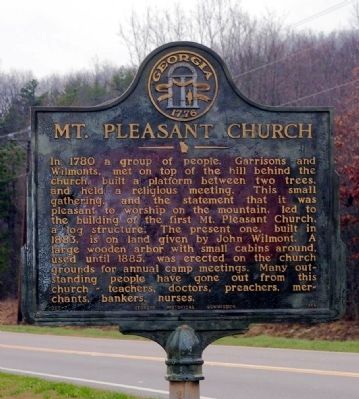
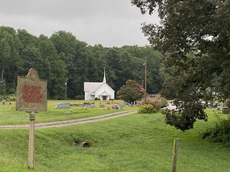
Mt. Pleasant Church
Erected 1956 by Georgia Historical Commission. (Marker Number 006-7.)
Topics and series. This historical marker is listed in these topic lists: Churches & Religion • Education • Industry & Commerce • Science & Medicine. In addition, it is included in the Georgia Historical Society series list. A significant historical year for this entry is 1780.
Location. 34° 21.821′ N, 83° 26.647′ W. Marker is near Homer, Georgia, in Banks County. Marker is on Georgia Route 51, 0.1 miles west of Damascus Road (Old Georgia Route 184), on the right when traveling east. Touch for map. Marker is in this post office area: Homer GA 30547, United States of America. Touch for directions.
Other nearby markers. At least 8 other markers are within 8 miles of this marker, measured as the crow flies. Nails Creek Baptist Church (approx. 2.3 miles away); Banks County (approx. 3.7 miles away); Indian Boundary (approx. 3.8 miles away); Line Baptist Church (approx. 4.8 miles away); Hebron Presbyterian Church (approx. 5.6 miles away); Leatherwood Baptist Church (approx. 7.1 miles away); Middle River Volunteers (approx. 7.2 miles away); Old Federal Road Historic District (approx. 7.8 miles away). Touch for a list and map of all markers in Homer.
Credits. This page was last revised on August 29, 2021. It was originally submitted on December 16, 2008, by David Seibert of Sandy Springs, Georgia. This page has been viewed 2,053 times since then and 46 times this year. Last updated on March 13, 2009, by David Seibert of Sandy Springs, Georgia. Photos: 1. submitted on December 16, 2008, by David Seibert of Sandy Springs, Georgia. 2. submitted on August 29, 2021, by Darren Jefferson Clay of Duluth, Georgia. • Kevin W. was the editor who published this page.

