Lexington in Fayette County, Kentucky — The American South (East South Central)
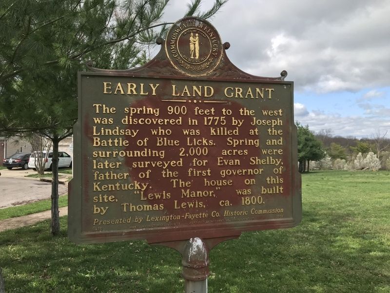
Early Land Grant
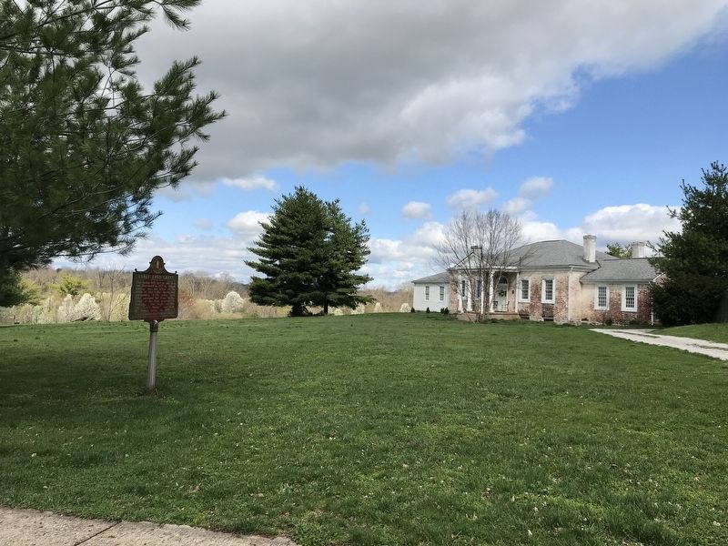
This spring 900 feet to the west was discovered in 1775 by Joseph Lindsay who was killed at the Battle of Blue Licks. Spring and surrounding 2,000 acres were later surveyed for Evan Shelby, father of the first governor of Kentucky. The house on this site, "Lewis Manor," was built by Thomas Lewis, circa 1800.
Erected 1976 by Kentucky Historical Society and Kentucky Department of Transportation. (Marker Number 1558.)
Topics and series. This historical marker is listed in these topic lists: Settlements & Settlers • Waterways & Vessels. In addition, it is included in the Kentucky Historical Society series list. A significant historical year for this entry is 1775.
Location. 38° 4.601′ N, 84° 33.093′ W. Marker is in Lexington, Kentucky, in Fayette County. Marker is on Coronado Ridge, 0.1 miles south of Sprinters Trail, on the right when traveling south. Touch for map. Marker is at or near this postal address: 2625 Coronado Ridge, Lexington KY 40511, United States of America. Touch for directions.
Other nearby markers. At least 8 other markers are within walking distance of this marker. Americas First West (approx. 0.6 miles away); Geology And The Land (approx. 0.6 miles away); Welcome To The Old Frankfort Pike Scenic Byway and the Lexington-Frankfort Scenic Corridor (approx. 0.6 miles away); The Settlers (approx. 0.6 miles away); Create An Agri-culture (approx. 0.6 miles away); Breed Only The Best (approx. 0.6 miles away); Gentlemen Farmers and Burley Tobacco (approx. 0.6 miles away); the International Thoroughbred Landscape (approx. 0.6 miles away). Touch for a list and map of all markers in Lexington.

Photographed By Duane and Tracy Marsteller, March 28, 2021
2. Early Land Grant Marker
"History of Col. Joseph Lindsay"
Martha T. Nuckols in the May, 1914 edition of the Register of the Kentucky State Historical Society at JSTOR.
Click for more information.
Martha T. Nuckols in the May, 1914 edition of the Register of the Kentucky State Historical Society at JSTOR.
Click for more information.
Credits. This page was last revised on April 26, 2022. It was originally submitted on April 3, 2021, by Duane and Tracy Marsteller of Murfreesboro, Tennessee. This page has been viewed 342 times since then and 67 times this year. Photos: 1, 2. submitted on April 3, 2021, by Duane and Tracy Marsteller of Murfreesboro, Tennessee.
