Lexington in Fayette County, Kentucky — The American South (East South Central)
Glengarry Field-Cool Meadow
⎯⎯⎯
Fasig-Tipton Since 1898
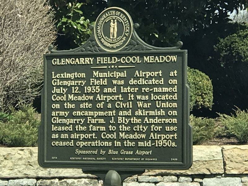
Photographed by Duane and Tracy Marsteller, March 28, 2021
1. Glengarry Field-Cool Meadow Marker
Erected 2014 by Kentucky Historical Society and Kentucky Department of Highways. (Marker Number 2439.)
Topics and series. This historical marker is listed in these topic lists: Air & Space • Animals • Industry & Commerce • Sports. In addition, it is included in the Kentucky Historical Society series list. A significant historical date for this entry is July 12, 1935.
Location. 38° 6.61′ N, 84° 28.909′ W.
this page online

Regionally, this marker is in Kentucky’s Bluegrass Region. It is also in the American South and specifically in the Upper South. Globally, it is in North America, the Western Hemisphere, the Western World, and the Anglosphere. Historically, it finds itself in what was once the territory of the Mississippian Culture and also the Antebellum South.
Other nearby markers. At least 8 other markers are within 3 miles of this marker, measured as the crow flies: Artistides (approx. 1.3 miles away); Coldstream Farm (approx. 1.4 miles away); Mt. Horeb Presbyterian Church (approx. 1.4 miles away); Wing Commander / Famous Saddle Horse (approx. 1½ miles away); Man o' War / Man o' War (1917-1947) (approx. 1.9 miles away); Maddoxtown (approx. 2.1 miles away); Lexington Colored Fair Association / Successful Enterprise (approx. 2.6 miles away); Joyland Park Paris Pike

Photographed by Duane and Tracy Marsteller, March 28, 2021
2. Fasig-Tipton Since 1898 Marker
Also see . . .
1. Cool Meadow Field. Explore Kentucky History website entry (Submitted on January 7, 2022, by Larry Gertner of New York, New York.)
2. Fasig-Tipton - About Us. Company website entry (Submitted on April 3, 2021, by Duane and Tracy Marsteller of Murfreesboro, Tennessee.)
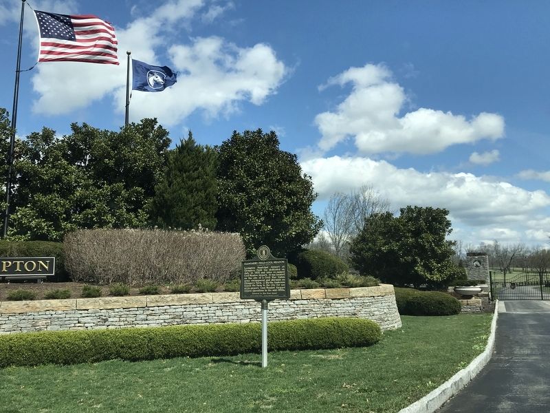
Photographed by Duane and Tracy Marsteller, March 28, 2021
3. Glengarry Field-Cool Meadow / Fasig-Tipton Since 1898 Marker
Credits. This page was last revised on January 7, 2022. It was originally submitted on April 3, 2021, by Duane and Tracy Marsteller of Murfreesboro, Tennessee. This page has been viewed 552 times since then and 53 times this year. Photos: 1, 2, 3. submitted on April 3, 2021, by Duane and Tracy Marsteller of Murfreesboro, Tennessee.
