Ixmiquilpan, Hidalgo, Mexico — The Central Highlands (North America)
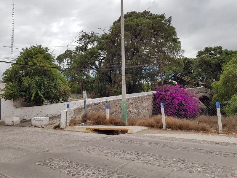
The San Miguel Arcangel Bridge
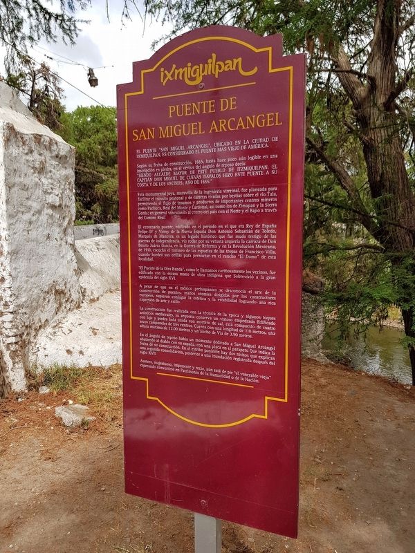
El puente "San Miguel Arcangel", ubicado en la Ixmiquilpan, es considerado el puente mas viejo de América.
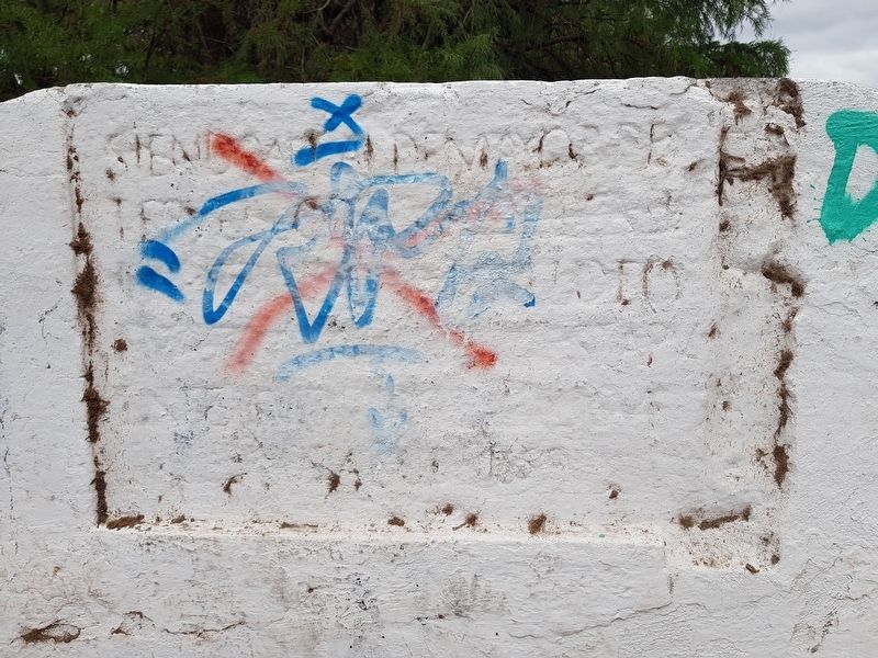
Según su fecha de construcción, 1665, hasta hace poco aún legible en una Inscripción en piedra, en el vértice del ángulo de reposo decía: "siendo alcalde mayor de este pueblo de Itzmiquilpan, el Capitán Don Miguel de Cuevas Davalos hizo este puente a su costa y de los vecinos; año de 1655."
Esta monumental joya, maravilla de la ingeniería virreinal, fue planeada para facilitar el tránsito peatonal y de carretas tiradas por bestias sobre el río Tula, permitiendo el flujo de insumos y productos de importantes centros mineros como Pachuca, Real del Monte y Cardonal, así como los de Zimapan y la Sierra Gorda; en general vinculando al centro del país con el Norte y el Bajío a través del Camino Real.
El centenario puente, edificado en el periodo en el que era Rey de España Felipe IV y Virrey de la Nueva España Don Antonio Sebastián de Toledo, Marqués de Mancera, es un legado histórico que fue mudo testigo de las guerras de independencia, vio rodar por su vetusta arquería la carroza de Don Benito Juárez García, en la Guerra de Reforma y en la Revolución Mexicana, de 1910, escuchó el tintineo de las espuelas de las tropas de Francisco Villa, cuando bordeó sus orillas para pernoctar en el rancho "El Domo" de esta localidad.
"El Puente de la Otra Banda", como le llamamos cariñosamente los vecinos, fue edificado con la escasa mano de obra indigena que sobrevivió a la gran epidemia del siglo XVI.
A pesar de que en el méxico prehispánico se desconocía el arte de la construcción de puentes, manos otomies dirigidas por los constructores europeos, supieron conjugar la estética y la estabilidad logrando una rica expresión de arte y estilo.
La construcción fue realizada con la técnica de la época y algunos toques artisticos medievales, su arqueria conserva un vistoso empedrado edificado con laja y piedra bola unida con mortero de cal, está compuesto de cuatro arcos campaneles de tres centros. Cuenta con una longitud de 110 metros, una altura máxima de 12.00 metros y un ancho de Via de 3.90 metros.
En el ángulo de reposo había un momento dedicado a San Miguel Arcángel abatiendo al diablo con su espada, con una placa en el parapeto Que indica la fecha de su construcción. En el estribo poniente hay dos nichos que explican una segunda consolidación, posterior a una inundación registrada
después del
siglo XVII.
Austero, majestuoso, imponente y recio, aún está de pie "el venerable viejo" esperando convertirse en Patrimonio de la Humanidad o de la Nación.
The San Miguel Arcangel Bridge
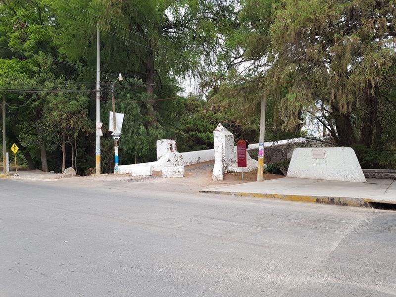
The San Miguel Arcangel bridge, located here in Ixmiquilpan, is considered the oldest bridge in America, according to its construction in 1665.
Until recently the following was legible in a stone inscription at the top of the bridge: "Being mayor of this town of Itzmiquilpan, Captain Miguel de Cuevas Davalos made this bridge at his cost and that of his neighbors in1655."
This monumental gem, a marvel of engineering, was planned to facilitate pedestrian and animal-drawn cart traffic over the Tula River, allowing the flow of inputs and products from important mining centers such as Pachuca, Real del Monte and Cardonal, as well as products from Zimapan and from the Sierra Gorda. The bridge linked the center of the country with the north and the Bajío Region through the Camino Real.
The centuries-old bridge, built in the period when Felipe IV was King of Spain and the Viceroy of New Spain was Antonio Sebastián de Toledo, Marquis de Mancera, is a historical legacy that witnessed the wars of independence. It saw Benito Juárez García’s carriage pass during the War of Reform. During the Mexican
Revolution starting in 1910, it heard the jingle of the spurs of Francisco Villa's troops, when they skirted its banks to stay overnight at the "El Domo" ranch in this town.
"The Bridge to the Other Side", as its neighbors affectionately call it, was built with the scarce indigenous labor that survived the great epidemic of the 16th century.
Although the art of building bridges was not well-known in pre-Hispanic Mexico, the indigenous laborers led by European builders were able to combine aesthetics and stability in an achievement rich in the expression of art and style.
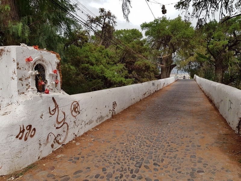
The construction was carried out with the technique of the time and some medieval artistic touches, its arch preserves a cobblestone paving of river stone joined with lime mortar. It is composed of four campanel arches along three centers. It has a length of 110 meters, a maximum height of 12 meters and a width of 3.90 meters.
At the top of the bridge there was a moment dedicated to St. Michael the Archangel with his sword, with a marker on the parapet indicating the date of its construction. On the western end of the bridge there are two niches that were part of a later restoration, after a flood recorded in the 17th century.
Austere, majestic, imposing and determined, this venerable bridge still stands, hoping to one day become a National or World Heritage Site.
Topics.
This historical marker is listed in these topic lists: Bridges & Viaducts • Colonial Era. A significant historical year for this entry is 1665.
Location. 20° 29.269′ N, 99° 13.323′ W. Marker is in Ixmiquilpan, Hidalgo. Marker is at the intersection of Avenida Maestro Rural and Progreso, on the right when traveling north on Avenida Maestro Rural. Touch for map. Marker is in this post office area: Ixmiquilpan HGO 42302, Mexico. Touch for directions.
Other nearby markers. At least 8 other markers are within 16 kilometers of this marker, measured as the crow flies. Hidalgo Theater (approx. 0.4 kilometers away); Municipal Palace (approx. half a kilometer away); Benito Juárez (approx. half a kilometer away); Diana the Huntress (approx. half a kilometer away); Temple and Convent of San Miguel Arcángel (approx. 0.7 kilometers away); Convent of San Miguel Archangel Ixmiquilpan (approx. 0.7 kilometers away); Alfonso Corona del Rosal (approx. 0.8 kilometers away); The Founding of Alfajayucan (approx. 15.9 kilometers away). Touch for a list and map of all markers in Ixmiquilpan.
Credits. This page was last revised on April 4, 2021. It was originally submitted on April 3, 2021, by J. Makali Bruton of Accra, Ghana. This page has been viewed 568 times since then and 145 times this year. Photos: 1, 2, 3, 4, 5. submitted on April 3, 2021, by J. Makali Bruton of Accra, Ghana.
