Albemarle High School near Charlottesville in Albemarle County, Virginia — The American South (Mid-Atlantic)
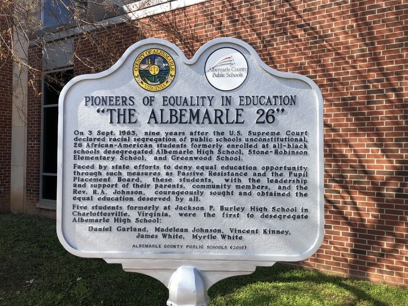
“The Albemarle 26”
Pioneers of Equality in Education
On 3 Sept. 1963, nine years after the U.S. Supreme Court declared racial segregation of public schools unconstitutional, 26 African-American students formerly enrolled at all-black schools desegregated Albemarle High School, Stone-Robinson Elementary School, and Greenwood School.
Faced by state efforts to deny equal education opportunity through such measures such as Passive Resistance and the Pupil Placement Board, these students, with the leadership and support of their parents, community members, and the Rev. R.A. Johnson, courageously sought and obtained the equal education deserved by all.
Five students formerly at Jackson P. Burley High School in Charlottesville, Virginia, were the first to desegregate Albemarle High School:
Daniel Garland, Madelean Johnson, Vincent Kinney, James White, Myrtle White
Erected 2018 by Albemarle County Public Schools.
Topics. This historical marker is listed in these topic lists: African Americans • Civil Rights • Education. A significant historical date for this entry is September 3, 1963.
Location. 38° 4.505′ N, 78° 29.991′ W. Marker is near Charlottesville, Virginia, in Albemarle County. It is in Albemarle High School. Marker can be reached from the intersection of Hydraulic Road (County Road 743) and Hydraulic Ridge Road, on the left when traveling north. Touch for map. Marker is at or near this postal address: 2775 Hydraulic Rd, Charlottesville VA 22901, United States of America. Touch for directions.
Other nearby markers. At least 8 other markers are within 2 miles of this marker, measured as the crow flies. The Origins of Ivy Creek Natural Area (approx. 1.2 miles away); Legacy of Hugh Carr / The Village of Hydraulic Mills (approx. 1.2 miles away); Six Miles of Trails (approx. 1.2 miles away); Old Springs (approx. 1.3 miles away); Rio Hill 1864 Skirmish (approx. 1.7 miles away); Rio Hill (approx. 1.7 miles away); Albemarle Barracks Burial Site (approx. 1.7 miles away); Skirmish at Rio Hill (approx. 1.7 miles away). Touch for a list and map of all markers in Charlottesville.
Related markers. Click here for a list of markers that are related to this marker. There are three historical markers in Albemarle County with this title. For all three markers, the first paragraph is the same.
Additional commentary.
1. Passive Resistance
The campaign by the Virginia government to subvert integration of schools is more often referred to as Massive Resistance, rather than Passive Resistance, a protest tactic advocated by Ghandi.
— Submitted April 4, 2021, by Devry Becker Jones of Washington, District of Columbia.
Additional keywords. Massive Resistance
Credits. This page was last revised on October 11, 2023. It was originally submitted on April 4, 2021, by Devry Becker Jones of Washington, District of Columbia. This page has been viewed 539 times since then and 119 times this year. Photos: 1, 2. submitted on April 4, 2021, by Devry Becker Jones of Washington, District of Columbia.

