The Blair Property and Sugar Bottom
Early 1900's and Today
— Town of Culpeper, Virginia —

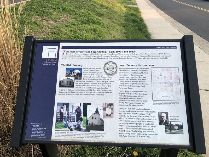
This area of Downtown Culpeper is historically known as "Sugar Bottom," home to many of Culpeper's black Americans around 1900. Former residents refer to this enclave as a friendly neighborhood, where everybody knew everybody, the church was the center of the community, and the nearby spring water was so sweet that it tasted like sugar. the people that lived in Sugar Bottom in the early 1900's enjoyed a happy, clean and simple life.
The Blair Property
On this site once stood a 1920's American Four-Square single family home and a detached, commercial structure, located on W. Culpeper street. These structures were integrally tied to the historical significance of Antioch Baptist Church and Sugar Bottom. Claiborne Blair, grandson of Antioch's first minister, Reverend Harrison Blair — and son of its second minister, purchased the property in 1922 and built the house by 1924. The Blair Family owned the property for decades, residing in the impressive two-story house and operating, at alternate times, a taxi business and a barbershop.
Sugar Bottom — then and now
As illustrated on the 1924 Sanborn Map, small homes or "shanties" adorned the streets of W. Locust Street and S. West Street. Some of the homes were painted — many were not. This was home for the families of Blair, Love, Grasty,
Former Sugar Bottom residents Mrs. Virginia Dudley and Mrs. Jean Gray, remember this area as a safe and friendly neighborhood where residents could enjoy a movie at the nearby Pitts Theatre, located on Main Street, for about 20 cents.
During the mid 1900's in Sugar Bottom, a beloved family doctor lived and worked in this area — his name was Doctor Kyle "O.K." Burnette. Dr. Burnette delivered most — if not all — of the babies of Sugar Bottom. Later in his life, he built a four-unit apartment building, exclusively for black people, in an effort to upgrade living standards and provide a better quality of life for some of the residents of Sugar Bottom. This building now occupies an accounting office, located at the intersection of S. West Street and W. Locust Street.
Erected by Town of Culpeper, Virginia.
Topics. This historical marker is listed in these topic lists: African Americans • Churches & Religion • Science & Medicine • Settlements & Settlers. A significant historical year for this entry is 1900.
Location. 38° 28.375′ N, 77° 59.872′ W. Marker is in Culpeper, Virginia, in Culpeper County. Marker is at the intersection of

Other nearby markers. At least 8 other markers are within walking distance of this marker. Historic Antioch Baptist Church (within shouting distance of this marker); Vietnam War Memorial (about 300 feet away, measured in a direct line); Confederate Memorial (about 300 feet away); A.P. Hill's Boyhood Home (about 500 feet away); George Washington (about 700 feet away); The Gallant Pelham (about 700 feet away); “Gallant” Pelham’s Last Days (approx. 0.2 miles away); Mountain Run Watershed (approx. 0.2 miles away). Touch for a list and map of all markers in Culpeper.
Credits. This page was last revised on April 4, 2021. It was originally submitted on April 4, 2021, by Devry Becker Jones of Washington, District of Columbia. This page has been viewed 361 times since then and 68 times this year. Photos: 1, 2. submitted on April 4, 2021, by Devry Becker Jones of Washington, District of Columbia.