Wrightsville in York County, Pennsylvania — The American Northeast (Mid-Atlantic)
Burning the Wrightsville Bridge
River Towns - Civil War Trails
Photographed by Craig Swain, March 27, 2010
1. Burning the Wrightsville Bridge Marker
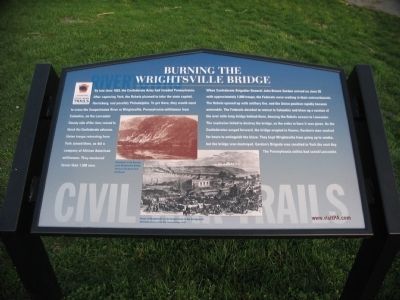
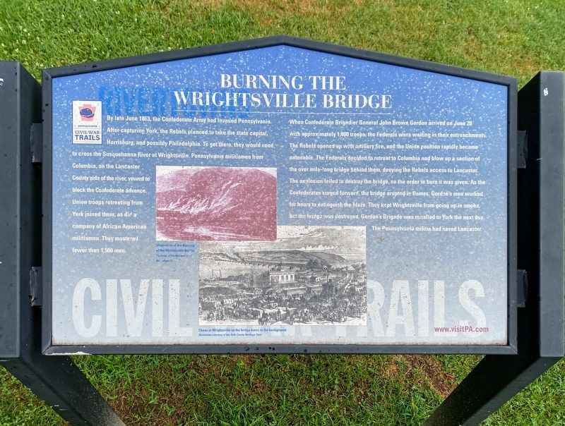
When Confederate Brigadier General John Brown Gordon arrived on June 28 with approximately 1,800 troops, the Federals were waiting in their entrenchments. The Rebels opened up with artillery fire, and the Union position rapidly became untenable. The Federals decided to retreat to Columbia and blow up a section of the over mile-long bridge behind them, denying the Rebels access to Lancaster. The explosions failed to destroy the bridge, so the order to burn it was given. As the Confederates surged forward, the bridge erupted in flames. Gordon's men worked for hours to extinguish the blaze. They kept Wrightsville from going up in smoke, but the bridge
this page online
Illustration of the Burning of the Wrightsville Bridge
Courtesy of the National Civil War Museum
Chaos in Wrightsville as the bridge burns in the background
Illustration Courtesy of the York County Historic Trust
Erected by Pennsylvania Civil War Trails.
Topics and series. This historical marker is listed in this topic list: War, US Civil. In addition, it is included in the Covered Bridges, and the Pennsylvania Civil War Trails series lists. A significant historical month for this entry is June 1863.
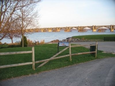
Location. This marker has been replaced by another marker nearby. It was located near 40° 1.72′ N, 76° 31.698′ W. Marker was in Wrightsville, Pennsylvania, in York County. It was at the intersection of Walnut Street and North Front Street, on the right when traveling west on Walnut Street. Located in a parking area at the end of Walnut Street, next to a riverside trail. Touch for map. Marker was in this post office area: Wrightsville PA 17368, United States of America. Touch for directions.

Regionally, this marker was
Photographed by Shane Oliver, July 10, 2020
2. Burning the Wrightsville Bridge Marker
Other nearby markers. At least 8 other markers are within walking distance of this location: The River: a Corridor and a Barrier (a few steps from this marker); Necessary Destruction (a few steps from this marker); Wrightsville's Lime Kilns (about 400 feet away, measured in a direct line); The Old Post Office Building (approx. 0.2 miles away); Gettysburg Campaign (approx. 0.2 miles away); Veterans Memorial Bridge (approx. 0.2 miles away); Wrightsville (approx. 0.2 miles away); American Legion Monument (approx. ¼ mile away). Touch for a list and map of all markers in Wrightsville.
More about this marker. In the center are wartime drawings of the action described in the text. The upper illustration
Photographed by Craig Swain, March 27, 2010
3. Burning the Wrightsville Bridge Marker
Related marker. Click here for another marker that is related to this marker. This marker has been replaced by the linked marker.
Also see . . . Buring of the Wrightsville Bridge. Historian Scott Mingus discusses the burning of the bridge in part five of his seven part tour of Wrightsville on Gettysburg Daily. (Submitted on June 12, 2010, by Craig Swain of Leesburg, Virginia.)
Photographed by Craig Swain, March 27, 2010
4. Wrightsville Bridge
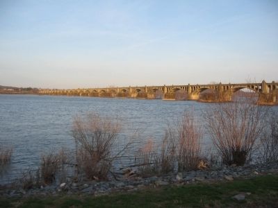
The piers of the wartime bridge still stand in river just upstream of the modern highway bridge.
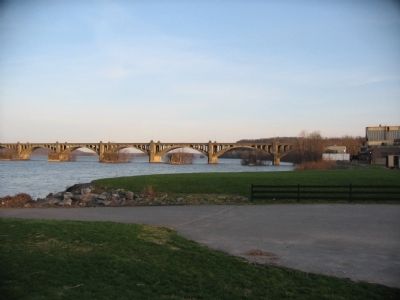
Photographed by Craig Swain, March 27, 2010
5. Wrightsville Bank and Bridge
Looking from the marker location downstream at the bridge. The older piers are better seen in this view.
Credits. This page was last revised on September 7, 2022. It was originally submitted on June 12, 2010, by Craig Swain of Leesburg, Virginia. This page has been viewed 3,217 times since then and 104 times this year. Last updated on April 5, 2021, by Carl Gordon Moore Jr. of North East, Maryland. Photos: 1. submitted on June 12, 2010, by Craig Swain of Leesburg, Virginia. 2. submitted on May 12, 2021, by Shane Oliver of Richmond, Virginia. 3, 4, 5. submitted on June 12, 2010, by Craig Swain of Leesburg, Virginia. • Bernard Fisher was the editor who published this page.
