Settlement
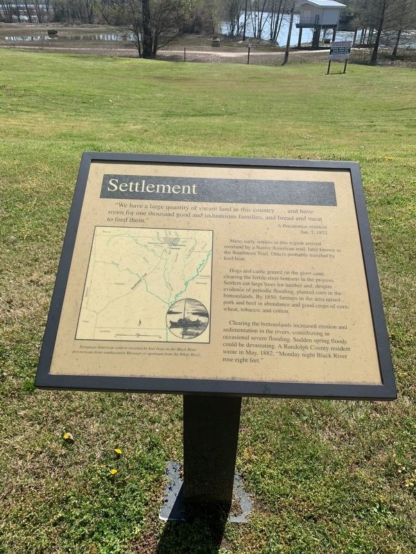
"We have a large quantity of vacant land in this country … and have room for one thousand good and industrious families, and bread and meat to feed them."
A Pocahontas resident
Jan. 2. 1852
Many early settlers in this region arrived overland by a Native American trail, later known as the Southwest Trail. Others probably traveled by keel boat.
Hogs and cattle grazed on the giant cane, clearing the fertile river bottoms in the process. Settlers cut large trees for lumber and despite evidence of periodic flooding, planted corn in the bottomlands. By 1850, farmers in the area raised pork and beef in abundance and good crops of corn wheat, tobacco, and cotton.
Clearing the bottomlands increased e3rosion and sedimentation in the rivers, contributing to occasional severe flooding. Sudden spring floods could be devastating. A Randolph County residence wrote in May, 1882, "Monday night Black River rose eight feet."
Topics. This historical marker is listed in these topic lists: Agriculture • Settlements & Settlers • Waterways & Vessels. A significant historical month for this entry is May 1882.
Location. 36° 15.604′ N, 90° 58.15′ W. Marker is in Pocahontas, Arkansas, in Randolph County. Marker is at the intersection of U.S. 62/67
Other nearby markers. At least 8 other markers are within walking distance of this marker. Native American Culture (a few steps from this marker); A Shipping Route (a few steps from this marker); The River Basin (a few steps from this marker); The Black River Today (a few steps from this marker); The Black River (within shouting distance of this marker); Mr. Earney L. Dickson (within shouting distance of this marker); Randolph County during the War Between the States (within shouting distance of this marker); Futrell Pharmacy (about 500 feet away, measured in a direct line). Touch for a list and map of all markers in Pocahontas.
More about this marker. European American settlers traveled by keel boat on the Black River downstream from southwestern Missouri or upstream from the White River.
Credits. This page was last revised on April 10, 2021. It was originally submitted on April 7, 2021, by Thomas Smith of Waterloo, Ill. This page has been viewed 129 times since then and 12 times this year. Photos: 1. submitted on April 7, 2021, by Thomas Smith of Waterloo, Ill. 2. submitted on April 8, 2021, by Mark Hilton of Montgomery, Alabama. • Devry Becker Jones was the editor who published this page.

