Lajitas in Brewster County, Texas — The American South (West South Central)
Lajitas Cemetery
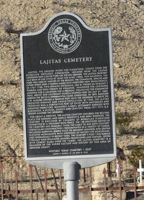
Lajitas, the Spanish word for flagstone, comes from the Boquillas Geologic Formation. Located near the Lajitas Crossing/San Carlos ford on the Rio Grande, the Lajitas cemetery has been in use since at least the early 1900s. For millennia, the ford was used by natives of the region; the Comanche, Apache and other tribes used it during raids into northern New Spain/Mexico. In 1747-1748, two Spanish entradas, led by Pedro de Rábago y Therán and Don Fermín de Vidaurre, traversed the crossing looking for a location for a presidio. Following the Comanche Trail, Brevet 2nd lieutenant Echols stopped here on July 27, 1860, during the second experimental camel expedition. In 1899, rancher H.W. McGuirk opened a trading post near the crossing to serve the growing Hispanic and Anglo population. By 1900, the Lajitas crossing was a substation port of entry with uniformed and mounted inspectors. Ultimately, a small settlement emerged with businesses, a school, church and cemetery. From 1911-1917, U.S. Troops manned the crossing.
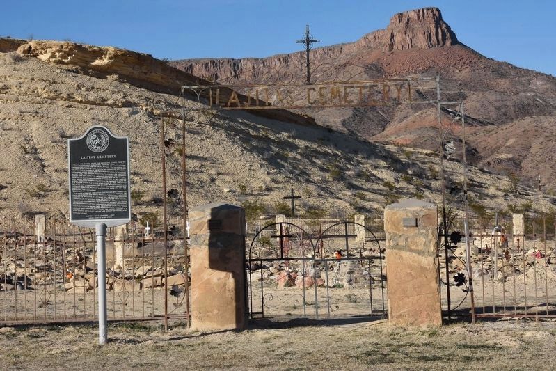
For about a century, the Lajitas cemetery has been the resting place for Hispanic and Anglo residents and area workers. The cemetery is enclosed by columns of Boquillas flagstone connected by a wrought-iron fence. The 138 identified graves in the cemetery are primarily from the early to mid-20th century. Vernacular construction predominates in a variety of forms, including barrows (simple rock or sediment mounds) and grutas (elevated monuments with openings or niches for memorials). Used sporadically in recent times, the cemetery’s post-1950 burials typically have engraved modern headstones and statues, often with cement slabs over the tombs. The Lajitas cemetery is a reminder of the varied culture and history of this area of Brewster County.
Historic Texas Cemetery - 2007
Erected 2007 by Texas Historical Commission. (Marker Number 18262.)
Topics. This historical marker is listed in this topic list: Cemeteries & Burial Sites.
Location. 29° 15.725′ N, 103° 46.491′ W. Marker is in Lajitas, Texas, in Brewster County. Marker is on State Highway 170 west of Comanche Mesa, on the right when traveling west. Touch for map. Marker is in this post office area: Terlingua TX 79852, United States of America. Touch for directions.
Other nearby markers. At least 8 other markers are within 14 miles of this marker, measured as the crow flies. Quicksilver (approx. 9.8 miles away); Terlingua Cemetery (approx. 10.6 miles away); Chisos Mine and Terlingua (approx. 10.6 miles away); Federico Villalba (approx. 10.6 miles away); Terlingua (approx. 10.9 miles away); Terlingua Abaja (approx. 11.3 miles away); Into the Canyon! (approx. 11.9 miles away); Grand Canyon Farms (approx. 13.9 miles away).
Credits. This page was last revised on April 11, 2021. It was originally submitted on April 11, 2021, by Daniel Phillips of Lumberton, New Jersey. This page has been viewed 207 times since then and 24 times this year. Photos: 1, 2. submitted on April 11, 2021, by Daniel Phillips of Lumberton, New Jersey. • J. Makali Bruton was the editor who published this page.

