Near Orange in Orange County, Virginia — The American South (Mid-Atlantic)
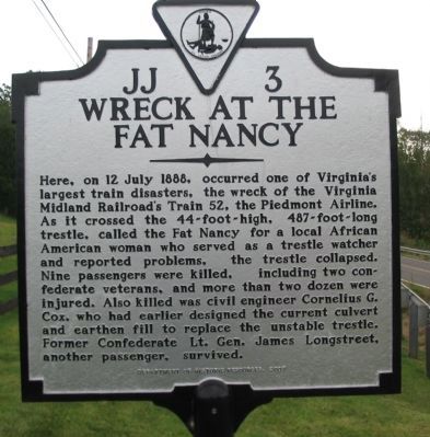
Wreck at the Fat Nancy
Photographed by Craig Swain, September 6, 2009
1. Wreck at the Fat Nancy Marker
Erected 2007 by Department of Historic Resources. (Marker Number JJ-3.)
Topics and series. This historical marker is listed in these topic lists: African Americans • Railroads & Streetcars • War, US Civil. In addition, it is included in the Virginia Department of Historic Resources (DHR) series list. A significant historical date for this entry is July 12, 1888.
Location. 38° 14.355′ N, 78° 8.967′ W. Marker is near Orange, Virginia, in Orange County. It is on Constitution
this page online

Regionally, this marker is in Northern Virginia and in the Piedmont. It is also in the American South and specifically in the Upper South. Globally, it is in North America, the Western Hemisphere, the Western World, and the Anglosphere. Historically, it finds itself in what was once the territory of the Mississippian Culture, one of the original Thirteen Colonies, one of the Confederate States of America, and the Antebellum South.
Other nearby markers. At least 8 other markers are within 2 miles of this marker, measured as the crow flies: Oakley (a few steps from this marker); In Memory of the Dead (approx. 1.3 miles away); Orange Graded School (approx. 1.6 miles away); Madison-Barbour Rural Historic District (approx. 1.6 miles away); Confederate Camp & Freedman's Farm Trail (approx. 1.6 miles away); Lafayette's Tour (approx. 1.6 miles away); Civil War & Gilmore Farm Trail (approx. 1.6 miles
Photographed by Craig Swain, September 6, 2009
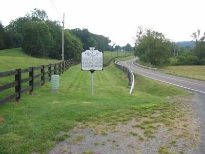
2. Wreck at the Fat Nancy Marker
Looking east at the marker. The trestle spanned Laurel Creek at a point just east of the marker's location and near the modern highway. Presently the railroad line runs further to the south.
Photographed by Craig Swain, September 6, 2009
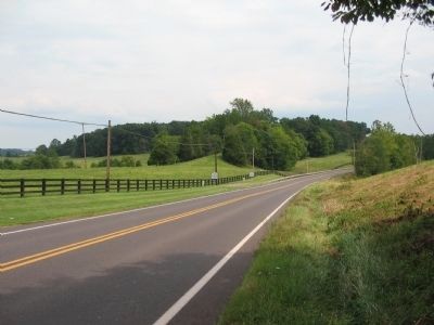
3. The Markers and the Old Railroad Grade
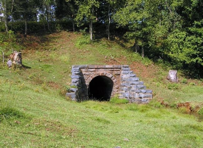
Looking beyond the marker is a path through the trees. After the disaster the railroad build an embankment with a stone culvert, to replace the trestle. That embankment stands today just north of the modern highway, and the culvert remains to allow Laurel Creek to pass.
Photographed by Paul Crumlish, September 27, 2009
4. Current Culvert at the Wreck of the Fat Nancy trestle site
Photographed by Paul Crumlish, September 27, 2009
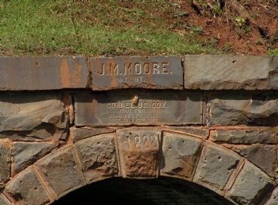
5. Detail of the Current Culvert at the Wreck of the Fat Nancy trestle site
Memorializing Cornelius Cox, the civil engineer who designed the replacement railroad right-of-way and Laurel Creek culvert for the Fat Nancy wooden trestle. Cox was killed in the wreck of the Virginia Midland Railroad's Train 52, the Piedmont Airline, on July 12, 1888.
Credits. This page was last revised on April 14, 2021. It was originally submitted on September 6, 2009, by Craig Swain of Leesburg, Virginia. This page has been viewed 7,121 times since then and 317 times this year. Last updated on April 12, 2021, by Carl Gordon Moore Jr. of North East, Maryland. Photos: 1, 2, 3. submitted on September 6, 2009, by Craig Swain of Leesburg, Virginia. 4, 5. submitted on September 27, 2009, by PaulwC3 of Northern, Virginia. • Bernard Fisher was the editor who published this page.
