Paintsville in Johnson County, Kentucky — The American South (East South Central)
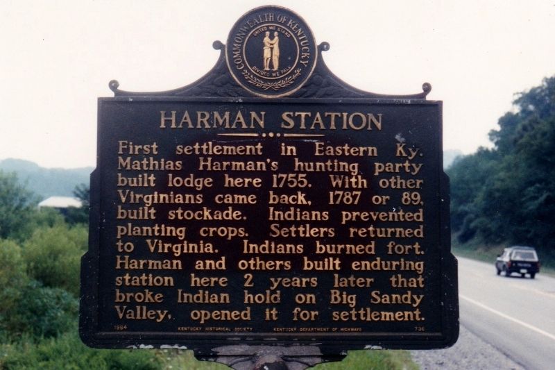
Harman Station
Erected 1964 by Kentucky Historical Society Kentucky Department of Highways. (Marker Number 736.)
Topics. This historical marker is listed in these topic lists: Native Americans • Settlements & Settlers. A significant historical year for this entry is 1755.
Location. 37° 44.744′ N, 82° 46.566′ W. Marker is in Paintsville, Kentucky, in Johnson County. Marker is on Kentucky Route 321, 0.2 miles north of Annie's Lane, on the right when traveling south. Marker is adjacent to Paintsville-Prestonsburg/Combs Field. Touch for map. Marker is in this post office area: Paintsville KY 41240, United States of America. Touch for directions.
Other nearby markers. At least 8 other markers are within 5 miles of this marker, measured as the crow flies. Jenny (Jennie) Wiley (about 300 feet away, measured in a direct line); Morgan’s Last Raid (approx. 4.1 miles away); Samuel May / Samuel May House (approx. 4.3 miles away); The May Farm (approx. 4.3 miles away); Paintsville (approx. 4.8 miles away); The Walker Expedition (approx. 4.9 miles away); County Named, 1843 (approx. 5 miles away); War on the Big Sandy (approx. 5.1 miles away). Touch for a list and map of all markers in Paintsville.
Also see . . . Story of Harmon Station In Historic Block House Bottom. (Submitted on April 12, 2021, by Tim Fillmon of Webster, Florida.)
Credits. This page was last revised on April 12, 2021. It was originally submitted on April 12, 2021, by Tim Fillmon of Webster, Florida. This page has been viewed 914 times since then and 152 times this year. Photo 1. submitted on April 12, 2021, by Tim Fillmon of Webster, Florida.
Editor’s want-list for this marker. A wide view photo of the marker and the surrounding area in context. • Can you help?
