Resaca in Gordon County, Georgia — The American South (South Atlantic)
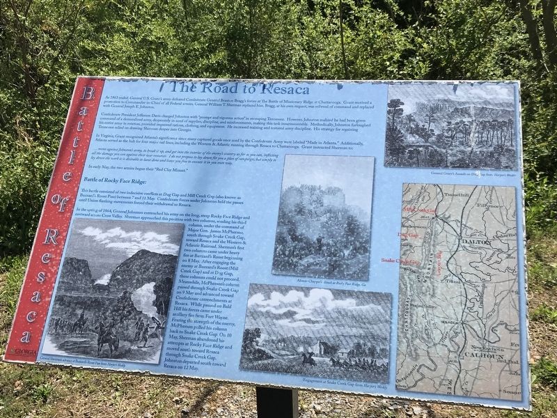
The Road to Resaca
Confederate President Jefferson Davis charged Johnston with “prompt and vigorous action” in recouping Tennessee. However, Johnston realized he had been given command of a demoralized army, desperately in need of supplies, discipline, and reinforcements, making this task insurmountable. Methodically, Johnston furloughed his entire army in rotation, provided improved rations, clothing, and equipment. He increased training and restored army discipline. His strategy for regaining Tennessee relied on drawing Sherman deeper into Georgia.
In Virginia, Grant recognized Atlanta's significance since many captured goods once used by the Confederate Army were labeled “Made in Atlanta.” Additionally, Atlanta served as the hub for four major rail lines, including the Western & Atlantic running through Resaca to Chattanooga. Grant instructed Sherman to:
…move against Johnston's army, to break it up, and get into the interior of the enemy's country as far as you can, inflicting all the damage you can against their war resources. I do not propose to lay down for you a plan of campaign; but simply to lay down the work it is desirable to have done and leave you free to execute it in your own way.
In early May, the two armies began their “Red Clay Minuet.”
Battle of Rocky Face Ridge:
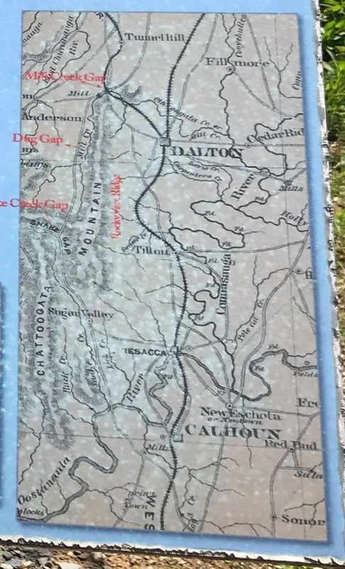
This battle consisted of two indecisive conflicts at Dug Gap and Mill Creek Gap (also known as Buzzard's Roost Pass) between 7 and 11 May. Confederate forces under Johnston held the passes until Union flanking movements forced their withdrawal to Resaca.
In the spring of 1864, General Johnston entrenched his army on the long, steep Rocky Face Ridge and eastward across Crow Valley. Sherman approached this position with two columns, sending his third column, under the command of Major Gen. James McPherson, south through Snake Creek Gap, toward Resaca and the Western & Atlantic Railroad. Sherman's first two columns came under heavy fire at Buzzard's Roost beginning on 8 May. After engaging the enemy at Buzzard's Roost (Mill Creek Gap) and at Dug Gap, these columns could not proceed. Meanwhile, McPherson's column passed through Snake Creek Gap on 9 May and advanced toward Confederate entrenchments at Resaca. While paused on Bald Hill his forces came under artillery fire from Fort Wayne. Fearing the
strength of the enemy, McPherson pulled his column back to Snake Creek Gap. On 10 May, Sherman abandoned his attempts at Rocky Face Ridge and moved south toward Resaca through Snake Creek Gap. Johnston departed south toward Resaca on 12 May.
Captions:
Left: General Sherman's advance at Buzzard's Roost Pass from Harper's Weekly
Center, top: Alonzo Chappel's Attack at Rocky Face Ridge, Ga.
Center, bottom: Engagement at Snake Creek Gap from Harper's Weekly
Right, top: General Geary's Assault on Dug Gap from Harper's Weekly
Erected by Georgia Department of Natural Resources - State Parks and Historic Sites.
Topics. This historical marker is listed in this topic list: War, US Civil. A significant historical year for this entry is 1864.
Location. 34° 34.639′ N, 84° 57.158′ W. Marker is in Resaca, Georgia, in Gordon County. Marker can be reached from Resaca Lafayette Road Northwest (Georgia Route 136). Marker is on entrance road to Resaca Battlefield State Historic Site. Touch for map. Marker is at or near this postal address: 6 GA-136, Resaca GA 30735, United States of America. Touch for directions.
Other nearby markers. At least 8 other markers are within walking distance of this marker. Resaca — A Defensible Position (here, next to this marker); Crossing the Oostanaula at Lay's Ferry (here, next to this marker); Battle of Resaca
(a few steps from this marker); Logan's XV Corps to the South (approx. ¼ mile away); Dancers in the Red Clay Minuet (approx. 0.3 miles away); South Toward Atlanta (approx. 0.3 miles away); a different marker also named Battle of Resaca (approx. 0.6 miles away); a different marker also named Battle of Resaca (approx. 0.6 miles away). Touch for a list and map of all markers in Resaca.
Credits. This page was last revised on April 14, 2021. It was originally submitted on April 13, 2021, by Duane and Tracy Marsteller of Murfreesboro, Tennessee. This page has been viewed 169 times since then and 35 times this year. Photos: 1, 2, 3. submitted on April 13, 2021, by Duane and Tracy Marsteller of Murfreesboro, Tennessee.


