Tulsa in Tulsa County, Oklahoma — The American South (West South Central)
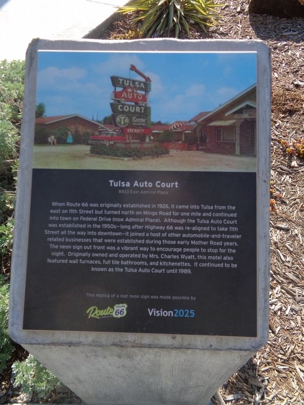
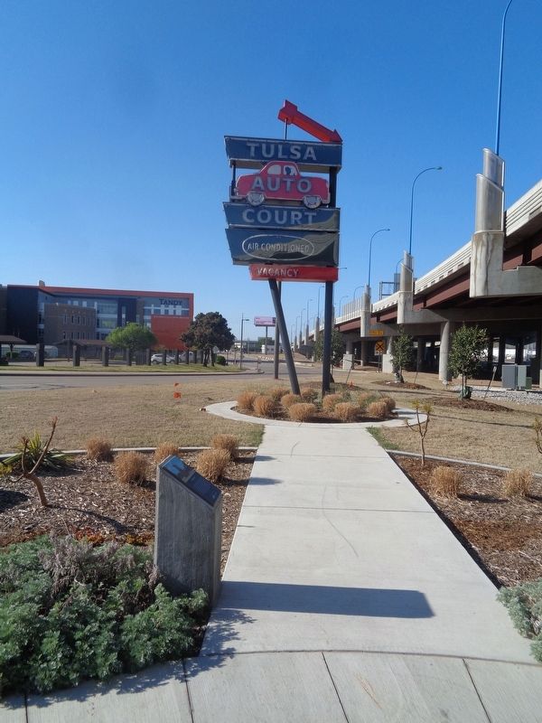
Tulsa Auto Court
8833 East Admiral Place
Erected 2020 by Tulsa Route 66 Commission and Vision 2025.
Topics and series. This historical marker is listed in these topic lists: Industry & Commerce • Roads & Vehicles. In addition, it is included in the U.S. Route 66 series list. A significant historical year for this entry is 1926.
Location. 36° 8.445′ N, 96° 0.405′ W. Marker is in Tulsa, Oklahoma, in Tulsa County. Marker is on Southwest Boulevard (Old U.S. 66) north of West 17th Street, on the right when traveling south. Marker and sign are located at the Route 66 Neon Sign Park. Touch for map. Marker is at or near this postal address: 1450 Southwest Blvd, Tulsa OK 74107, United States of America. Touch for directions.
Other nearby markers. At least 8 other markers are within walking distance of this marker. Will Rogers Motor Court (here, next to this marker); Oil Capital Motel (a few steps from this marker); West Tulsa (approx. ¼ mile away); Tulsa's 11th Street Bridge (approx. 0.3 miles away); a different marker also named Tulsa's 11th Street Bridge (approx. 0.3 miles away); The Bridge that Saved Tulsa (approx. 0.3 miles away); "East Meets West" (approx. 0.3 miles away); Cyrus Stevens Avery (approx. 0.3 miles away). Touch for a list and map of all markers in Tulsa.
Also see . . . Route 66 Neon Sign Park Takes Shape in Tulsa (article). Published on 8/19/2020 by Route66news.com, this article is about the Neon Sign Park, also known as Southwest Avery Plaza. Three long-gone Route 66 businesses' signs were in the process of being restored and placed near the old Historic 11th Street Bridge. Signs were cleaned and installed during the summer of 2020. A "lights on" event was hosted by the City of Tulsa in September 2020. (Submitted on April 21, 2021, by Jason Voigt of Glen Carbon, Illinois.)
Credits. This page was last revised on April 21, 2021. It was originally submitted on April 21, 2021, by Jason Voigt of Glen Carbon, Illinois. This page has been viewed 283 times since then and 51 times this year. Photos: 1, 2. submitted on April 21, 2021, by Jason Voigt of Glen Carbon, Illinois.

