Clute in Brazoria County, Texas — The American South (West South Central)
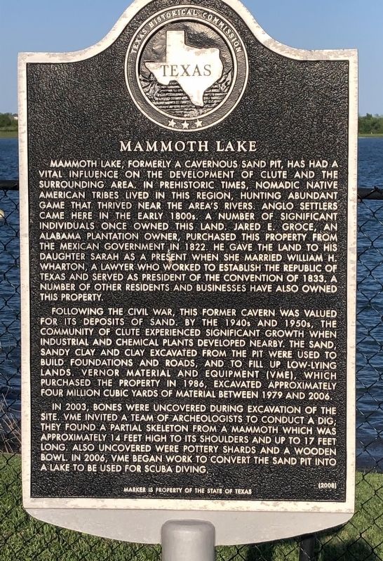
Mammoth Lake
Mammoth Lake, formerly a cavernous sand pit, has had a vital influence on the development of Clute and the surrounding area. In prehistoric times, nomadic Native American tribes lived in this region, hunting abundant game that thrived near the area’s rivers. Anglo settlers came here in the early 1800s. A number of significant individuals once owned this land. Jared E. Groce, an Alabama plantation owner, purchased this property from the Mexican government in 1822. He gave the land to his daughter Sarah as a present when she married William H. Wharton, a lawyer who worked to establish the Republic of Texas and served as president of the convention of 1833. A number of other residents and businesses have also owned this property.
Following the Civil War, this former cavern was valued for its deposits of sand. By the 1940s and 1950s, the community of Clute experienced significant growth when industrial and chemical plants developed nearby. The sand, sandy clay and clay excavated from the pit were used to build foundations and roads, and to fill up low-lying lands. Vernor Material and Equipment (VME), which purchased the property in 1986, excavated approximately four million cubic yards of material between 1979 and 2006.
In 2003, bones were uncovered during excavation of the site. VME invited a team of archeologists to conduct a dig; they found a partial skeleton from a mammoth which was approximately 14 feet high to its shoulders and up to 17 feet long. Also uncovered were pottery shards and a wooden bowl. In 2006, VME began work to convert the sand pit into a lake to be used for scuba diving.
Erected 2008 by Texas Historical Commission. (Marker Number 14211.)
Topics. This historical marker is listed in these topic lists: Paleontology • Parks & Recreational Areas. A significant historical year for this entry is 1822.
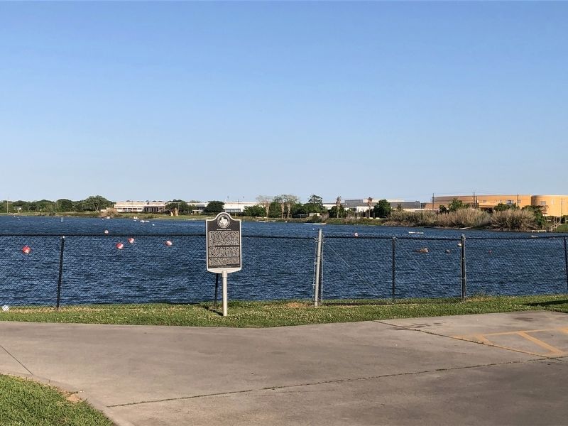
Location. 29° 1.781′ N, 95° 25.239′ W. Marker is in Clute, Texas, in Brazoria County. Marker is on Unnamed Road east of Dixie Drive, on the right when traveling east. The marker is on the north side of a building used for Asiel's Restaurant, which was the name given to the mammoth skeleton found in the original sand pit. Touch for map. Marker is at or near this postal address: 330 N Dixie Drive, Clute TX 77531, United States of America. Touch for directions.
Other nearby markers. At least 8 other markers are within 5 miles of this marker, measured as the crow flies. William Harris Wharton (approx. 0.6 miles away); Dr. Branch Tanner Archer (approx. 0.6 miles away); Eagle Island Plantation (approx. 0.7 miles away); The Brazos Canal (approx. 2 miles away); Site of Crosby's Landing (approx. 2.6 miles away); Abner Jackson Plantation (approx. 3.2 miles away); Joseph H. Hawkins (approx. 3.7 miles away); Phair Cemetery (approx. 4.1 miles away). Touch for a list and map of all markers in Clute.
Credits. This page was last revised on April 22, 2021. It was originally submitted on April 21, 2021, by Chris Kneupper of Brazoria, Texas. This page has been viewed 629 times since then and 84 times this year. Photos: 1, 2. submitted on April 21, 2021, by Chris Kneupper of Brazoria, Texas. • J. Makali Bruton was the editor who published this page.

