Near Manassas in Prince William County, Virginia — The American South (Mid-Atlantic)
Thomas Jonathan Jackson
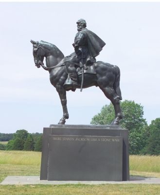
Photographed by Tom Fuchs, June 10, 2006
1. The Jackson Monument
Bronze sculpture by Joseph P. Pollia (1893–1954) is approx 13 foot tall on a 6 foot black granite base.
(Front Face)
Jackson
1824 1863
The State of Virginia
Under Act of 1938
Governors
George C. Peery
James H. Price
Sponsors
John W. Rust
Henry T. Wickham
Aubrey G. Weaver
Erected 1940 by The State of Virginia.
Topics. This memorial is listed in this topic list: War, US Civil.
Location. 38° 48.837′ N, 77° 31.239′ W. Memorial is near Manassas, Virginia, in Prince William County. It can be reached from Sudley Road (Virginia Route 234) 0.6 miles south of Lee Highway (U.S. 29), on the right when traveling north. The marker on the Henry House Hill trail, which starts at the Manassas National Battlefield Park visitor center. Touch for map. Memorial is in this post office area: Manassas VA 20109, United States of America. Touch for directions.

Regionally, this memorial is in the Washington Metropolitan Area, in Northern Virginia, and in the Piedmont. It is also in the American South, specifically
this page online
Other nearby markers. At least 8 other markers are within walking distance of this marker: The War Over Memory (a few steps from this marker); General Barnard Elliott Bee (within shouting distance of this marker); Brigadier General Francis Stebbings Bartow (within shouting distance of this marker); The Bartow Monument (within shouting distance of this marker); Henry Hill (about 300 feet away, measured in a direct line); Colonel Thomas (about 300 feet away); Lieutenant William P. Mangum (about 400 feet away); Artillery Duel (about 400 feet away). Touch for a list and map of all markers in Manassas.
Other markers no longer nearby. Henry Hill Walking Tour (was about 300 feet away but has been reported to have been replaced with another
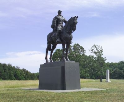
Photographed by Tom Fuchs, June 10, 2006
2. The General Bee Monument Can Be Seen in the Distance
More about this memorial. Monument stands in the approximate position General Jackson was holding at First Manassas. It was commissioned by the Virginia Conservation Commission when ownership of the site was transfered from Battlefield Confederate Park and Sons of Confederate Veterans to the United States.
Regarding Thomas Jonathan Jackson. It was General Bee who gave General Jackson his nickname “Stonewall Jackson”. General Bee's marker, nearby, tells the story.
Also see . . .
1. Stonewall Jackson. Biography and portraits of the General. (Submitted on September 23, 2006.)
2. There Stands Jackson. Excerpt from Lost Victories: The Military Genius of Stonewall Jackson, by Bevin Alexander. (Submitted on September 23, 2006.)
3. List of Stonewall Jackson books. Currently available titles on Amazon.com (Submitted on September 23, 2006.)
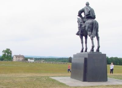
Photographed by J. J. Prats, June 10, 2006
3. An Imposing Monument
It is a large monument. The black stone used makes it visible summer and winter, almost alone in the large grassy rise of Henry Hill. The Henry House and the Union lines that were behind it are in the distance.
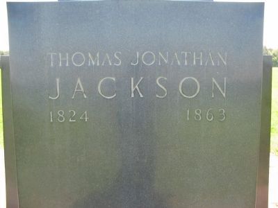
Photographed by Craig Swain, May 4, 2008
4. Front Face Inscription
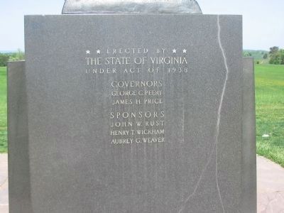
Photographed by Craig Swain, May 4, 2008
5. Rear Inscription
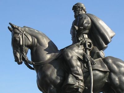
Photographed by Bill Coughlin, November 11, 2007
6. Closeup of Jackson equestrian monument
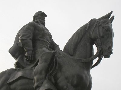
Photographed by Bill Coughlin, November 8, 2007
7. Another closeup of Jackson on Little Sorrel
Credits. This page was last revised on September 18, 2025. It was originally submitted on September 23, 2006, by Tom Fuchs of Greenbelt, Maryland. This page has been viewed 3,688 times since then and 58 times this year. Last updated on April 25, 2021, by Bradley Owen of Morgantown, West Virginia. Photos: 1, 2. submitted on September 23, 2006, by Tom Fuchs of Greenbelt, Maryland. 3. submitted on September 23, 2006, by J. J. Prats of Powell, Ohio. 4, 5. submitted on June 8, 2008, by Craig Swain of Leesburg, Virginia. 6, 7. submitted on November 28, 2007, by Bill Coughlin of Woodland Park, New Jersey. • Bernard Fisher was the editor who published this page.
