
Near Westerville in Delaware County, Ohio — The American Midwest (Great Lakes)
Sharp Family Homes
Photographed by William Fischer, Jr., June 7, 2009
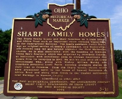
1. Sharp Family Homes Marker (Side A)
The Sharp family homes and their locations on N. State Street and Africa Road mark an important route through Westerville on the Underground Railroad. The family patriarch, Garrit Sharp, was an original settler of Sharp's Settlement, now Westerville, and donated land for and helped organize the first Methodist church. He is also associated with the founding of Blendon Young Men's Seminary, which was acquired by Otterbein College, an institution with enrollment open to African Americans and women from its inception in 1847. He and his sons were all noted abolitionists who, along with Bishop William Hanby and Otterbein president Lewis Davis, assisted southern slaves on their road to freedom. From the Sharp homes, slaves would have proceeded north to the house of Samuel Patterson on Africa Road and along Alum Creek to the Quaker settlement near Marengo in Morrow County.
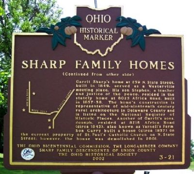
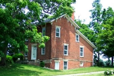
Garrit Sharp's home at 259 N. State Street, built in 1849, served as a Westerville meeting place. His son Stephen, a teacher and justice of the peace, resided in the stately home at 8025 Africa Road, built in 1857-58. The home's construction is representative
this page online
Erected 2002 by Ohio Bicentennial Commission, The Longaberger Company, Sharp Family Descendents of Union County, and The Ohio Historical Society. (Marker Number 3-21.)
Topics and series. This historical marker is listed in these topic lists: Abolition & Underground RR • African Americans • Education • Religion & Religious Structures. In addition, it is included in the Ohio Historical Society / The Ohio History Connection series list. A significant historical year for this entry is 1847.
Location. 40° 8.611′ N, 82° 56.347′ W. Marker is near Westerville, Ohio, in Delaware County. It is on Africa Road ¼ mile south of Polaris Parkway, on the right when traveling north. Touch for map. Marker is at or near this postal address: 8025 Africa Road,
Photographed by William Fischer, Jr., June 7, 2009
2. Sharp Family Homes Marker (Side B)

Regionally, this marker is in the Scioto Valley and in the Columbus Metropolitan Area. It is also in the American Midwest and in the Corn Belt. Globally, it is in North America, the Western Hemisphere, the Western World, and the Anglosphere. Historically, it finds itself in what was once the Haudenosaunee (Iroquois) Confederacy, the territory of the Mississippian Culture, and the Northwest Territory.
Other nearby markers. At least 8 other markers are within walking distance of this marker: In Memory of St. Paul the Apostle Rectory (approx. 0.7 miles away); Warren 'Ernie' Ernsberger (approx. 0.8 miles away); The Alkire House (approx. 0.8 miles away); Veterans Memorial Fund Sponsor Request (approx. 0.8 miles away); Veterans Memorial (approx. 0.8 miles away); Prisoner of War ★ Missing in Action (approx. 0.8 miles away); Homecoming (approx. 0.8 miles away); Transitions (approx. 0.8 miles away). Touch for a list and map of all markers in Westerville.
Photographed by William Fischer, Jr., June 7, 2009
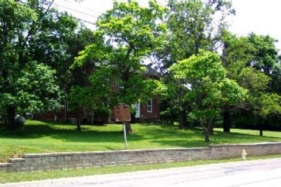
3. Sharp Family Homes Marker at Stephen Sharp Home
Photographed by William Fischer, Jr., June 7, 2009
4. Stephen Sharp Home
Credits. This page was last revised on April 19, 2024. It was originally submitted on July 4, 2009, by William Fischer, Jr. of Reynoldsburg, Ohio. This page has been viewed 8,586 times since then and 374 times this year. Last updated on April 25, 2021, by Robert Baughman of Bellefontaine, Ohio. Photos: 1, 2, 3, 4. submitted on July 4, 2009, by William Fischer, Jr. of Reynoldsburg, Ohio. • Devry Becker Jones was the editor who published this page.
