From Bison to Cattle
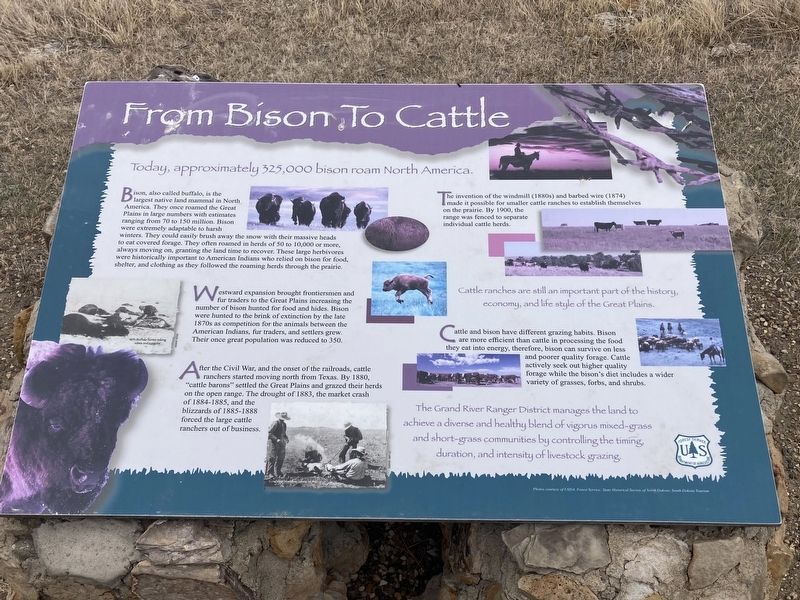
Bison, also called buffalo, is the largest native land mammal in North America. They once roamed the Great Plains in large numbers with estimates ranging from 70 to 150 million. Bison were extremely adaptable to harsh winters. They could easily brush away the snow with their massive heads to eat covered forage. They often roamed in herds of 50 to 10,000 or more, always moving on, granting the land time to recover. These large herbivores were historically important to American Indians who relied on bison for food, shelter, and clothing as they followed the roaming herds through the prairie.
Westward expansion brought frontiersmen and fur traders to the Great Plains increasing the number of bison hunted for food and hides. Bison were hunted to the brink of extinction by the late 1870s as competition for the animals between the American Indians, fur traders, and settlers grew. Their once great population was reduced to 350.
After the Civil War, and the onset of the railroads, cattle ranchers started moving north from Texas. By 1880, “cattle barons” settled the Great Plains and grazed their herds on the open range. The drought of 1883, the market crash of 1884-1885, and the blizzards of 1885-1888 forced the large cattle ranchers
out of business.The invention of the windmill (1880s) and barbed wire (1874) made it possible for smaller cattle ranches to establish themselves on the prairie. By 1900, the range was fenced to separate individual cattle herds.
Cattle ranches are still an important part of the history, economy, and life style of the Great Plains.
Cattle and bison have different grazing habits. Bison are more efficient than cattle in processing the food they eat into energy, therefore, bison can survive on less and poorer quality forage. Cattle actively seek out higher quality forage while the bison's diet includes a wider variety of grasses, forbs, and shrubs.
The Grand River Ranger District manages the land to
achieve a diverse and healthy blend of vigorus mixed-grass
and short-grass communities by controlling the timing,
duration, and intensity of livestock grazing.
Erected by US Forest Service, Department of Agriculture.
Topics. This historical marker is listed in these topic lists: Agriculture • Animals • Settlements & Settlers. A significant historical year for this entry is 1880.
Location. 45° 43.105′ N, 102° 9.273′ W. Marker is near Shadehill, South Dakota, in Perkins County. Marker can be reached from Forest Road 5740, one mile Forest Road 5626
Other nearby markers. At least 8 other markers are within 13 miles of this marker, measured as the crow flies. Great Plains Weather: Land of Extremes (approx. 0.2 miles away); Public Land Surveying (approx. 0.2 miles away); Welcome to the Grand River National Grassland (approx. 0.2 miles away); Hugh Glass - Adventurer (approx. 4.1 miles away); Shadehill Dam & Reservoir (approx. 4˝ miles away); Hugh Glass (approx. 4˝ miles away); Seim, South Dakota (approx. 4˝ miles away); WWII Bomber Crashes near Meadow, SD (approx. 12.3 miles away). Touch for a list and map of all markers in Shadehill.
Credits. This page was last revised on April 27, 2021. It was originally submitted on April 26, 2021, by Connor Olson of Kewaskum, Wisconsin. This page has been viewed 104 times since then and 10 times this year. Photos: 1, 2. submitted on April 26, 2021, by Connor Olson of Kewaskum, Wisconsin. • Mark Hilton was the editor who published this page.
Editor’s want-list for this marker. A wide shot of the marker and its surroundings. • Can you help?

