
Cuba in Crawford County, Missouri — The American Midwest (Upper Plains)
History at the 4-Way
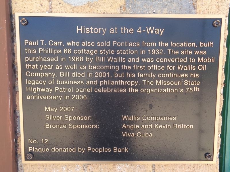
Photographed by Jason Voigt, April 25, 2021
1. History at the 4-Way Marker
Erected by People's Bank. (Marker Number 12.)
Topics. This historical marker is listed in these topic lists: Industry & Commerce • Roads & Vehicles. A significant historical year for this entry is 1932.
Location. 38° 3.75′ N, 91° 24.215′ W. Marker is in Cuba, Missouri, in Crawford County. It is at the intersection of West Washington Street (Old U.S. 66) and South Franklin Street (State Highway 19), on the left when traveling west on West Washington Street. Touch for map. Marker is at or near this postal address: 102 W Washington St, Cuba MO 65453, United States of America. Touch for directions.

Regionally, this marker is in South-Central Missouri. It is also in the American Ozarks,
this page online
Other nearby markers. At least 8 other markers are within walking distance of this marker: St Louis, Salem & Little Rock Railroad (within shouting distance of this marker); Amelia (within shouting distance of this marker); The River (about 400 feet away, measured in a direct line); Mayor Al West (about 500 feet away); John Manson Munro House (about 600 feet away); Cuba's Gold Star Boys aboard the Blue Bonnet Frisco Train (about 600 feet away); Civil War (approx. 0.2 miles away); Confederates in Cuba (approx. 0.2 miles away). Touch for a list and map of all markers in Cuba.
Regarding History at the 4-Way. The building housed a restaurant, The FourWay, that closed on December 2020 after five years of business. In June 2021, Weir on 66, a new restaurant/diner, opened.
Also see . . . Cuba, MO's Route 66 Murals. Known as
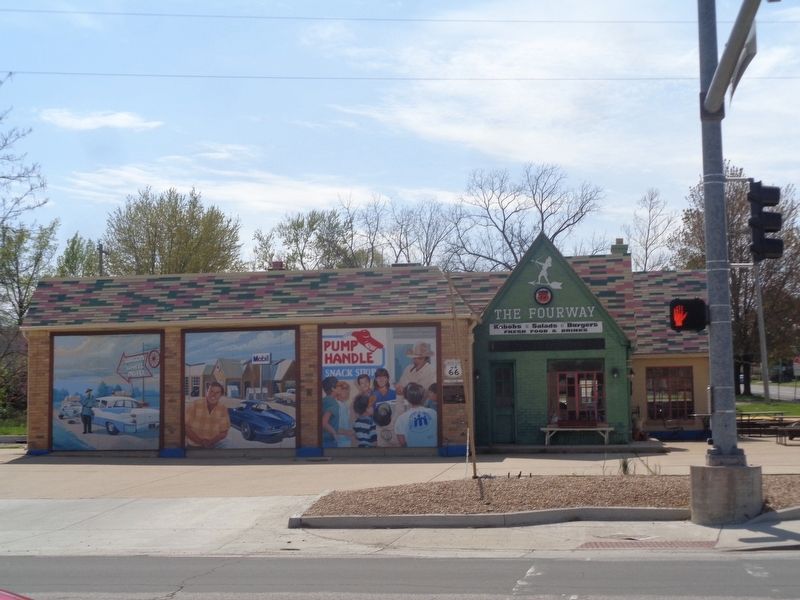
Photographed by Jason Voigt, April 25, 2021
2. History at the 4-Way Marker
Marker is mounted on the building, under the Route 66 shield
Additional keywords. four-way
Credits. This page was last revised on December 2, 2021. It was originally submitted on April 26, 2021, by Jason Voigt of Glen Carbon, Illinois. This page has been viewed 313 times since then and 15 times this year. Photos: 1, 2. submitted on April 26, 2021, by Jason Voigt of Glen Carbon, Illinois.
