Near Williamsburg in James City County, Virginia — The American South (Mid-Atlantic)
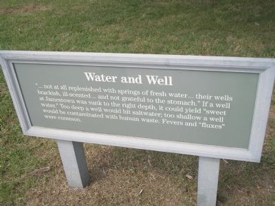
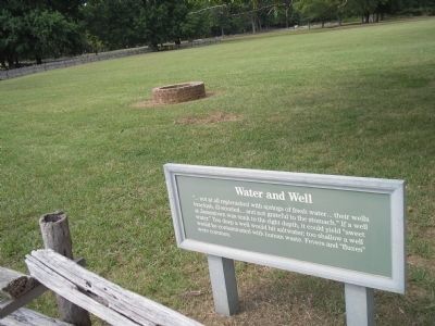
Water and Well
Erected by Colonial National Historic Park.
Topics. This historical marker is listed in this topic list: Colonial Era.
Location. 37° 12.45′ N, 76° 46.575′ W. Marker is near Williamsburg, Virginia, in James City County. Marker can be reached from Colonial Parkway, on the right when traveling west. Marker is in the "New Towne" section of the Historic Jamestown unit of Colonial National Historic Park. Touch for map. Marker is in this post office area: Williamsburg VA 23185, United States of America. Touch for directions.
Other nearby markers. At least 8 other markers are within walking distance of this marker. Efforts of a Virginia Tradesman 1670s (a few steps from this marker); Interpreting Jamestown (within shouting distance of this marker); A Campsite pre-1607 (within shouting distance of this marker); Ditch and Mound (about 300 feet away, measured in a direct line); Row Houses (about 300 feet away); The Jamestown Riverfront 1630-1690 (about 300 feet away); Colonial Highway (about 300 feet away); Oyster Shells to Mortar (about 300 feet away). Touch for a list and map of all markers in Williamsburg.
Also see . . .
1. Historic Jamestowne. Colonial National Historic Park from National Park Service website. (Submitted on March 19, 2009, by Bill Coughlin of Woodland Park, New Jersey.)
2. Historic Jamestowne. Historic Jamestowne is the site of the first permanent English settlement in America. The site is jointly administered by APVA Preservation Virginia and the National Park Service. (Submitted on March 19, 2009, by Bill Coughlin of Woodland Park, New Jersey.)
Credits. This page was last revised on June 16, 2016. It was originally submitted on March 19, 2009, by Bill Coughlin of Woodland Park, New Jersey. This page has been viewed 756 times since then and 11 times this year. Photos: 1, 2. submitted on March 19, 2009, by Bill Coughlin of Woodland Park, New Jersey.

