Winston-Salem in Forsyth County, North Carolina — The American South (South Atlantic)
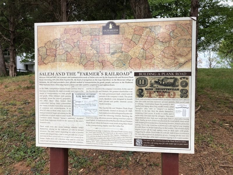
Salem and the "Farmer's Railroad"
Old Salem Museums & Gardens
— 1766 —

Photographed By Devry Becker Jones (CC0), April 23, 2021
1. Salem and the "Farmer's Railroad" Marker
Between 1854 and 1862, the economic and communication needs of Salem were met by the Fayetteville and Western Plank Road. Stretching 129 miles from Fayetteville, the head of navigation on the Cape Fear River, to the Moravian village of Bethania, the toll road provided a fast, efficient method of transportation for goods, people, and news in the Piedmont. What had once been a three-day trip for a horse and rider could be completed in just eighteen hours.
In the 1840s, entrepreneurs across North Carolina tried to find ways to stimulate the state's economy and improve the means of transportation for both people and goods. While railroads were gaining popularity across the country, geography, and other issues often limited their construction, leaving many communities like Salem excluded from these networks of commerce and communication. In an effort to cater to these areas, some in the state government began advocating for the construction of plank roads to meet North Carolina's needs. Deemed "farmer's railroads," investors hoped these highways would be the answer to the state's financial woes.
Plank roads were also money-making ventures within themselves, relying on the collection of tolls to reward investors. The rates varied depending on what a traveler carried and ranged from a half a cent per mile for a horse and rider to four cents a mile for a wagon and a team of six horses. Profits from toll collect were used to cover the cost of road maintenance, the salaries of the toll collectors, and the dividends to the company's investors. In the case of the Fayetteville and Western, the greatest shareholder was the state government itself, which held 60 percent of the company's stock. The plank roads, therefore, were designed to benefit both private and public interests across North Carolina.
The Fayetteville and Western Plank Road was formally charted on January 27, 1849, but construction did not begin in Fayetteville until the following October. Building the road was a long, laborious process, taking over four years to reach Salem. To learn more about the Fayetteville and Western Plank Road, follow it historic route north along Main Street to corresponding display near the Coffee Pot.
[Sidebar:]
Building a Plank Road
Plank roads provided a transportation alternatives that was more efficient than dirt roads and less expensive—at least initially—than paved roads or railways. Construction began by grading a dirt roadbed and laying down long wooden beams called "stringers" (also "sills" or "sleepers") in shallow trenches in the bed. Next the planks themselves measuring 8 feet across, 8 inches in width, and 4 inches deep, were

Photographed By Devry Becker Jones (CC0), April 23, 2021
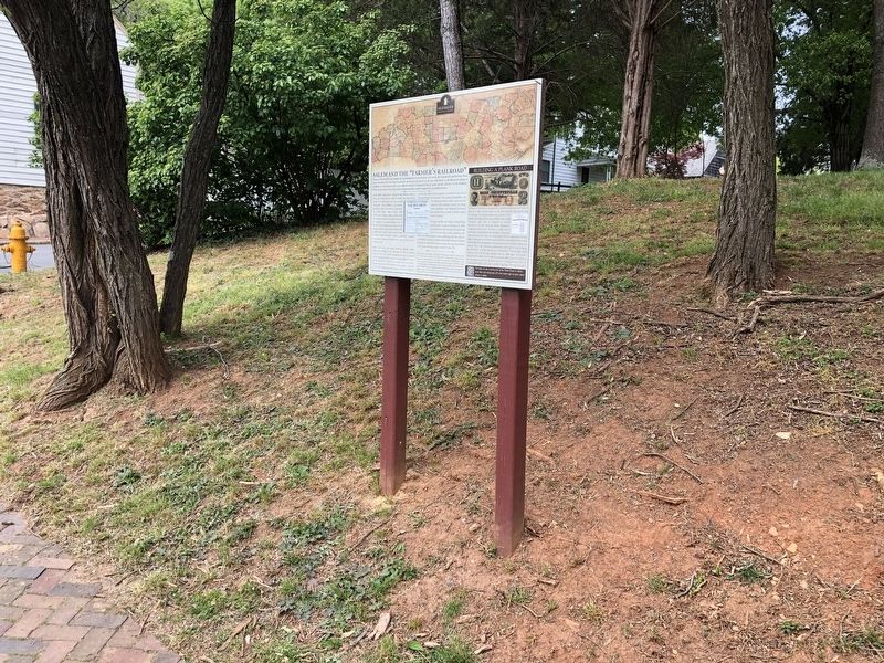
2. Salem and the "Farmer's Railroad" Marker
Erected by Old Salem Museums & Gardens.
Topics. This historical marker is listed in these topic lists: Agriculture • Industry & Commerce • Roads & Vehicles. A significant historical date for this entry is January 27, 1849.
Location. 36° 5.008′ N, 80° 14.479′ W. Marker is in Winston-Salem, North Carolina, in Forsyth County. Marker is at the intersection of South Main Street and Race Street, on the left when traveling south on South Main Street. Touch for map. Marker is at or near this postal address: 921 S Main St, Winston Salem NC 27101, United States of America. Touch for directions.
Other nearby markers. At least 8 other markers are within walking distance of this marker. Reich-Hege Lot (1830) (within shouting distance of this marker); Lewis Hege (1840-1918) (within shouting distance of this marker); Reich-Hege House Site (1830-1922) (within shouting distance of this marker); Squire's Grave (about 300 feet away, measured in a direct line); Washington's Southern Tour (about 400 feet away); Last Burials in the Parish Graveyard (about 400 feet away); Old Salem Historic District (about 400 feet away); The African American Graveyard (about 400 feet away). Touch for a list and map of all markers in Winston-Salem.
Credits. This page was last revised on March 3, 2023. It was originally submitted on April 27, 2021, by Devry Becker Jones of Washington, District of Columbia. This page has been viewed 140 times since then and 10 times this year. Photos: 1, 2. submitted on April 27, 2021, by Devry Becker Jones of Washington, District of Columbia.