Riverview in Tulsa in Tulsa County, Oklahoma — The American South (West South Central)
"East Meets West"
Photographed by Jason Voigt, April 7, 2021
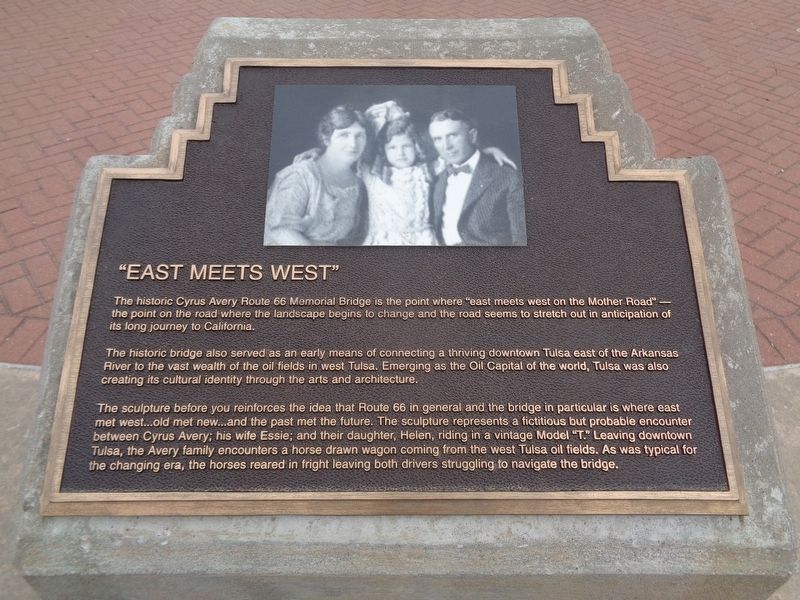
1. "East Meets West" Marker
The historic bridge also served as an early means of connecting a thriving downtown Tulsa east of the Arkansas River to the vast wealth of the oil fields in west Tulsa. Emerging as the Oil Capital of the world, Tulsa was also creating its cultural identity through the arts and architecture.
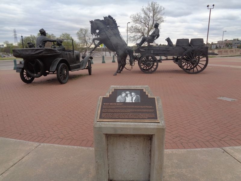
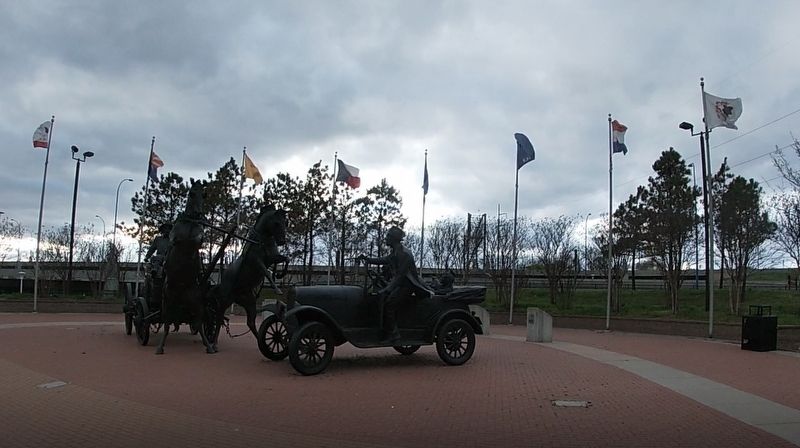
The sculpture before you reinforces the idea that Route 66 in general and the bridge in particular is where east met west…old met new…and the past met the future. The sculpture represents a fictitious but probable encounter between Cyrus Avery; his wife Essie; and their daughter, Helen, riding in a vintage Model "T". Leaving downtown Tulsa, the Avery family encounters a horse drawn wagon coming from the west Tulsa oil fields. As was typical for the changing era, the horses reared in fright leaving both drivers struggling to navigate the bridge.
Erected by Vision 2025.
Topics and series.
this page online
Location. 36° 8.675′ N, 96° 0.192′ W. Marker is in Tulsa, Oklahoma, in Tulsa County. It is in Riverview. It is at the intersection of Old U.S. 66 and Riverside Drive, on the right when traveling west on U.S. 66. Marker is located at Cyrus Avery Centennial Plaza, behind the East Meets West sculpture. Touch for map. Marker is at or near this postal address: 1300 U.S Rte 66, Tulsa OK 74127, United States of America. Touch for directions.

Regionally, this marker is in Oklahoma’s Muscogee Nation and specifically in the Cherokee Nation. It is also in the American South, specifically on the prairies, and on the Southern Plains. Globally, it is in North America, the Western Hemisphere, the Western World, and the Anglosphere. Historically, it finds itself in what was once the territory of the Mississippian Culture and also the Louisiana Purchase.
Other nearby markers. At least 8 other markers are within walking distance of this marker: Cyrus Stevens Avery
Photographed by Jason Voigt, April 7, 2021
2. "East Meets West" Marker
Another marker is no longer nearby. 11th Street Bridge, Tulsa, Oklahoma (was within shouting distance of this marker but has been permanently removed).
Photographed by Jason Voigt, April 7, 2021
3. "East Meets West" sculpture (front)
Credits. This page was last revised on February 16, 2023. It was originally submitted on April 28, 2021, by Jason Voigt of Glen Carbon, Illinois. This page has been viewed 1,081 times since then and 64 times this year. Photos: 1, 2, 3. submitted on April 28, 2021, by Jason Voigt of Glen Carbon, Illinois.
