Central Park West Historic District in Manhattan in New York County, New York — The American Northeast (Mid-Atlantic)
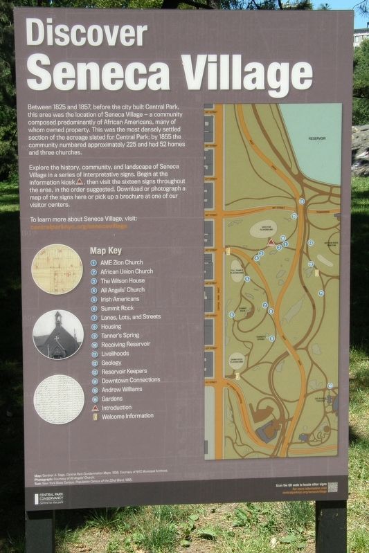
Discover Seneca Village
Photographed by Larry Gertner, June 17, 2020
1. Discover Seneca Village marker
Between 1825 and 1857, before the city built Central Park, this area was the location of Seneca Village – a community composed predominantly of African Americans, many of whom owned property. This was the most densely settled section of the acreage slated for Central Park; by 1855 the community numbered approximately 225 and had 52 homes and three churches.
Explore the history, community and landscape of Seneca Village in a series of interpretative signs. Begin at the information kiosk, then visit the sixteen signs throughout the area, in the order suggested. Download or photograph a map of the signs here to pick up a brochure at one of our visitor centers.
Erected 2020 by Central Park Conservancy.
Topics. This historical marker is listed in these topic lists: African Americans • Parks & Recreational Areas • Settlements & Settlers. A significant historical year for this entry is 1825.
Location. 40° 46.98′ N, 73° 58.057′ W. Marker is in Manhattan, New York, in New York County. It is in the Central Park West Historic District. It can be reached from West 84th Street east of Central Park West. Touch for map. Marker is at or near this postal address: Central Park, New York NY 10024, United States of America. Touch for directions.

Regionally, this marker is in New York City. It is also in the American Northeast, in the Mid-Atlantic, and on the Eastern Seaboard. Globally, it is in the North Atlantic Region, North America, the Western Hemisphere, the Western World, and the Anglosphere. Historically, it finds itself in what was once New Netherland and also one of the original Thirteen Colonies.
Other nearby markers. At least 8 other markers are within walking distance of this marker: Livelihoods (within shouting distance of this marker); Geology (within shouting distance of this marker);
this page online
More about this marker. An identical wayside can be found at the Central Park West and West 85th Street entrance to the park.
Also see . . .
1. Seneca Village. Wikipedia entry (Submitted on May 3, 2021, by Larry Gertner of New York, New York.)
2. Seneca Village Site. Central Park Conservancy entry: (Submitted on May 3, 2021, by Larry Gertner of New York, New York.)
3. Seneca Village, New York City. National Park Service entry (Submitted on May 3, 2021, by Larry Gertner of New York, New York.)

Photographed by Larry Gertner, June 17, 2020
2. Discover Seneca Village Marker
An outcropping of Manhattan Schist is nearby.
Photographed by Larry Gertner
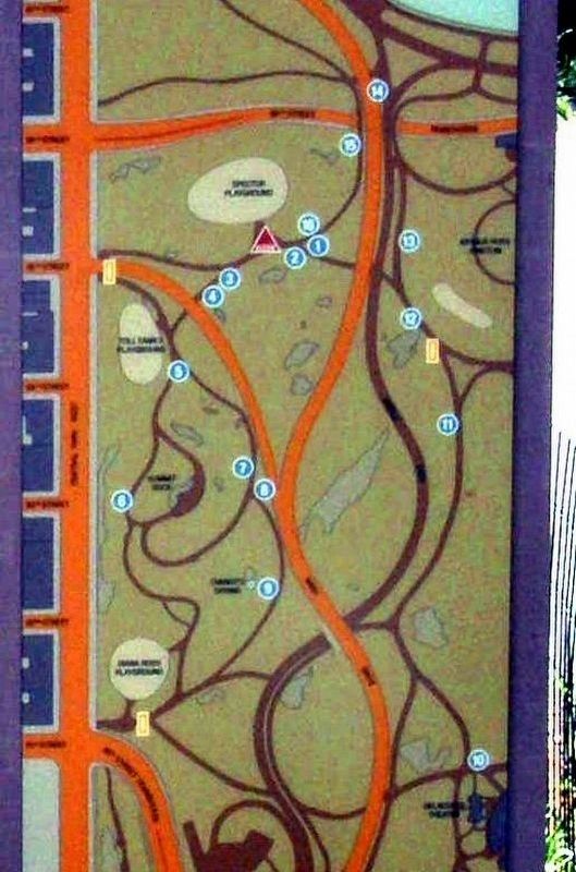
3. Map Key
1 – AME Zion Church; 2 – African Union Church; 3 – The Wilson House; 4 – All Angels Church; 5 – Irish Americans; 6 - Summit Rock; 7 – Lanes, Lots, and Streets; 8 – Housing; 9 – Tanner’s Spring; 10 – Receiving Reservoir; 11 – Livelihoods; 12 – Geology; 13 – Reservoir Keepers; 14 – Downtown Connections; 15 – Andrew Williams; 16 – Gardens
Photographed by Larry Gertner, April 11, 2021
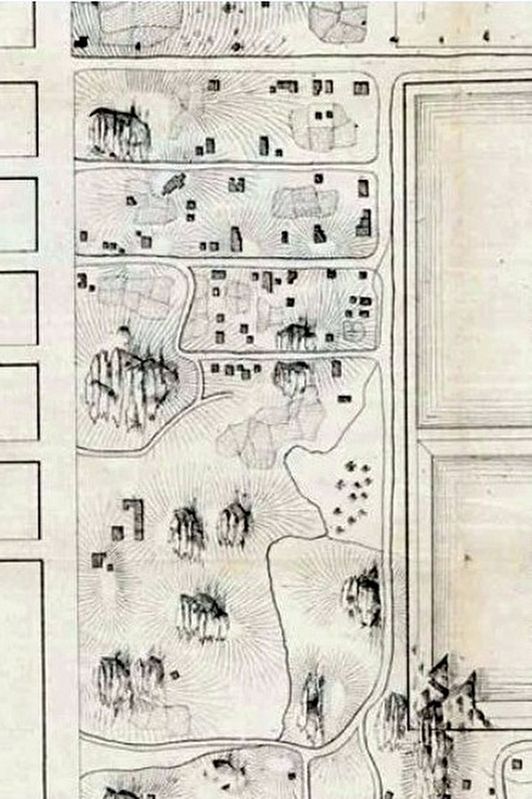
4. Detail of map of the pre-Central Park landscape showing the area of Seneca Village
Summit Rock, center left, can be used for orientation on the current site map.
Credits. This page was last revised on February 10, 2026. It was originally submitted on May 3, 2021, by Larry Gertner of New York, New York. This page has been viewed 467 times since then and 91 times this year. Photos: 1, 2, 3, 4. submitted on May 3, 2021, by Larry Gertner of New York, New York.
