Near Marietta in Cobb County, Georgia — The American South (South Atlantic)
The Reversed Trench
Pine Knob Battle
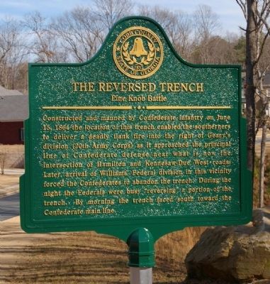
Photographed by David Seibert, February 2, 2008
1. The Reversed Trench Marker
Erected 2008 by Cobb County Community Development Department.
Topics. This historical marker is listed in this topic list: War, US Civil. A significant historical month for this entry is June 1945.
Location. 33° 58.604′ N, 84° 39.393′ W. Marker is near Marietta, Georgia, in Cobb County. It is on Maryhill Lane, on the left when traveling west. Marker site is in the new Woodbridge Subdivision off Hamilton Road. Touch for map. Marker is at or near this postal address: 3524 Maryhill Lane, Kennesaw GA 30152, United States of America.
this page online

Regionally, this marker is in Georgia’s Piedmont and in Metro Atlanta. It is also in the American South and specifically in the Deep South. Globally, it is in North America, the Western Hemisphere, the Western World, and the Anglosphere. Historically, it finds itself in what was once the original Cherokee Nation, the territory of the Mississippian Culture, one of the original Thirteen Colonies, one of the Confederate States of America, and the Antebellum South.
Other nearby markers. At least 8 other markers are within one mile of this marker, measured as the crow flies: Battle of Pine Knob (approx. ¼ mile away); Battle of Gilgal Church (approx. 0.6 miles away); Due West Community (approx. 0.6 miles away); Site of the Dickson House (approx. ¾ mile away); Captain Peter Simonson (approx. ¾ mile away); Military Action at Gilgal Church (approx. 0.9 miles away); General Leonidas Polk Memorial (approx. one mile away); Pine Mountain (approx. 1.1 miles away). Touch for a list and map of all markers in Marietta.
Another marker is no longer nearby. Main Confederate Battle Line (was approx. 0.9
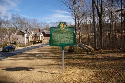
Photographed by David Seibert, February 2, 2008
2. The Reversed Trench Marker
Credits. This page was last revised on May 4, 2021. It was originally submitted on September 8, 2008, by David Seibert of Sandy Springs, Georgia. This page has been viewed 2,974 times since then and 89 times this year. Last updated on May 3, 2021, by Neal of Kennesaw, Georgia. Photos: 1, 2. submitted on September 8, 2008, by David Seibert of Sandy Springs, Georgia. • J. Makali Bruton was the editor who published this page.
