
Downtown Detroit in Wayne County, Michigan — The American Midwest (Great Lakes)
War of 1812 Dead
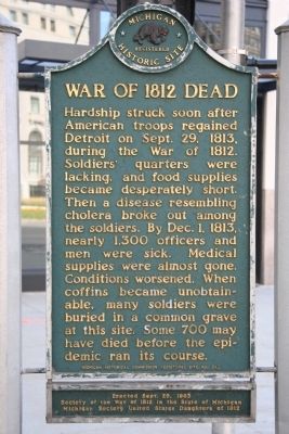
Photographed by Dale K. Benington, August 13, 2009
1. War of 1812 Dead Marker
Erected 1963 by Michigan Historical Commission, Society of the War of 1812 in the State of Michigan, and Michigan Society United States Daughters of 1812. (Marker Number 242.)
Topics and series. This historical marker is listed in these topic lists: Forts and Castles • Indigenous Peoples and Communities • Military • War of 1812. In addition, it is included in the Michigan Historical Commission, and the United States Daughters of 1812, National Society series lists. A significant historical date for this entry is September 29, 1813.
Location. Marker has been permanently removed. It was located near 42° 19.892′ N, 83° 3.076′ W. Marker was in Detroit, Michigan, in Wayne County. It was in Downtown Detroit. It was at the intersection of Washington Boulevard and Michigan Avenue (U.S. 12) on Washington Boulevard. Located on the SW corner of the intersection of Washington Blvd and Michigan Ave. Touch for map. Marker was at or near this postal address: 305 Michigan Ave, Detroit MI 48226, United States of America.
We have been informed that this marker is no longer there and will not be replaced. This page is an archival view of what was.
Regionally, this marker was in Southeast Michigan. It was also in the American Midwest. Globally, it was in North America, on the Great Lakes, in the Western Hemisphere,

this page online
Other nearby markers. At least 8 other markers are within walking distance of this location: General Casimir Pulaski (a few steps from this marker); Chicago Road (within shouting distance of this marker); The War of 1812 in Detroit / War of 1812 Grave Site (within shouting distance of this marker); Detroit Plaindealer (about 500 feet away, measured in a direct line); Rosa Parks Transit Center (about 500 feet away); Michigan's First Capitol / Capitol Union School (about 700 feet away); The First Capitol Building in Michigan (about 700 feet away); Detroit Club (about 700 feet away). Touch for a list and map of all markers in Detroit.
More about this marker. This marker has been replaced with a newer marker and moved 200 ft NNE.
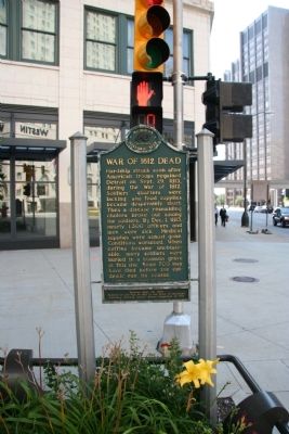
Photographed by Dale K. Benington, August 13, 2009
2. War of 1812 Dead Marker
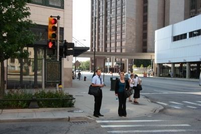
Photographed by Dale K. Benington, August 13, 2009
3. War of 1812 Dead Marker
View of the historical marker at the south-west corner of Washington Boulevard and Michigan Avenue.
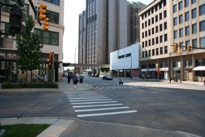
Photographed by Dale K. Benington, August 13, 2009
4. War of 1812 Dead Marker
View of the historical marker, under the traffic light, on the south-east corner of the intersection, in downtown Detroit.
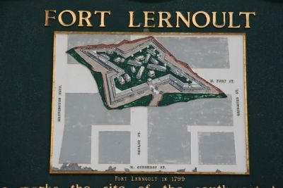
Photographed by Dale K. Benington, August 13, 2009
5. War of 1812 Dead Marker
View of map showing where Fort Lernoult was located in modern day, downtown Detroit. The map shows Washington Boulevard on the left side of the fort so the "War of 1812 Dead," would have been buried just beyond the upper left hand corner of the image.
Credits. This page was last revised on February 12, 2023. It was originally submitted on August 17, 2009, by Dale K. Benington of Toledo, Ohio. This page has been viewed 2,720 times since then and 70 times this year. Last updated on May 4, 2021, by J.T. Lambrou of New Boston, Michigan. Photos: 1, 2, 3, 4, 5. submitted on August 17, 2009, by Dale K. Benington of Toledo, Ohio. • Mark Hilton was the editor who published this page.
