Inwood in Manhattan in New York County, New York — The American Northeast (Mid-Atlantic)
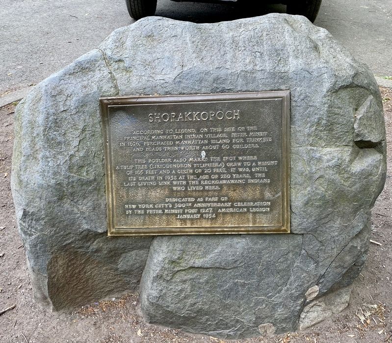
Shorakkopoch
Photographed by Andrew Ruppenstein, May 3, 2021
1. Shorakkopoch Marker
According to legend, on this site of the principal Manhattan Indian village, Peter Minuit in 1626, purchased Manhattan Island for trinkets and beads then worth about 60 guilders.
This boulder also marks the spot where a tulip tree (Liriodendron Tiipifera) grew to a height of 165 feet and a girth of 20 feet. It was, until its death in 1938 at the age of 280 years, the last living link with the Reckgawawanc Indians who lived here.
Dedicated as part of New York City's 300th anniversary celebration by the Peter Minuit Post 1247, American Legion
January 1954
Erected 1954 by American Legion Peter Minuit Post 1247.
Topics. This historical marker is listed in these topic lists: Indigenous Peoples and Communities • Settlements & Settlers. A significant historical year for this entry is 1626.
Location. 40° 52.402′ N, 73° 55.423′ W. Marker is in Manhattan, New York, in New York County. It is in Inwood. It can be reached from no nearby sstreet. Touch for map. Marker is in this post office area: New York NY 10034, United States of America. Touch for directions.

Regionally, this marker is in New York City.
this page online
Other nearby markers. At least 8 other markers are within walking distance of this marker: The Hessian Military Hut (approx. 0.4 miles away); Bruce Reynolds Garden (approx. 0.4 miles away); The Military Hut (approx. 0.4 miles away); Catholic War Veterans Memorial (approx. 0.4 miles away); Dyckman Farmhouse Museum (approx. 0.4 miles away); Dyckman Farmhouse (approx. 0.4 miles away); Trace (approx. 0.6 miles away); Henry Hudson Park (approx. 0.6 miles away). Touch for a list and map of all markers in Manhattan.
Another marker is no longer nearby. Dyckman Farmhouse Museum (was approx. 0.4 miles away but has been replaced with another marker now near it).
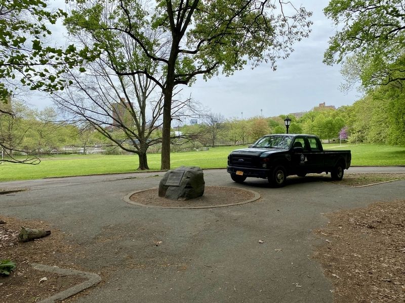
More about this marker. The marker is mounted to a low rock in Inwood Hill Park, about a 5-minute walk in from the the park entrance at the intersection
Photographed by Andrew Ruppenstein, May 3, 2021
2. Shorakkopoch Marker - wide view
Also see . . . Shorakkopoch Rock. Atlas Obscura website entry (Submitted on April 28, 2026, by Larry Gertner of New York, New York.)
Credits. This page was last revised on April 28, 2026. It was originally submitted on May 4, 2021, by Andrew Ruppenstein of Lamorinda, California. This page has been viewed 1,179 times since then and 78 times this year. Photos: 1, 2. submitted on May 4, 2021, by Andrew Ruppenstein of Lamorinda, California.
