Aurora in Portage County, Ohio — The American Midwest (Great Lakes)
The Chillicothe Turnpike
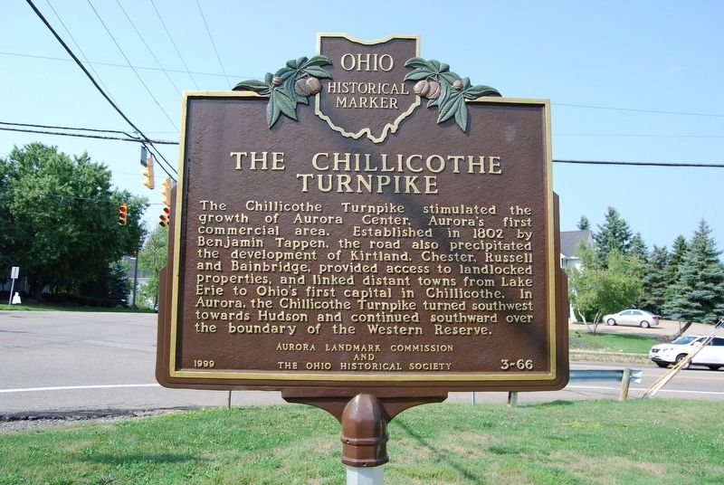
Photographed by Mike Wintermantel, August 18, 2018
1. The Chillicothe Turnpike Marker
Erected 1999 by Aurora Landmark Commission and The Ohio Historical Society. (Marker Number 3-66.)
Topics and series. This historical marker is listed in these topic lists: Industry & Commerce • Roads & Vehicles. In addition, it is included in the Ohio Historical Society / The Ohio History Connection series list. A significant historical year for this entry is 1802.
Location. 41° 19.034′ N, 81° 20.717′ W. Marker is in Aurora, Ohio, in Portage County. It is at the intersection of South Chillicothe Road (Ohio Route 306) and East Garfield Road ( Route 82), on the right when traveling north on South Chillicothe Road. Touch for map. Marker is
this page online

Regionally, this marker is in Greater Cleveland and in the Western Reserve. It is also in the American Midwest. Globally, it is in North America, the Western Hemisphere, the Western World, and the Anglosphere. Historically, it finds itself in what was once the Haudenosaunee (Iroquois) Confederacy, the territory of the Mississippian Culture, and the Northwest Territory.
Other nearby markers. At least 8 other markers are within walking distance of this marker: The James Converse & Hopson Hurd Store / A Commercial Site Since 1825 (within shouting distance of this marker); Aurora Veterans Memorial (about 500 feet away, measured in a direct line); City of Aurora Veterans Memorial (about 600 feet away); Veterans Memorial (approx. ¼ mile away); The Church In Aurora (approx. 0.3 miles away); In Memory of Those (approx. 0.3 miles away); Ebenezer Sheldon (approx. 0.3 miles away); The Ebenezer-Sheldon Deed House Project (approx. 0.3 miles away). Touch for a list and map of all markers in Aurora.
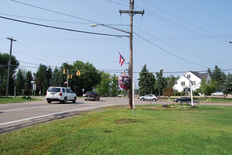
Photographed by Mike Wintermantel, August 18, 2018
2. The Chillicothe Turnpike Marker
Credits. This page was last revised on May 6, 2021. It was originally submitted on August 19, 2018, by Mike Wintermantel of Pittsburgh, Pennsylvania. This page has been viewed 1,114 times since then and 63 times this year. Last updated on May 6, 2021, by Robert Baughman of Bellefontaine, Ohio. Photos: 1, 2. submitted on August 19, 2018, by Mike Wintermantel of Pittsburgh, Pennsylvania. • J. Makali Bruton was the editor who published this page.
