Near Williamsburg in James City County, Virginia — The American South (Mid-Atlantic)
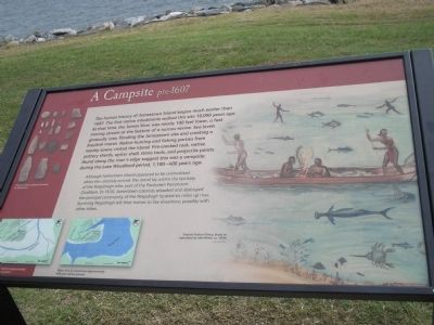
A Campsite pre-1607
Although Jamestown Island appeared to be uninhabited when the colonists arrived, the island lay within the territory of the Paspahegh tribe, part of the Powhatan Paramount Chiefdom. In 1610, Jamestown colonists attacked and destroyed the principal community of the Paspahegh located six miles up river. Surviving Paspahegh left their homes to live elsewhere, possibly with other tribes.
Erected by Colonial National Historic Park.
Topics. This historical marker is listed in these topic lists: Notable Places • Settlements & Settlers. A significant historical year for this entry is 1607.
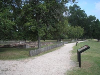
Location. 37° 12.425′ N, 76° 46.543′ W. Marker is near Williamsburg , Virginia, in James City County. Marker can be reached from Colonial Parkway, on the right when traveling west. Marker is in the "New Towne" section of the Historic Jamestown unit of Colonial National Historic Park. Touch for map. Marker is in this post office area: Williamsburg VA 23185, United States of America. Touch for directions.
Other nearby markers. At least 8 other markers are within walking distance of this marker. The Jamestown Riverfront 1630-1690 (a few steps from this marker); Row Houses (a few steps from this marker); Fences and Livestock (within shouting distance of this marker); Water and Well (within shouting distance of this marker); Efforts of a Virginia Tradesman 1670s (within shouting distance of this marker); Ditch and Mound (within shouting distance of this marker); Jackson Home 1620s (about 300 feet away, measured in a direct line); Oyster Shells to Mortar (about 300 feet away). Touch for a list and map of all markers in Williamsburg.
More about this marker. The right side of the marker contains an illustration by Sidney King, ca. 1957 of “Virginia Indians fishing, based on [a] watercolor by John White, ca. 1580s.” The left side features pictures indicating the water level at Jamestown at different times in history. Above this is a photograph of “Virginia Indian artifacts recovered at Jamestown.”
Also see . . .
1. A Campsite pre-1607. Colonial National Historic Park from National Park Service website. (Submitted on March 22, 2009, by Bill Coughlin of Woodland Park, New Jersey.)
2. Historic Jamestowne. Historic Jamestowne is the site of the first permanent English settlement in America. The site is jointly administered by APVA Preservation Virginia and the National Park Service. (Submitted on March 22, 2009, by Bill Coughlin of Woodland Park, New Jersey.)
Credits. This page was last revised on June 16, 2016. It was originally submitted on March 22, 2009, by Bill Coughlin of Woodland Park, New Jersey. This page has been viewed 1,073 times since then and 23 times this year. Photos: 1, 2, 3. submitted on March 22, 2009, by Bill Coughlin of Woodland Park, New Jersey.


