Dover in Stewart County, Tennessee — The American South (East South Central)
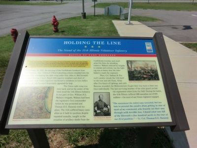
Holding The Line
The Stand of the 11th Illinois Volunteer Infantry
— Battle of Fort Donelson —
In February 1862, Union Gen. Ulysses S. Grant attacked Forts Henry and Donelson on the Tennessee and Cumberland Rivers to take control of western Tennessee and Kentucky as well as the rivers. Grant captured Fort Henry on February 6, then approached Fort Donelson with his army on February 14 while Flag Officer Andrew H. Foote's gunboats shelled it. Confederate artillery repulsed the ironclads. Confederate Gen. John B. Floyd ordered a breakout from the fort for the next morning. At first successful, the Confederates retreated, and the Federals counterattacked. On February 16, part of Floyd's command escaped in boats. The remainder yielded to Grant's demand for “unconditional surrender”.
(main text)
On February 15, 1862, the morning of the Confederate breakout from Fort Donelson, Gen. Gideon J. Pillow’s attacking column smashed into the Federal line, overlapping the right wing under Gen. John A. McClernand, and began driving it back. Faced with superior numbers and short of ammunition, each Union regiment was forced to withdraw in turn before it was cut off. McClernand desperately appealed for help.
The Union right wing was bent back, and at the center of the bend stood the 11th Illinois Infantry. It was part of Gen. William H.L. Wallace’s brigade; Wallace had been the regiment’s first commander before he was promoted and Thomas E.G. Ransom took his place. The 11th suffered heavy casualties as it held its position despite repeated assaults, caught in the crossfire of artillery shells from the Confederate trenches and small arms fire from the attacking infantry. Wallace ordered his brigade to retreat and re-form, but the fighting was so heavy that the order failed to reach the regiment.
Then, Col. Nathan B. Forrest’s cavalry struck the 11th hard in the rear and left flank. Alone after five hours of fighting, and with Ransom wounded, the Midwesterners fought their way back to their own lines individually. The last surviving member of the color guard carried the regimental colors from the field. During the battle, the 11th Illinois suffered 399 casualties out of 500 soldiers—the most of any Union regiment engaged.
“The movement (to retire) was executed, but too late to prevent the cavalry from getting in rear of most of my command, who bravely cut their way through with terrible loss. I found what was left of the Eleventh a few hundred yards in the rear of our first position.” — Lt. Col. Thomas E.G. Ransom.
(captions)
Sneden map - Courtesy Library of Congress
Col. Thomas E.G. Ransom Courtesy Library of Congress
Battle of Fort Donelson - Courtesy Library of Congress
Erected by Tennessee Civil War Trails.
Topics and series. This historical marker is listed in this topic list: War, US Civil. In addition, it is included in the Tennessee Civil War Trails series list. A significant historical month for this entry is February 1862.
Location. Marker has been reported permanently removed. It was located near 36° 28.74′ N, 87° 52.021′ W. Marker was in Dover, Tennessee, in Stewart County. Marker could be reached from the intersection of Donelson Parkway (U.S. 79) and Moores Drive, on the left when traveling west. The marker is on the grounds of the Stewart County Visitor Center. Touch for map. Marker was at or near this postal address: 117 Visitor Center Lane, Dover TN 37058, United States of America.
We have been informed that this sign or monument is no longer there and will not be replaced. This page is an archival view of what was.
Other nearby markers. At least 8 other markers are within walking distance of this location. 6-pounder Gun (approx. 0.3 miles away); Porter's Battery (approx. 0.3 miles away); Fort Donelson Confederate Monument (approx. half a mile away); Confederate Monument (approx. half a mile away); Union Camp (approx. half a mile away); Lauman's Brigade (approx. half a mile away); Graves' Battery (approx. half a mile away); Holding the Outer Lines (approx. 0.6 miles away). Touch for a list and map of all markers in Dover.
Credits. This page was last revised on May 11, 2021. It was originally submitted on September 30, 2013, by Don Morfe of Baltimore, Maryland. This page has been viewed 756 times since then and 37 times this year. Last updated on May 10, 2021, by Shane Oliver of Richmond, Virginia. Photos: 1, 2. submitted on September 30, 2013, by Don Morfe of Baltimore, Maryland. • Devry Becker Jones was the editor who published this page.

