Colonial Heights, Virginia — The American South (Mid-Atlantic)
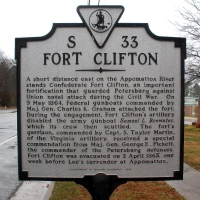
Fort Clifton
Erected 1998 by Department of Historic Resources. (Marker Number S-33.)
Topics and series. This historical marker is listed in these topic lists: Forts and Castles • War, US Civil • Waterways & Vessels. In addition, it is included in the Virginia Department of Historic Resources (DHR) series list. A significant historical date for this entry is April 2, 1865.
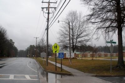
Location. 37° 16.85′ N, 77° 22.315′ W. Marker is in Colonial Heights, Virginia. Marker is at the intersection of Conduit Road and Brockwell Lane, on the right when traveling north on Conduit Road. The marker is in front of Tussing Elementary School. Touch for map. Marker is in this post office area: Colonial Heights VA 23834, United States of America. Touch for directions.
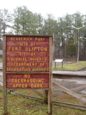
Other nearby markers. At least 8 other markers are within 2 miles of this marker, measured as the crow flies. Confederate Fortification (approx. ¼ mile away); a different marker also named Fort Clifton (approx. ¼ mile away); a different marker also named Fort Clifton (approx. 0.3 miles away); The Brick House At Conjurer's Neck (approx. 0.4 miles away); The Old Brick (Kennon) House (approx. half a mile away); Conjurer's Field Prehistoric Native American Village (approx. half a mile away); Ellerslie (approx. 1.9 miles away); a different marker also named Ellerslie (approx. 1.9 miles away). Touch for a list and map of all markers in Colonial Heights.
Credits. This page was last revised on July 6, 2021. It was originally submitted on March 16, 2009, by Bernard Fisher of Richmond, Virginia. This page has been viewed 1,365 times since then and 31 times this year. Last updated on May 11, 2021, by Bradley Owen of Morgantown, West Virginia. Photos: 1, 2. submitted on March 16, 2009, by Bernard Fisher of Richmond, Virginia. 3. submitted on October 22, 2009, by Bernard Fisher of Richmond, Virginia. • J. Makali Bruton was the editor who published this page.


