Providence Township near Grand Rapids in Lucas County, Ohio — The American Midwest (Great Lakes)
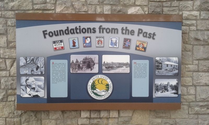
Foundations From The Past
America needed hope in the early 1930s, as The Great Depression took its toll. Newly elected President Franklin D. Roosevelt implemented social programs, such as the Works Progress Administration (W.P.A) and the Civilian Conservation Corps (C.C.C.), which put men to work. The young park district played an important role in these Depression-era work programs, and vice-versa.
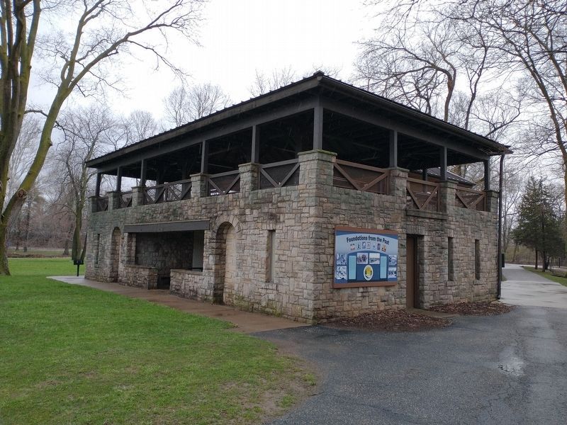
Metroparks had nearly 1,400 people working through these programs. They planted trees, restored canal locks, drained swamps, and constructed shelters, bridges and ponds. This shelter is a prime example of work from the era. As you explore Metroparks see how many others you can find.
Topics and series. This historical marker is listed in these topic lists: Charity & Public Work • Parks & Recreational Areas. In addition, it is included in the Civilian Conservation Corps (CCC), the Former U.S. Presidents: #32 Franklin D. Roosevelt, and the Works Progress Administration (WPA) projects series lists.
Location. 41° 25.014′ N, 83° 52.195′ W. Marker is near Grand Rapids, Ohio, in Lucas County. It is in Providence Township. Marker is at the intersection of South River Road (U.S. 24) and Ludwig Road, on the right when traveling east on South River Road. Touch for map. Marker is at or near this postal address: 13875 S River Rd, Grand Rapids OH 43522, United States of America. Touch for directions.
Other nearby markers. At least 8 other markers are within walking distance of this marker. Water's Way: Flood And Ice (a few steps from this marker); Tempers Explode As Dams Get Built (a few steps from this marker); The Towpath Trail (about 300 feet away, measured in a direct line); Providence Historical District (approx. 0.2 miles away); The 150th Anniversary of the Great Starvation (approx. ¼ mile away); St. Patrick Church (approx. ¼ mile away); M. J. Wright Pavillion (approx. 0.3 miles away); In Memory Of Julie Pontasch (approx. 0.3 miles away). Touch for a list and map of all markers in Grand Rapids.
Credits. This page was last revised on February 6, 2023. It was originally submitted on May 13, 2021, by Craig Doda of Napoleon, Ohio. This page has been viewed 128 times since then and 13 times this year. Photos: 1. submitted on May 13, 2021, by Craig Doda of Napoleon, Ohio. 2. submitted on April 14, 2022, by Craig Doda of Napoleon, Ohio. • Devry Becker Jones was the editor who published this page.

