Maumee in Lucas County, Ohio — The American Midwest (Great Lakes)
A Strategic Location
The British constructed Fort Miamis at the foot of the Maumee River rapids to challenge U.S. General Anthony Wayne and his Legionnaires marching through the Ohio country in 1794.
Besides preventing a U.S. advance on British-controlled Detroit, the fort was strategically located to control the waterway to the south, allow reinforcements and supplies to arrive by river from the north, and embolden the American Indian confederacy's resistance to American settlers.
After the Battle of Fallen Timbers in August 1794, the British continued to occupy Fort Miamis until peaceably handing it over to the Americans in July 1796 as a result of the Jay Treaty. Americans then occupied the fort until abandoning it in 1798. British troops reoccupied the Fort Miamis site in 1813 when they were battling American forces at Fort Meigs, a large U.S. supply depot about two miles upriver.
Topics. This historical marker is listed in these topic lists: Forts and Castles • Native Americans • War of 1812 • Wars, US Indian. A significant historical month for this entry is July 1796.
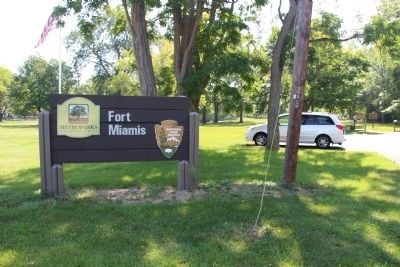
Location. Marker has been reported permanently removed. It was located near 41° 34.328′ N, 83° 37.568′ W. Marker was in Maumee, Ohio, in Lucas County. Marker could be reached from the intersection of River Road and Michigan Avenue. This historical marker is located where Michigan Avenue. dead ends into River Road, on the river side of River Road, in a small, Lucas County MetroPark, which is situated along the west side of the Maumee River. The marker is situated along the lone park walking path that leads from the parking lot to the site of the old fort's earthworks. Touch for map. Marker was at or near this postal address: 1900 River Road, Maumee OH 43537, United States of America.
We have been informed that this sign or monument is no longer there and will not be replaced. This page is an archival view of what was.
Other nearby markers. At least 8 other markers are within walking distance of this location. Old Fort, New Battle (here, next to this marker); Running A Gauntlet (here, next to this marker); A Shattered Truce (here, next to this marker); The Formidable Fort Miamis (about 300 feet away, measured in a direct line); 41st Regiment of Foot - War of 1812 / Private Patrick Russell (about 400 feet away); Fallen Timbers Battlefield and Fort Miamis National Historic Site (about 400 feet away); Letters From 1794 / A Strategic Location (about 400 feet away); The Great Trail (approx. 0.3 miles away). Touch for a list and map of all markers in Maumee.
Credits. This page was last revised on October 26, 2021. It was originally submitted on September 8, 2014, by Dale K. Benington of Toledo, Ohio. This page has been viewed 671 times since then and 51 times this year. Last updated on May 14, 2021, by Craig Doda of Napoleon, Ohio. Photos: 1, 2, 3. submitted on September 8, 2014, by Dale K. Benington of Toledo, Ohio. • Devry Becker Jones was the editor who published this page.


