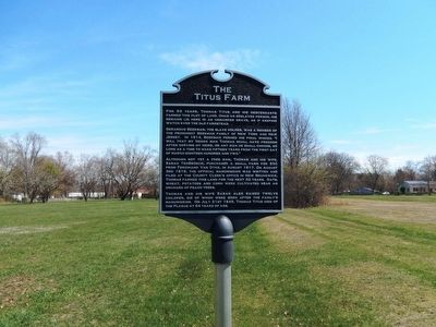
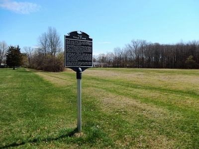
The Titus Farm
Gerardus Beekman, the slave holder, was a member of the prominent Beekman family of New York and New Jersey. In 1814, Beekman penned his final wishes, “I will that my negro man Thomas shall have freedom after serving my heirs, or any man he shall choose, so long as a time to make fifteen years from the first day of March Eighteen Hundred and Two.” Although not yet a free man, Thomas and his wife, Sarah Tenbroeck, purchased a small farm for $50 from Ferdinand Van Dyke, in August 1817. On August 3rd, 1818, the official manumission was written and filed at the county clerk’s office in New Brunswick.
Thomas farmed this land for the next 32 years. Oats, wheat, potatoes and corn were cultivated near an orchard of peach trees.
Thomas and his wife Sarah also raised twelve children, six of whom were born after the family’s manumission. On July 21st 1849, Thomas Titus died of the Plague at 64 years of age.
Topics. This historical marker is listed in these topic lists: African Americans • Agriculture. A significant historical date for this entry is July 21, 1849.
Location. 40° 24.781′ N, 74° 33.976′
Other nearby markers. At least 8 other markers are within 4 miles of this marker, measured as the crow flies. Washington’s Route from Princeton (approx. 2.9 miles away); Griggstown Bridge Tender’s Station (approx. 3 miles away); Historic River Road and River Crossing (approx. 3.3 miles away); Rockingham (approx. 3.4 miles away); Kate McFarlane and Josephine Swann (approx. 3.4 miles away); Washington’s Route from Princeton to Morristown (approx. 3.7 miles away); Kingston Cemetery (approx. 3.7 miles away); Kingston Presbyterian Church (approx. 3.7 miles away).
Credits. This page was last revised on May 17, 2021. It was originally submitted on April 13, 2016, by Don Morfe of Baltimore, Maryland. This page has been viewed 826 times since then and 58 times this year. Last updated on May 17, 2021, by Kate McGuire of Trenton, New Jersey. Photos: 1, 2. submitted on April 13, 2016, by Don Morfe of Baltimore, Maryland. • J. Makali Bruton was the editor who published this page.

