Sylvan Lake in Oakland County, Michigan — The American Midwest (Great Lakes)
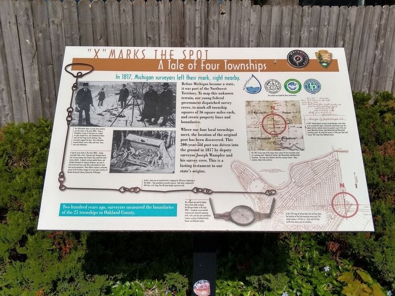
"X" Marks the Spot
A Tale of Four Townships
In 1817, Michigan surveyors left their mark, right nearby.
Before Michigan became a state, it was part of the Northwest Territory. To map this unknown terrain, our young federal government dispatched survey crews, to mark off township squares of 36 square miles each, and create property lines and boundaries.
Where our four local townships meet, the location of the original post has been discovered. This 200-year-old post was driven into the ground in 1817 by deputy surveyor Joseph Wampler and his survey crew. This is a lasting testament to our state's origins.
Two hundred years ago, surveyors measured the boundaries of the 25 townships in Oakland County.
This exhibit was funded by the communities of Waterford, the City of Pontiac, West Bloomfield Township, and Bloomfield Township.
Erected 2013 by MotorCities National Heritage Area, National Park Service.
Topics and series. This historical marker is listed in this topic list: Political Subdivisions. In addition, it is included in the MotorCities National Heritage Area series list. A significant historical year for this entry is 1817.
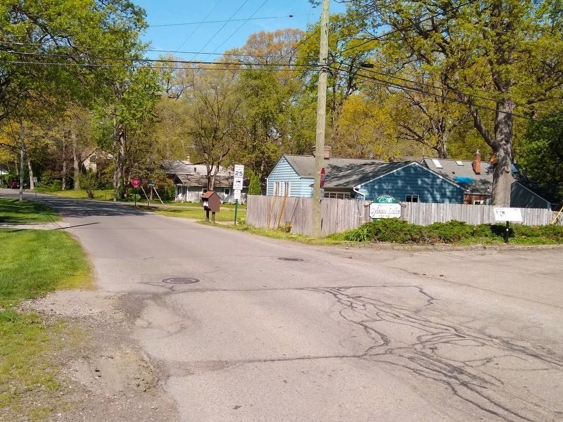
Location. 42° 37.084′ N, 83° 19.505′ W. Marker is in Sylvan Lake, Michigan, in Oakland County. Marker is on Pontiac Drive , 0.2 miles west of Orchard Lake Road, on the right when traveling west. Marker is also about 75 feet west of the Clinton River Trail. Touch for map. Marker is at or near this postal address: 2000 Pontiac Drive, Keego Harbor MI 48320, United States of America. Touch for directions.
Other nearby markers. At least 8 other markers are within walking distance of this marker. Ordered by Mail - Sent by Rail (within shouting distance of this marker); The Great Escape (approx. ¼ mile away); "Body by Fisher" (approx. ¼ mile away); Oakland County Boat Club (approx. 0.4 miles away); Learning and Growing (approx. 0.4 miles away); New Life for Children (approx. half a mile away); Sylvan Lake Inn (approx. half a mile away); Welcome to Beaudette Park (approx. 0.6 miles away). Touch for a list and map of all markers in Sylvan Lake.
Images of survey teams courtesy of Bentley Historical Library, University of Michigan.
2. "X" Marks the Spot: A Tale of Four Townships Marker — left images
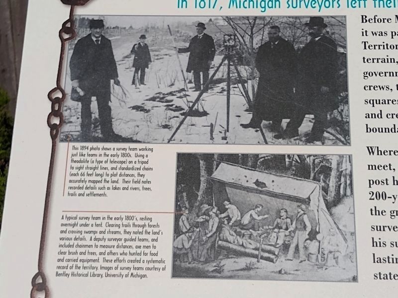
Top: This 1894 photo shows a survey team working just like teams in the early 1800s. Using a theodolite (a type of telescope) on a tripod to sight straight lines, and standardized chains (each 66 feet long) to plot distances, they accurately mapped the land. Their field notes recorded details such as lakes and rivers, trees, trails and settlements.
Bottom: A typical survey team in the early 1800's, resting overnight under a tent. Clearing trails through forests and crossing swamps and streams, they noted the land's various details. A deputy surveyor guided teams, and included chainmen to measure distances, axe men to clear bush and trees, and others who hunted for food and carried equipment. These efforts created a systematic record of the territory.
Bottom: A typical survey team in the early 1800's, resting overnight under a tent. Clearing trails through forests and crossing swamps and streams, they noted the land's various details. A deputy surveyor guided teams, and included chainmen to measure distances, axe men to clear bush and trees, and others who hunted for food and carried equipment. These efforts created a systematic record of the territory.
Top: Anonymous. Bottom: Compass courtesy of Oakland County Pioneer and Historical Society.
3. "X" Marks the Spot: A Tale of Four Townships Marker — lower middle images
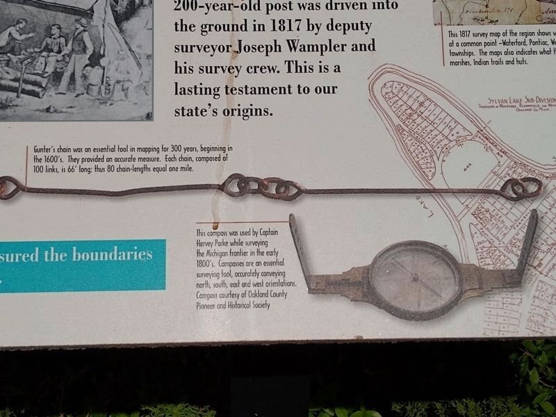
Top: Gunter's chain was an essential tool in mapping for 300 years, beginning in the 1600's. They provided an accurate measure. Each chain, composed of 100 links, is 66' long; thus 80 chain-lengths equal one mile.
Bottom: This compass was used by Captain Hervey Parke while surveying the Michigan frontier in the early 1800's. Compasses are an essential surveying tool, accurately conveying north, south, east and west orientations.
Bottom: This compass was used by Captain Hervey Parke while surveying the Michigan frontier in the early 1800's. Compasses are an essential surveying tool, accurately conveying north, south, east and west orientations.
Source: 1817 maps from Oakland County.
4. "X" Marks the Spot: A Tale of Four Townships Marker — upper right images
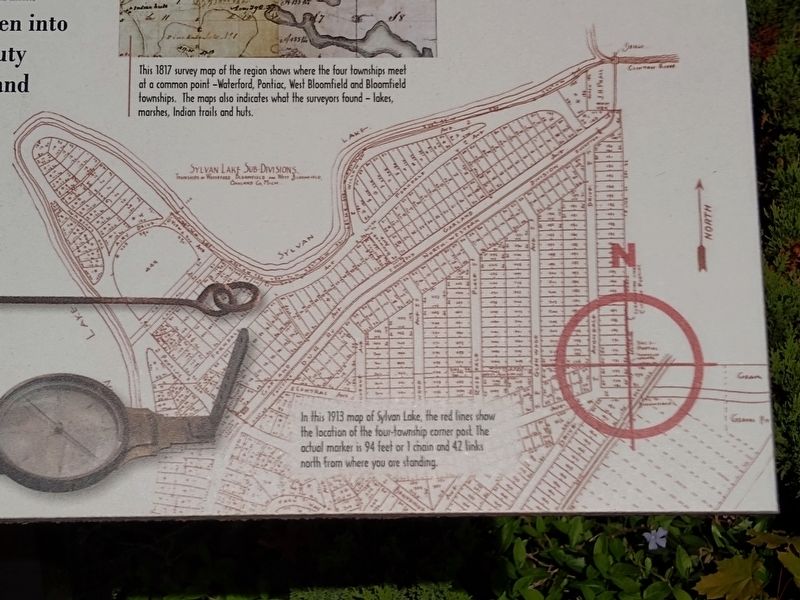
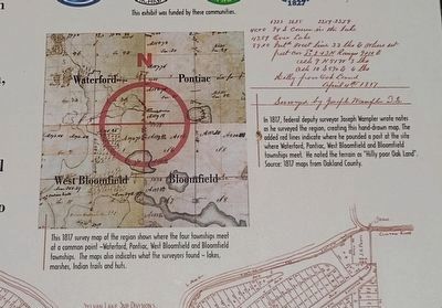
Left: This 1817 survey map of the region shows where the four townships meet at a common point —Waterford, Pontiac, West Bloomfield and Bloomfield townships. The maps [sic] also indicates what the surveyors found — lakes, marshes, Indian trails and huts.
Right: In 1817, federal deputy surveyor Joseph Wampler wrote notes as he surveyed the region, creating this hand-drawn map. The added red lines indicate where he pounded a post at the site where Waterford, Pontiac, West Bloomfield and Bloomfield townships meet. He noted the terrain as "Hilly poor Oak Land".
Right: In 1817, federal deputy surveyor Joseph Wampler wrote notes as he surveyed the region, creating this hand-drawn map. The added red lines indicate where he pounded a post at the site where Waterford, Pontiac, West Bloomfield and Bloomfield townships meet. He noted the terrain as "Hilly poor Oak Land".
Credits. This page was last revised on May 22, 2021. It was originally submitted on May 22, 2021, by Joel Seewald of Madison Heights, Michigan. This page has been viewed 198 times since then and 26 times this year. Photos: 1, 2, 3, 4, 5, 6. submitted on May 22, 2021, by Joel Seewald of Madison Heights, Michigan.
